

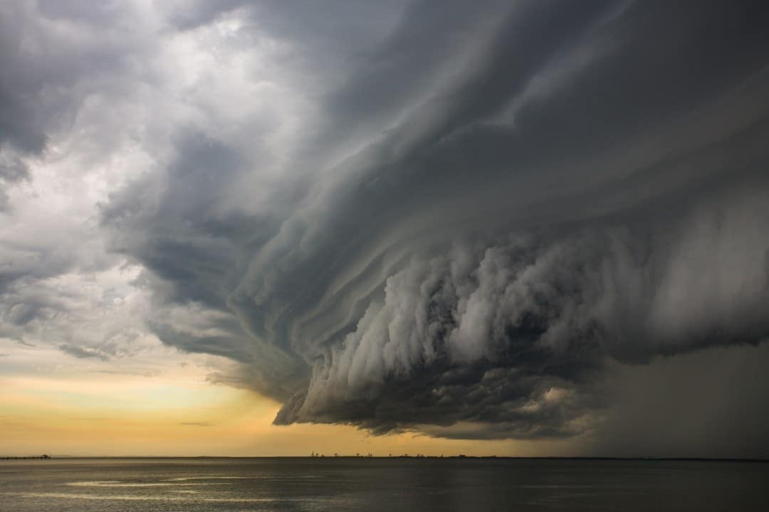
The Washington, DC, region is on high alert as meteorologists warn of severe weather sweeping through on Friday, May 16, 2025. The WUSA9 Weather Team has issued a Weather Impact Alert, signaling the potential for hazardous conditions that could disrupt daily routines. Scattered storms, some of which may turn severe, are expected to bring damaging winds, large hail, and localized flooding. Residents are urged to stay vigilant and prepare for rapidly changing conditions.
This alert comes as the region experiences an unusually warm and humid spring, creating a volatile atmosphere ripe for intense weather events. The National Weather Service has placed the DC area under a Severe Thunderstorm Watch until 10 p.m., emphasizing the need for caution. Key concerns include wet roads, reduced visibility, and water ponding, which could complicate travel and outdoor activities.
Here’s what you need to know to stay safe and informed:
- Download the WUSA9 app for real-time weather updates.
mismatch between closing tags: expected
but found – Keep rain gear, such as umbrellas or raincoats, readily accessible. Stay flexible with outdoor plans, as storms may intensify quickly. Monitor local warnings for potential sheltering needs.
The day’s forecast paints a picture of a region on edge, with meteorologists closely tracking the storm’s progression. As the DC area braces for impact, understanding the timeline and risks is critical for residents and visitors alike.
Timing of the storm threat
The severe weather threat on Friday is expected to unfold in distinct phases, with the most intense activity concentrated in the afternoon and early evening. Meteorologists have outlined a clear timeline to help residents prepare. From now until 6 p.m., showers and storms will gradually build across the region, with some storms potentially reaching severe levels. The primary risks during this window include damaging winds and large hail, which could pose dangers to property and safety.
After 6 p.m., the risk of severe storms begins to taper off, though showers and isolated storms may persist into the late evening. By midnight, the likelihood of severe weather diminishes significantly, but lingering showers could still affect nighttime plans. The WUSA9 Weather Team emphasizes that the period between 4 p.m. and 8 p.m. is likely to see the peak of storm activity, urging residents to stay updated via weather apps or local news.
No mesmo tema: Weather alert: DC faces heavy rain Friday, clear skies for Mother’s Day
This timeline aligns with broader regional weather patterns, as a warm, humid air mass collides with a cold front moving through the mid-Atlantic. The interaction of these systems is fueling the potential for intense thunderstorms, particularly in areas northwest of DC, such as Fairfax, Loudoun, and Montgomery counties.
Primary hazards to watch
The storms sweeping through the DC area on Friday carry multiple threats, each with the potential to disrupt daily life. The WUSA9 Weather Team has identified damaging winds as a primary concern, with gusts capable of bringing down tree limbs and power lines. Such winds, potentially reaching speeds of 60 mph, could lead to isolated power outages and hazardous driving conditions.
Large hail is another significant risk, with some storms capable of producing hail the size of quarters or larger. Hail of this magnitude can damage vehicles, windows, and outdoor structures, posing risks to both property and personal safety. Residents are advised to park cars in covered areas if possible and avoid open spaces during the height of the storm.
- Additional hazards include:
- Localized flooding in low-lying areas, particularly near streams and urban drainage systems.
- Wet roads leading to reduced visibility and increased risk of hydroplaning.
- Water ponding on roadways, which could create obstacles for commuters.
The combination of these hazards underscores the importance of preparedness. Meteorologists recommend keeping rain gear handy and avoiding unnecessary travel during the peak storm hours.
Areas most at risk
While the entire DC metro area faces some level of storm risk, certain regions are more likely to experience severe conditions. Northwest of DC, counties such as Fairfax, Loudoun, and Montgomery are under heightened scrutiny due to their proximity to the storm’s projected path. These areas have already seen severe thunderstorm warnings issued, with reports of 60 mph winds and quarter-sized hail.
Urban areas, including downtown DC, are also at risk, particularly for flash flooding due to heavy downpours overwhelming drainage systems. The National Weather Service has noted that low-lying areas near Georgetown and Fletcher’s Boathouse could see significant water accumulation, exacerbating travel disruptions.
Residents in these high-risk zones should take extra precautions, such as securing outdoor furniture and monitoring local alerts. The WUSA9 app is a valuable tool for receiving real-time updates tailored to specific locations, helping individuals stay one step ahead of the storm.
Historical weather patterns
The DC area is no stranger to severe spring storms, with May often bringing a surge of volatile weather. In recent years, the region has experienced similar events, including a storm on May 6, 2025, that brought quarter-sized hail and wind gusts nearing 50 mph. These storms disrupted commutes and caused minor property damage, setting a precedent for the current alert.
The warm, humid conditions fueling Friday’s storms are part of a broader trend of unseasonably warm springs in the mid-Atlantic. Meteorologists note that the region has seen an increase in severe weather events in recent years, driven by shifting atmospheric patterns. For instance, an omega block pattern earlier this month led to days of heavy rain and thunderstorms across the Eastern Seaboard, raising concerns about flooding.
This historical context highlights the importance of preparedness in a region prone to unpredictable weather. Residents are encouraged to draw on past experiences, such as keeping emergency supplies ready and staying informed through reliable weather sources.
Safety measures for residents
As the DC area prepares for Friday’s storms, safety remains a top priority. Meteorologists and emergency officials are urging residents to take proactive steps to minimize risks. One key recommendation is to stay indoors during the height of the storm, particularly when severe thunderstorm warnings are issued.
- Essential safety tips:
- Seek shelter in a sturdy building, away from windows, during high winds or hail.
- Avoid driving through flooded areas, as even shallow water can be dangerous.
- Keep electronic devices charged in case of power outages.
- Monitor weather alerts via radio, TV, or mobile apps for real-time updates.
For those with outdoor plans, flexibility is crucial. Events such as evening commutes or recreational activities may need to be rescheduled or adjusted based on the storm’s progression. The WUSA9 Weather Team advises checking the forecast regularly and planning for potential delays.
Cobertura completa: EUA
Impact on transportation
Severe weather often disrupts transportation networks, and Friday’s storms are expected to be no exception. Wet roads and reduced visibility could create hazardous driving conditions, particularly during the evening rush hour. The risk of water ponding on major roadways, such as I-95 and the Beltway, may lead to traffic delays and accidents.
Public transit systems, including Metro and regional buses, may also face challenges. Heavy rain could cause delays or service disruptions, especially in areas prone to flooding. Commuters are advised to check transit updates before heading out and allow extra time for travel.
Air travel could see impacts as well, with potential delays at Reagan National Airport due to thunderstorms. Passengers are encouraged to monitor flight statuses and arrive early to account for possible disruptions. The combination of these factors underscores the need for patience and preparedness across all modes of transportation.
Effects on local events
Friday’s severe weather threat could cast a shadow over local events and activities in the DC area. Outdoor gatherings, such as festivals, sports games, and community events, may face cancellations or postponements. Organizers are closely monitoring the forecast and preparing contingency plans to ensure attendee safety.
For instance, evening concerts or markets in downtown DC may need to move indoors or reschedule if storms intensify. The WUSA9 Weather Team recommends that eventgoers stay updated via event websites or social media for last-minute changes. Indoor venues, such as museums or theaters, could see increased attendance as residents seek alternatives to outdoor plans.
The potential for disruptions highlights the importance of communication between event organizers and attendees. Clear updates and safety protocols will be essential to navigating the challenges posed by the storms.
Role of technology in preparedness
In an era of advanced weather forecasting, technology plays a critical role in keeping residents informed and safe. The WUSA9 app, highlighted by the Weather Team, offers real-time radar, warnings, and location-specific alerts. This tool allows users to track storms as they approach and receive immediate notifications of severe weather threats.
Other platforms, such as the National Weather Service website and local news apps, provide additional resources for staying updated. Social media also serves as a valuable channel, with meteorologists and news outlets posting timely updates. For example, posts on X from accounts like @WashingtonianWx and @capitalweather have emphasized the risks of damaging winds and hail, urging residents to seek shelter.
- Benefits of weather apps:
- Instant alerts for severe thunderstorm warnings.
- Interactive radar maps to track storm movement.
- Customizable notifications based on user location.
- Access to expert forecasts and safety tips.
By leveraging these tools, residents can make informed decisions and stay ahead of the storm’s impact.
Community response efforts
Local authorities and emergency services are gearing up for the potential impacts of Friday’s storms. DC’s Department of Homeland Security and Emergency Management Agency is coordinating with meteorologists to monitor conditions and deploy resources as needed. This includes ensuring that flood-prone areas, such as those near Rock Creek, are closely watched for rising water levels.
Community organizations are also stepping up, offering guidance on storm preparedness. Neighborhood associations are distributing information on safety measures, such as securing outdoor objects and reporting downed power lines. Volunteers may be mobilized to assist with cleanup efforts if storms cause significant damage.
The collaborative response reflects a region accustomed to handling severe weather. By working together, officials and residents aim to minimize disruptions and ensure a swift recovery from any impacts.
Economic implications
Severe storms can carry economic consequences, particularly for businesses and infrastructure. Outdoor vendors, such as food trucks or market stalls, may face losses if forced to close during peak hours. Similarly, construction projects could experience delays due to unsafe working conditions caused by high winds or heavy rain.
Utility companies are preparing for potential power outages, with crews on standby to address downed lines or equipment damage. The cost of repairs and lost productivity could add up, especially if storms cause widespread disruptions. Small businesses, in particular, may struggle to absorb these impacts, highlighting the broader economic stakes of severe weather.
Local governments are also mindful of the costs associated with emergency response and cleanup. Allocating resources to manage flooding or debris removal can strain budgets, underscoring the need for proactive planning and investment in resilient infrastructure.
Environmental factors at play
The severe weather forecast for Friday is driven by a combination of environmental factors, including high humidity and a dynamic cold front. The DC area’s warm temperatures, nearing 90 degrees in some spots, are creating an unstable atmosphere conducive to thunderstorm development. This heat, coupled with dew points in the 70s, is providing ample energy for storms to intensify.
The presence of a cold front moving through the mid-Atlantic is acting as a trigger, lifting warm, moist air and sparking convective activity. Meteorologists note that this setup is typical for May, when seasonal transitions often lead to volatile weather. However, the intensity of this event is amplified by broader climate trends, which have increased the frequency of extreme weather in the region.
Understanding these factors helps explain why the DC area is bracing for such significant storm activity. It also underscores the importance of ongoing research into weather patterns and their impacts on urban environments.