
São Paulo state to begin 2026 with storm alerts, cooling temperatures, and heavy rains
São Paulo state is set for a significant meteorological shift as 2026 commences, moving away from a period of intense heat to widespread instability. This change brings an elevated risk of storms, a marked decrease in temperatures, and substantial rainfall across all regions.
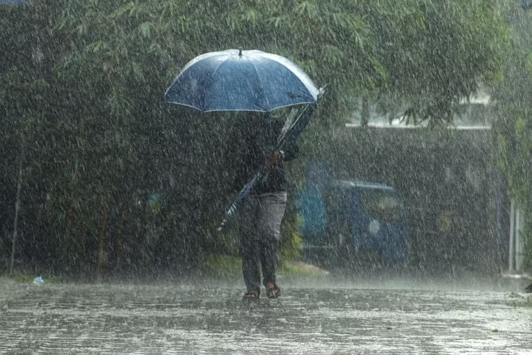
The atmospheric blocking that sustained a prolonged heatwave, leading to record-high temperatures, especially in the capital, is weakening. This allows for a more dynamic weather pattern to emerge, characterized by persistent precipitation and cooler conditions.
Authorities are issuing storm warnings and advising residents to prepare for a New Year’s week dominated by these changing weather dynamics, impacting travel and outdoor activities throughout the state.
Meteorological shift ushers in instability
The weakening of the atmospheric blocking mechanism marks the end of an intense heatwave that gripped São Paulo, causing unprecedented high temperatures. This transition paves the way for a period of increased meteorological instability, with more consistent rainfall expected in the coming days.
According to the State Civil Defense, the new weather pattern will feature not only persistent rain but also the potential for lightning strikes and strong wind gusts. These conditions are anticipated to be particularly pronounced in regions such as the Vale do Paraíba, the North Coast, and the Vale do Ribeira, where vulnerability to extreme weather events is higher.
Outlook for early January rainfall
For the initial days of January, the slow passage of a cold front is forecast to intensify atmospheric instability across São Paulo, significantly elevating the risk of heavy rain and severe storms in numerous areas. This weather system’s progression is also expected to contribute to a notable reduction in temperatures, bringing an end to the intense heat experienced previously.
On Thursday, January 1st, the sun is predicted to appear intermittently between clouds, with scattered showers developing from the afternoon. These precipitation events could range from moderate to strong, influenced by a rapidly moving cold front offshore and the influx of moisture from the Amazon region, creating conducive conditions for downpours.
Weekend weather forecast and impacts
Friday, January 2nd, will see a new cold front advancing along the São Paulo coast, leading to predominantly cloudy skies and a high probability of rain throughout the day. Coastal areas and the eastern strip of the state are particularly expected to experience the brunt of this precipitation.
Rainfall could be moderate to heavy, with significant cumulative totals, substantially increasing the risk of urban flooding, landslides, and fallen trees. Such conditions also raise concerns for traffic disruptions and infrastructure damage, particularly in densely populated or topographically challenging areas.
Elevated risks and vulnerable regions
Cumulative rainfall between January 1st and 4th is projected to be significant across São Paulo, with certain regions identified as being at particularly high risk. These substantial rainfall totals could lead to severe impacts, prompting heightened vigilance from local authorities and residents alike.
Regions expected to experience very high accumulated rainfall include the Vale do Ribeira, Sorocaba, Campinas, Baixada Santista, and the North Coast. Areas such as the Metropolitan Region of São Paulo, Serra da Mantiqueira, and Vale do Paraíba are also anticipated to receive high accumulations, increasing the potential for adverse events.
Other areas, including Araraquara, Bauru, São José do Rio Preto, Franca, Barretos, Ribeirão Preto, Itapeva, Marília, Presidente Prudente, and Araçatuba, are forecast to have medium rainfall accumulations, though vigilance remains crucial across the entire state due to widespread instability.
Government mobilizes for emergency response
The Government of São Paulo has proactively established a crisis cabinet to coordinate preventative measures and response efforts across municipalities in anticipation of these intense rainfall forecasts. This strategic mobilization aims to minimize potential damages and ensure rapid assistance to affected areas.
Throughout the entire week, various emergency response agencies are convening at the Civil Defense headquarters. These meetings are crucial for optimizing service delivery during occurrences and for significantly reducing response times when incidents like flooding or landslides arise.
Safety guidelines for new year travelers
The State Civil Defense strongly advises motorists planning to travel during the New Year period to exercise extreme caution, especially when confronted with heavy rain. Reduced visibility and slick road conditions necessitate careful driving practices to ensure safety.
Key recommendations for drivers include:
* Avoiding flooded areas
* Reducing speed on wet roads
* Maintaining a safe distance between vehicles
* Seeking a safe place to pull over in cases of low visibility
* Monitoring weather and road conditions before starting a journey
* Following instructions from traffic authorities and concessionaires
Specific advice for various locations
For individuals at the beach during storms, it is recommended to avoid remaining on the sand and refrain from entering the sea under adverse conditions. Seeking shelter in secure locations away from open areas is paramount, particularly in the event of lightning.
Those planning to spend the holiday at farms, country estates, or leisure areas with pools should also be extra vigilant regarding meteorological conditions. During periods of intense heat, sudden heavy showers with lightning and strong winds are common occurrences. In such instances, immediate exit from pools, avoidance of open spaces, and keeping away from trees, poles, or metallic structures are crucial. All outdoor activities should be suspended when lightning is present to mitigate risks.
The State Civil Defense continues to monitor weather conditions closely and emphasizes the critical importance of following official alerts through its designated channels, ensuring public safety during this volatile weather period.
São Paulo weather, storm alert, heatwave end, heavy rain, Civil Defense warnings
