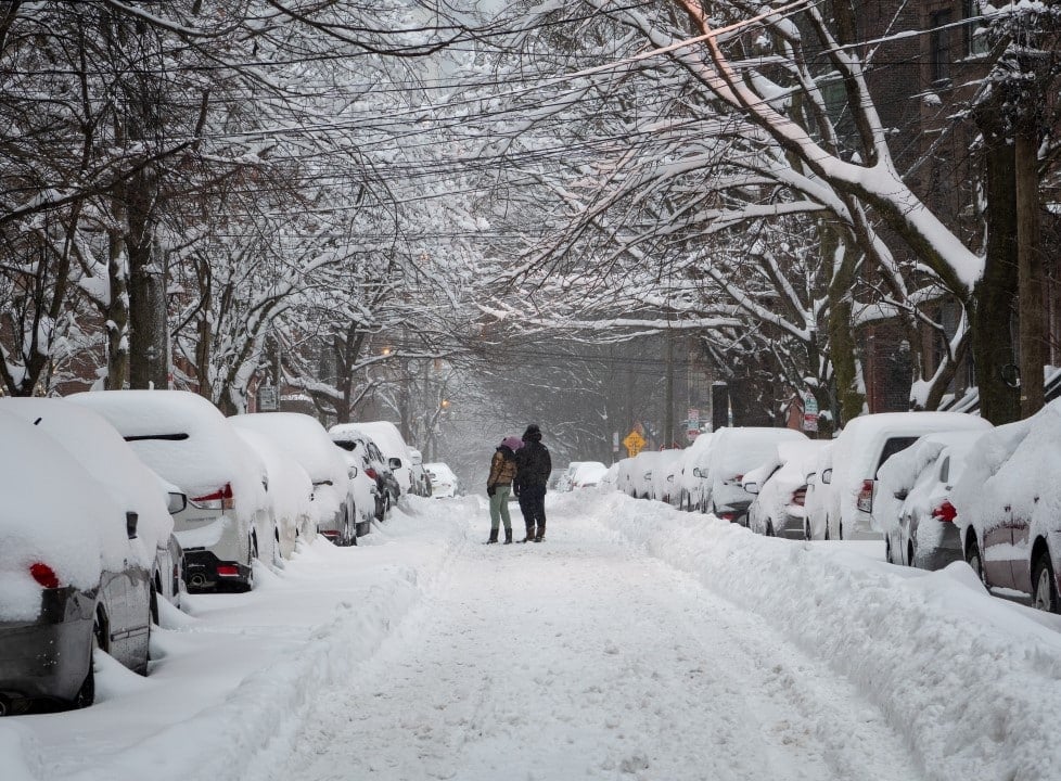
An intense arctic air mass advances over Flórida Central, dropping temperatures and placing much of the region under a frost and freeze warning. Residents felt the impact of climate change on the morning of Tuesday, January 27, with thermal sensations that approached -6°C (20°F) in several locations, an atypical scenario for the state known for its mild climate.
Weather authorities have issued comprehensive warnings covering most counties in the region, with the exception of the coastal areas of Brevard and Volusia, which are expected to see slightly warmer temperatures. The forecast indicates that conditions will worsen overnight, with thermometers potentially registering negative values, increasing concerns about agriculture and the safety of the population.
In response to the severity of the cold, emergency agencies reinforced the need for the community to adopt preventive measures, summarized in the “4 P’s”: protecting people (People), pets (Pets), plants (Plants) and pipes (Pipes). Preparation is seen as essential to avoid serious incidents resulting from low temperatures.
Details of the advance of the polar air mass
The incursion of this cold air mass is a significant phenomenon, originating in the polar regions of Ártico and which managed to move south with unusual strength, breaking the subtropical climate pattern of Flórida. The contrast between the cold, dry air and the humidity present in the region creates ideal conditions for the formation of widespread frost, which poses a substantial risk to sensitive crops, such as citrus, one of the main bases of the local economy. Meteorologists explain that the absence of clouds at night intensifies heat loss from the surface, allowing temperatures to drop even more quickly.
The thermal sensation, or wind chill, has been an aggravating factor. Ventos moderate temperatures combined with cold air mean that the temperature felt by the human body is much lower than that recorded on thermometers. Essa condition increases the risk of hypothermia for anyone exposed outdoors without adequate protection. Public health officials warn that prolonged exposure, even for short periods, can be dangerous, especially for children, the elderly and individuals with underlying medical conditions. The advice is to limit outdoor activities as much as possible during the peak of the cold.
Essential preventive measures to protect family and home
Pet protection is a top priority. Cães and cats should be kept indoors, in heated environments. Animais large animals living outdoors need adequate shelter, with wind protection and dry bedding to prevent loss of body heat.
For plants, especially tropical species common in Flórida gardens, frost can be fatal. The recommendation is to cover them with tarps or blankets before dark, ensuring that the cover does not directly touch the leaves. Vasos minors must be moved to indoor areas or protected balconies.
Plumbing outside or in unheated areas of the home, such as garages and basements, is vulnerable to freezing. Expanding water as it freezes can cause pipes to burst, resulting in flooding and expensive repairs. Isolar line pipes with foam or even towels and leaving a faucet dripping slowly can prevent freezing.
People’s safety is the most critical point. It is essential to dress in layers, wearing clothing that retains heat and protects against the wind. Gorros, gloves and scarves are essential to protect the extremities of the body. Também It is important to check the status of vulnerable neighbors, such as elderly people who live alone.
Climate projections and the freezing weekend
Despite the intense cold at the beginning of the week, the forecast indicates brief relief. The afternoons between Wednesday and Friday should be sunnier, allowing maximum temperatures to rise to the 15°C (60°F) range, providing a breather for residents and local vegetation.
However, this improvement will be temporary. A new storm system is forecast to form and move across the state over the weekend. Este system will act as a catalyst, pushing the Arctic air mass further south and intensifying the cold snap significantly.
The consequence will be a “hard freeze” in the metropolitan region of Orlando and surrounding areas. Projections indicate that temperatures could plummet again to -6°C (20°F) on the nights from Saturday to Sunday and from Sunday to Monday, requiring a new round of preparations and increased attention from everyone.
The impact on agriculture and local economy
The threat of a severe and prolonged freeze puts the Flórida Central agricultural sector, one of the pillars of the state’s economy, on high alert. Plantações of oranges, strawberries, tomatoes and other cold-sensitive crops face an imminent risk of massive losses. Agricultores are working around the clock to implement protective measures, such as using sprinkler irrigation systems, which create a protective layer of ice over plants, and covering large areas with thermal tarps. The cost of these operations is high and does not always guarantee the complete salvation of the harvest. A severe freezing event, such as the one predicted for the weekend, could decimate hectares of plantations, resulting in millions of dollars in losses and impacting the price of these products for the end consumer in the following months. Além In addition, the landscaping and ornamental plant nursery industry also suffers from the loss of valuable inventory.
Advice for safety and community support
Given the adverse scenario, it is crucial that the population stays updated through official meteorological information sources and follows the recommendations of civil defense authorities. Community collaboration plays a vital role in these moments.
Checking the well-being of neighbors, especially the elderly, families with young children and people with reduced mobility, is an act of solidarity that can save lives. Muitas times, these people need help protecting their homes or getting essential supplies.
Continuous surveillance and information sources
Monitoring updates in real time is essential for making safe decisions. Weather conditions can change quickly, and new alerts can be issued at any time. Canais of local news, weather apps, and government agency websites are the most reliable sources.
Individual and collective preparation is the best tool to minimize the negative impacts of extreme cold. Evitar unnecessary travel during high-risk periods, especially at night, helps ensure personal safety and that of others on the roads.
The impact on infrastructure
The intense cold also represents a challenge for urban infrastructure. The sudden increase in demand for heating energy can overload the electrical grid, leading to possible blackouts. It is advisable to have an emergency kit with flashlights, batteries, blankets and non-perishable food. Power and water utilities often beef up their teams to quickly respond to any service interruptions caused by severe weather.
