

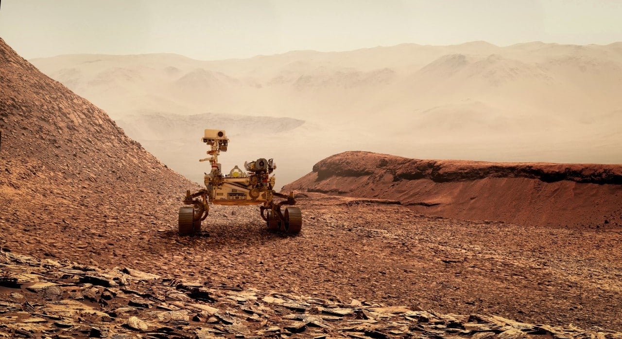
The Perseverance rover, from Nasa, completed five years of exploration in Marte on February 18, 2026 and marked the date with the implementation of a technology that allows it to determine its location autonomously. The vehicle, which landed in the Jezero crater in February 2021, now has the Mars Global Localization system, developed by Laboratório from Propulsão to Jato (JPL). Essa innovation compares panoramic images captured by the rover’s navigation cameras with orbital maps stored on board. The algorithm processes the data in around two minutes and defines the position with an accuracy of approximately 25 centimeters. The update reduces reliance on Terra commands and increases the ability to travel greater distances without frequent interruptions.
The absence of a satellite network like terrestrial GPS has always limited navigation in Marte. Anteriormente, Perseverance used cameras, sensors and estimates based on visual odometry to track its displacement, but errors accumulated over long routes. Incertezas could reach more than 35 meters, which forced the rover to stop in risky areas and wait for further instructions from the team at JPL. The delay in communications, due to the average distance of 225 million kilometers between the planets, further complicated operations. Agora, the autonomous system eliminates the need for immediate human confirmation for most locations.
Implementation and testing of the new system
The JPL team began developing the technology in 2023. The algorithm was validated with images from 264 previous stops of the rover, achieving success in all simulated cases. The first real applications occurred on February 2 and 16, 2026, during routine operations in the Jezero crater. The rover captured 360-degree panoramas with navigation cameras and compared the data with high-resolution maps obtained by the Mars Reconnaissance Orbiter probe. Processing took place on a powerful processor, originally used for communication with the Ingenuity helicopter.
The Mars Global Localization works without depending on external signals or constant updates from the Terra. The rover performs the analysis internally and proceeds with the planned route. Essa capability integrates with the AutoNav system, which already allows you to avoid obstacles autonomously. Juntos, resources expand the scope of scientific explorations.
Main improvements brought by the update
- Location accuracy went from uncertainty exceeding 35 meters to an average error of just 25 centimeters.
- Panoramic image processing time is completed in about two minutes on board the rover.
- The dependency on Terra commands has been drastically reduced, allowing for more continuous operations.
- The system was tested in 264 previous locations and successfully applied to real routes in February 2026.
- The technology reuses hardware previously dedicated to the Ingenuity helicopter, optimizing available resources.
Benefits for scientific operations
The new autonomy allows the Perseverance to travel potentially unlimited distances without frequent calls home. Antes, position uncertainty restricted daily progress and interrupted sample collections or analyzes in challenging terrain. With the precise location, the team can plan more ambitious routes on the edge of the Jezero crater, where the rover investigates sedimentary rocks and signs of an ancient aquatic environment.
Engineers tested the plan in digital simulations before sending commands to the rover. The process minimizes risks and confirms the safe execution of instructions. The technology also facilitates the continuous collection of data about Martian soil and rocks.
Integration with artificial intelligence
The advancement connects to other recent innovations at Perseverance. In December 2025, the rover carried out movements planned entirely by generative artificial intelligence. The system analyzed imagery and elevation data to identify hazards such as rocks, sand fields and slopes, generating safe waypoints. Essas routes reduced planning time and increased mission efficiency.
The combination of global location and autonomous planning optimizes the use of limited operations time. The rover can focus on scientific tasks rather than waiting for guidance for course corrections.
Applications in future space missions
The Nasa highlights that the Mars Global Localization can be adapted to other exploration vehicles. The technology extends independence in environments without navigation infrastructure, such as the surface of Marte or distant moons. Futuras planetary missions will gain in speed and coverage of larger areas.
The reused processor, previously dedicated to the Ingenuity, demonstrates the efficiency in using onboard resources. Especialistas hope similar innovations will support more complex explorations in Sistema Solar.