

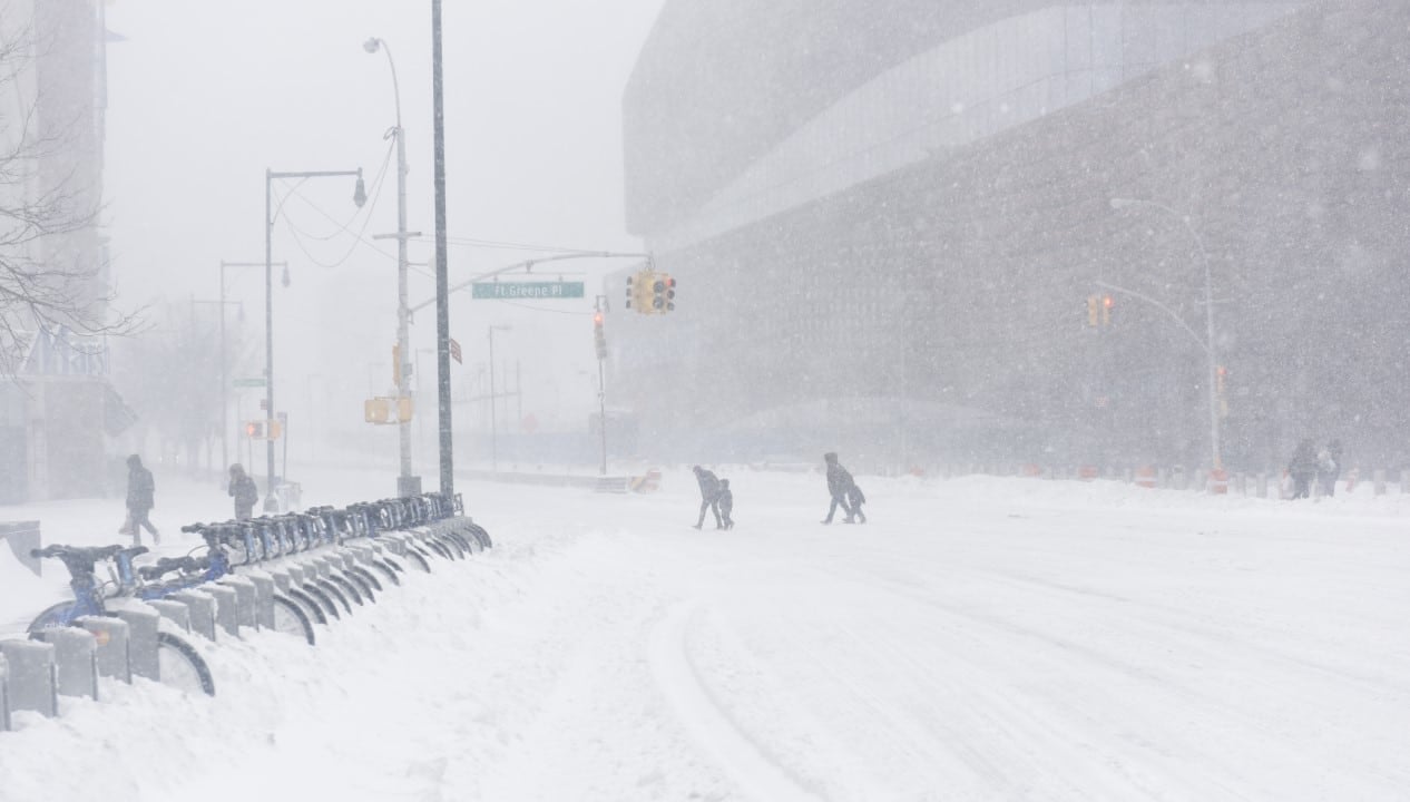
A historic blizzard hit the northeast of Estados Unidos between February 22 and 24, 2026, leaving record snowfalls in several cities and causing widespread disruption. The storm, classified as a bomb cyclone, brought strong winds with hurricane gusts, interruptions in power supply to hundreds of thousands of homes and travel bans in several areas. Regiões and Rhode Island recorded more than 90 centimeters of snow in some places, surpassing historical marks, while Nova York and Boston accumulated between 40 and 50 centimeters. Meteorologistas indicate that additional systems could bring more precipitation in the coming days, complicating the recovery.
The main storm occurred mainly on Monday and Tuesday, with rapid intensification along the coast. National Weather Service issued blizzard warnings in multiple states, and whiteout conditions persisted for hours along coastal stretches.

Accumulated records in several locations
Providence, in Rhode Island, recorded about 96 centimeters of snow at T.F. Locais in Massachusetts and Connecticut also surpassed 78 centimeters, with Somerset and
In Nova York, Central Park accumulated approximately 50 centimeters, placing the event among the ten largest in the city’s history. Long Island had spots larger than 78 centimeters, and Nova Jersey recorded similar totals in nearby areas.
Boston observed about 43 centimeters, contributing to an active winter in the region. Outros states such as Pensilvânia, Delaware and Maryland had accumulated between 35 and 53 centimeters in specific points.
Impacts on infrastructure and services
More than 600,000 customers were left without power in affected states, mainly due to trees fallen under the weight of wet snow and intense winds. Equipes of dealerships worked to restore service, but the combination of heavy snow and gusts over 80 mph delayed repairs.
Flights were canceled at major airports, and public transport systems suspended operations in cities such as Nova York and Boston. Escolas remained closed for days in the most impacted areas, with some adopting remote learning temporarily.
Forecast of new precipitation
Smaller systems brought an additional 2 to 7 centimeters to parts of the Northeast on Wednesday, shortly after the main storm. Meteorologistas monitor the possibility of another round of snow at the end of the week or beginning of next, with models indicating variable accumulations depending on the trajectory.
Serviço Nacional of Meteorologia warns of black ice on roads where melted snow refroze overnight. Condições drivability remains compromised in regions with high snow piles.
Recovery underway in major cities
Municipal crews in Nova York removed tons of snow from roads to gradually open up traffic. Em Providence, officials have stated that the cleanup represents a large-scale task, focusing on key corridors first.
Boston reopened schools after winter break, but in Rhode Island some districts maintained virtual activities. Residentes report difficulties accessing buried garages and sidewalks.
Emergency measures adopted
State governments activated emergency operations centers to coordinate responses. Alertas travel restrictions were issued, and temporary shelters opened for people in vulnerable situations.
The combination of heavy snow and winds caused isolated structural damage, such as collapsed roofs in areas with higher accumulations. Equipes rescue teams responded to incidents related to cold and reduced mobility.
Comparison with historical events
The blizzard of 2026 surpassed 1978 records by Rhode Island and entered top 10 lists by Nova York. The event highlights a pattern of intense winters in the region, with frequent bomb cyclogenesis on the east coast.
Experts note that the rapid intensification of the system contributed to the high precipitation totals and strong winds. The amount of water equivalent in melted snow reached significant volumes in affected states.
Continuation of meteorological monitoring
Forecasters monitor developments in models for the next potential storms. Qualquer new system can interact with the soil that is still covered, increasing the risk of flooding due to melting or further accumulation.
Winter 2025-2026 is already seeing above-average snow activity in the Northeast, and the conditions remain a main focus for local authorities.