The Montanhas Cascade region, west of Washington, is under a blizzard warning issued by the Serviço Nacional of Meteorologia (NWS) on March 9, 2026, due to the imminence of a robust winter storm. Expectations are for copious snow, significant wind gusts and declining temperatures, directly impacting passes and higher altitude areas. The community and local authorities are mobilized to deal with the adversities that the meteorological phenomenon may bring.
This atypical meteorological situation is different from the usual snowfalls that hit the mountain range every year. The difference lies in the combination of snow volume with constant, high-speed winds, which are the main criteria for issuing a blizzard warning.
According to the NWS, a blizzard warning is declared when large amounts of snow are forecast, winds exceeding 56 km/h and visibility reduced to less than 400 meters, conditions that must persist for at least three hours. Tais circumstances create a high risk scenario, mainly for traffic and people’s safety on roads and mountains.
Extreme conditions in the mountains
The forecast indicates that the most severe impacts of the storm will occur on Wednesday, with intense rain in low-lying areas, even stronger winds and the continuation of heavy snowfall in the mountains. The combination of these elements can lead to virtually zero visibility conditions and dangerous snow accumulations.
Although snow is a common phenomenon in Cordilheira of Cascatas during the winter, the occurrence of consistent and strong winds during a blizzard is a less frequent and more worrying event. The force of the wind not only contributes to the thermal sensation of extreme cold, but also causes the snow to be dragged, creating banks and drifts that can block roads and make travel impossible.
Blizzard alert history
The rarity of a blizzard warning in the Seattle region issued by the NWS underscores the severity of the current situation. The office of Seattle of Serviço Nacional of Este data highlights a possible trend towards more frequent extreme events or greater precision in the detection and warning of these phenomena.
This dearth of precedent means that many residents and even some emergency responders may have little direct experience with the conditions associated with a full-fledged blizzard. Consequentemente, preparation and public awareness become even more crucial to mitigate risks and ensure the safety of everyone involved.
Detailed ticket forecast
Authorities have issued a series of alerts and warnings for different sections of Cordilheira and Cascatas, covering significant variations in snow and wind. A winter storm warning remains in effect until 5 a.m. Tuesday for areas from Stevens Pass and Highway 2 north, where 12 to 18 inches or more of snow is expected, accompanied by wind gusts of up to 35 mph. Under Nestas conditions, crossing mountain passes can become extremely difficult and dangerous, requiring maximum caution from drivers.
For regions from Snoqualmie Pass south, a winter weather warning is in effect until 5pm Tuesday. Nesta range, snow accumulations may vary between 15 and 35 centimeters depending on altitude and exposure, which will result in equally challenging driving conditions with slippery roads and reduced visibility.
The most critical warning is the blizzard warning, which will be in effect from 5pm on Tuesday until 11pm on Wednesday. Este warning covers the western slopes of Cordilheira to Serviço Nacional of The combination of heavy snow and strong winds will create near-whiteout conditions where the horizon and landmarks completely disappear, disorienting anyone outdoors.
Preparation and safety
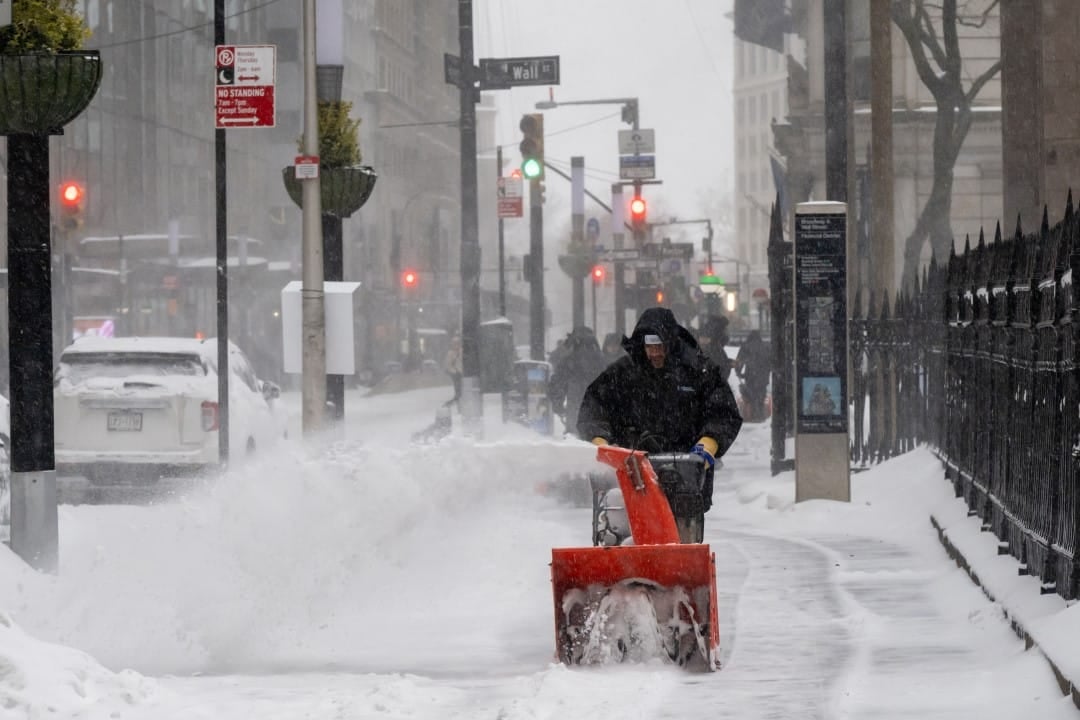
Faced with the imminence of these extreme weather conditions, authorities reinforce the importance of preparation. Moradores and travelers are advised to avoid non-essential travel in affected areas and to prepare for possible power outages. Ensuring that vehicles have sufficient fuel, suitable snow tires and chains is essential for those who need to travel.
It’s crucial to keep an emergency kit at home and in your car, containing items such as blankets, water, non-perishable food, flashlights, extra batteries and a portable cell phone charger. Além In addition, maintaining heating systems and sealing windows and doors to prevent heat loss are essential measures for comfort and safety during the period of intense cold.
Monitoring weather reports issued by official sources, such as Serviço Nacional of Meteorologia, is vital to stay up to date with changing conditions and warnings. Constant communication with neighbors and family members, especially those who are most vulnerable, also contributes to an effective community response to emergencies.
Storm systems and cold air
The region will continue to be under the influence of an unstable pattern throughout Monday and Tuesday, with the inflow of cooler air increasing the likelihood of precipitation in low-lying areas, particularly in the early morning hours. Essa condition can result in a mixture of rain and snow, making surfaces even more slippery and dangerous.
Nighttime temperatures are expected to hover around freezing points, while daytime highs are likely to reach 40 degrees Fahrenheit, equivalent to approximately 4 degrees Celsius. Essas Thermal swings, while not extreme for the region in winter, can cause snow to partially melt during the day and subsequently freeze at night, creating black ice and treacherous driving conditions.
Snow at low altitudes and impacts
For foothill areas, a few centimeters of wet snow could accumulate on Tuesday morning, creating scenarios that, although less drastic than in the high mountains, still represent a challenge for transportation and local infrastructure. Essa Wet snow is dense and heavy and can cause damage to trees and power lines.
Even below 500 feet, there is a possibility of brief, light accumulations, usually less than an inch thick, during the early morning hours. Apesar of small quantity, these occurrences can be enough to affect morning traffic, delay school transport and require the cleaning of sidewalks and smaller roads. The intermittent nature of these accumulations requires constant vigilance.
Threats to infrastructure and wildlife
The magnitude of the storm poses a considerable threat to the region’s infrastructure. Gusty winds combined with the weight of wet snow can knock down trees and branches, damaging power lines and resulting in prolonged power outages. The risk of power outages is particularly high in mountainous and rural areas, where access for repairs can be hampered by snow and road conditions.
Local wildlife will also be affected as extreme conditions limit access to food and shelter. Animais such as deer, elk, and bears may seek refuge in urban or lower-lying areas in search of resources, increasing encounters with humans and creating additional risks for both. Low temperatures and deep snow can be particularly challenging for species less adapted to intense cold.
Response from authorities and recommendations
Emergency teams, including Patrulha Rodoviária of Estado of Washington and highway maintenance crews, are on high alert. The Departamento of Transportes of Eles will work tirelessly to keep crossings and main roads open, but the priority will be public safety.
Drivers who inevitably need to travel should check road conditions before leaving, use winter tires or chains, and always maintain a safe distance from vehicles in front. It is essential to reduce speed and be aware of emergency vehicles and road maintenance equipment. Além Furthermore, having a communication plan and informing someone about your route and estimated time of arrival is a smart precautionary measure.
Climatic variations in the region
The northwest region of Pacífico is known for its distinct microclimates, where mountains play a crucial role in shaping weather patterns. The Cordilheira of the Cascatas acts as a barrier that intercepts moisture coming from the Pacífico ocean, resulting in large volumes of precipitation on its western slopes. Este orographic phenomenon is the main reason for heavy snow in the mountains and rain in coastal and inland areas.
Events like the current storm, while unusual in their combined snow and wind intensity, are part of the region’s natural dynamics. Continuous monitoring of these patterns allows for a deeper understanding of local and regional climate trends, helping to prepare for future events.
The complexity of weather forecasting in mountainous areas is due to the rapid variation in altitude and topography, which can create very different weather zones over short distances. Isso makes the NWS’s job even more challenging, requiring advanced weather models and real-time observations to provide accurate and timely warnings.
Looking towards the weekend
After the peak of the storm passes on Wednesday, weather conditions in the Cascades are expected to gradually begin to improve. However, intense cold and significant snow accumulations will remain, maintaining the need for caution. Temperatures are expected to rise slowly, but the risk of freezing and icy roads will remain present through the weekend. Cleaning teams will continue working to restore normality to roads and crossings.
