

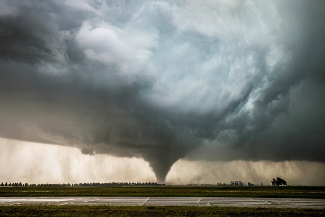
A regional wave of severe weather is forecast for Monday afternoon across parts of the Central Plains of Estados Unidos. Centro of Previsão of Tempestades of Serviço Nacional of Meteorologia issued a warning for a moderate risk (level 4 of 5) of severe thunderstorms, with the possibility of several strong tornadoes and significant damage. The forecast includes intense rotating supercells, baseball-sized hail and destructive winds.
The center warns of the potential for hurricane-force tornadoes in some hard-hit areas. The forecast was issued this Sunday, leaving just over 24 hours for communities to prepare. Meteorologistas warn about the dangerous combination of an unstable atmosphere and wind shear favorable to the development of severe storms.
Cenário of intense thunderstorms on Monday
Meteorologistas expect several rotating supercells to develop during the afternoon. Essas atmospheric structures are capable of producing long-lasting tornadoes and extreme hail. The central plains region presents ideal conditions for the formation of severe thunderstorms, with warm, moist air at the surface contrasting with dry air at altitude.
The possibility of hail the size of baseballs poses a high risk to windows, roofs and vehicles. Além Additionally, scattered winds with the potential to cause large-scale damage are forecast. Predicted wind shear for Monday afternoon will provide the necessary rotation for potentially violent tornadoes.

Avisos of Serviço Nacional of Meteorologia
The federal meteorological agency highlights:
Full coverage: Latest News (EN)
- Vários made possible during the event
- Generalized Granizo the size of baseballs
- Potencial for hurricane-force tornado in localized areas
- Vendavais capable of felling trees and damaging structures
- Duração extended from storms in affected region
Habitantes from areas at risk are recommended to constantly monitor alerts and keep security plans updated. Celeiros, warehouses and structures with fragile roofs face an elevated risk of structural collapse. Autoestradas may experience reduced visibility and obstacles caused by debris.
Distribuição geographic and timing
Severe activity is expected to concentrate in the Central Plains during Monday afternoon, with risk peaking between mid-afternoon and early evening. The time window allows residents to seek appropriate refuge. Meteorologistas monitor atmospheric patterns in real time to refine the forecast over the next few hours.
Moderate risk (level 4) represents one of the most serious alerts issued by the forecast center. Apenas level 5, categorized as extreme risk, exceeds this classification. Esse warning level is issued on average only a few days per year across the North American Plains region.
Histórico from similar events
Surtos of spring storms with risk of multiple tornadoes have caused significant losses in previous years. Comunidades in the Plains have developed emergency protocols for these recurring events. Community Abrigos are typically activated when moderate or higher risk alerts are issued by weather authorities.
Emergency Agências in affected states have initiated preparedness protocols. Disaster Response Equipes are on standby for emergency medical care and search and rescue operations. Power Linhas are under enhanced supervision due to the risk of windstorms.
Preparação recommended for residents
Especialistas recommend that residents of areas under alert prepare emergency supplies and identify safe shelters. Abrigos underground or windowless indoor rooms offer maximum protection against tornadoes. Veículos must be fueled and important documents kept accessible for quick evacuation if necessary.
Monitoramento continuous weather alerts are critical on Monday afternoon. Telefones cell phones must be charged and weather apps activated for automatic notifications. Rádios portable weather forecasters provide updates even during power outages caused by storms.