A strong earthquake struck the south coast of Mindanao, at Filipinas, on Monday morning. The tremor occurred at around 7:37 am local time. Autoridades recorded a magnitude of 7.8. The epicenter was close to the province of Sarangani.
The shock caused building collapses and damage to several structures in the region. Equipes rescue teams act to assess the extent of the impacts. A tsunami with waves of up to 75 centimeters was observed at Indonésia.
Initial Danos focus on Mindanao
The tremor occurred at a shallow depth, which increased the intensity felt on land. Várias buildings in General Santos have suffered partial collapses. Imagens show cracks in bridges and public buildings.
Preliminary Relatos indicates dozens of injuries due to falling debris. The Philippine government mobilized emergency teams to the area. Cortes of energy affected entire neighborhoods after the event. Equipes search for possible arrested victims.
- Prédios residential and commercial damaged in General Santos
- Ponte with serious cracks on an important access road
- Queda of energy in multiple municipalities close to the epicenter
- Deslizamentos of land reported in neighboring province
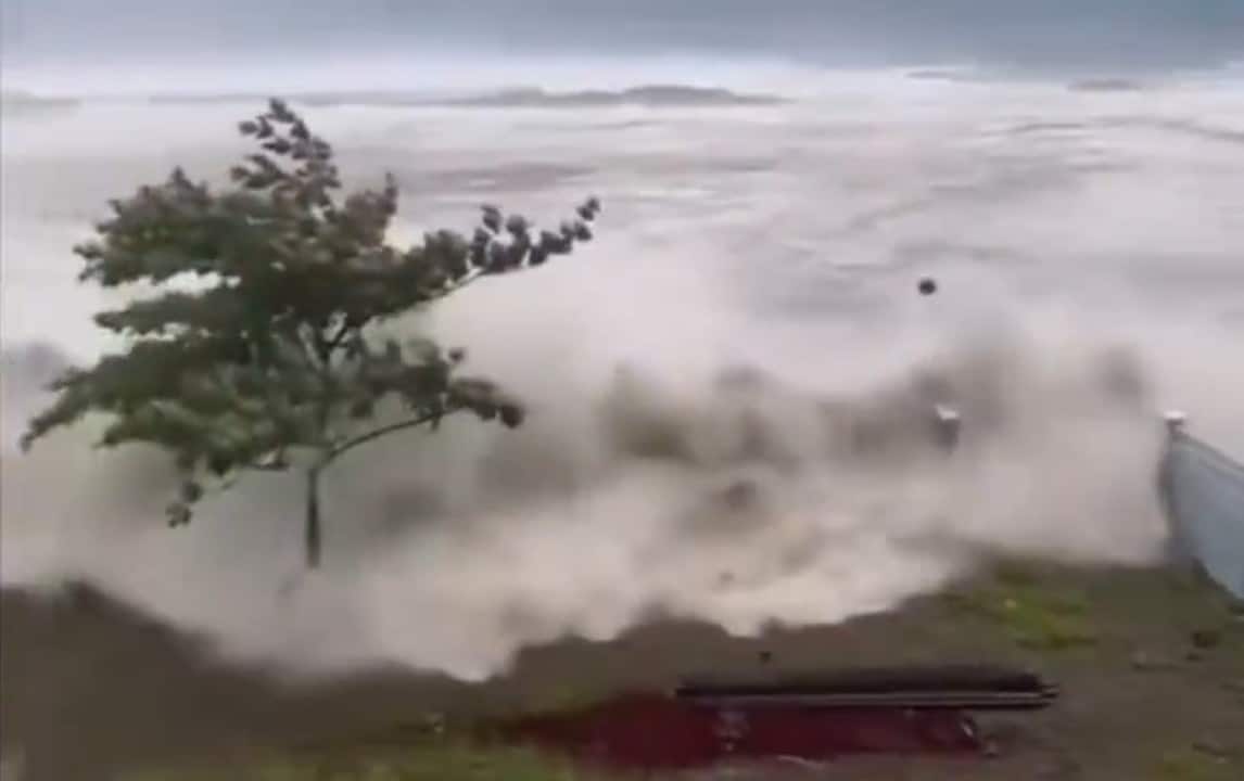
Tsunami Ondas arrives at Indonésia and other points
Indonesian authorities confirmed the observation of a 75-centimeter tsunami before 10:30 am Japão time. The phenomenon reached Ilhas Sanjaya, in the Sulawesi province of Norte. Smaller Ondas have appeared in other locations.
Centro of Alerta of Tsunamis of Pacífico followed the movement. Medições recorded 46 centimeters in Davao, in Filipinas. Ondas of 17 centimeters appeared in Bitung, in Indonésia. Pequenas sea rises were also noted in Palau.
No Japão, 30 centimeter tsunamis arrived at Miyazaki’s port. Outras stations recorded waves between 10 and 20 centimeters at different points on the south coast. The warnings led to preventive evacuations in coastal areas.
Resposta of Philippine authorities advances
The Philippine government has begun a full damage assessment. Presidentes locations coordinate aid distribution. Equipes of Instituto Filipino of Vulcanologia and Sismologia monitor replicas. Mais of a hundred aftershocks have been detected so far.
Moradores from coastal areas were ordered to move to higher ground. The warning system worked and allowed timely evacuations. Autoridades has not yet released the final casualty count.
The country is in a zone of high seismic activity. The archipelago records thousands of earthquakes per year. Muitos of them do not cause significant damage. Este event stands out for its magnitude and location close to the coast.
Impactos regional and monitoring continues
Vizinhos like Indonésia and Palau have activated prevention protocols. The Indonesian meteorological agency monitored the advance of the waves in real time. Nenhum severe tsunami damage has been reported so far in these areas.
Equipes international companies offer technical support for data analysis. The focus remains on searching for survivors and stabilizing compromised structures. Autoridades expect rescue work to last several days.
The shallow depth of the earthquake contributed to the tsunami generation. Especialistas highlight the importance of warning systems in the Anel region of Fogo. Filipinas and Indonésia constantly invest in preparing for events of this type.
Histórico of seismic activity in the region
Mindanao has faced strong tremors in the past. Local people know the evacuation procedures. Escolas and public buildings follow anti-seismic construction standards, but not all old homes resist.
This Monday’s event reignites discussions about resilient infrastructure. Governos locations review contingency plans regularly. Regional cooperation between Filipinas, Indonésia and Japão facilitates sharing of seismic information.
Réplicas can continue for weeks. Moradores were instructed to avoid damaged structures. Cleanup and reconstruction operations are dependent on completion of the initial damage assessment.
