
A powerful thunderstorm swept through northwestern Alabama on the evening of May 20, 2025, prompting urgent warnings from the National Weather Service. The storm, detected at 7:55 PM CDT, was located approximately 8 miles northwest of Hackleburg, roughly 12 miles north of Hamilton, and was charging eastward at 45 miles per hour. Capable of unleashing wind gusts up to 60 mph and quarter-size hail, the storm posed significant risks to infrastructure and safety across Franklin and southwestern Lawrence Counties. Residents were urged to seek immediate shelter as the region remained under a Tornado Watch until 10:00 PM CDT.
The storm’s potential for destruction was not to be underestimated, with authorities emphasizing the need for swift action. Vehicles, roofs, siding, and trees were particularly vulnerable to the high winds and hail, which could cause widespread damage in affected areas. Local communities, including Russellville, Hodges, and Mt Hope, braced for impact as the storm barreled through. The following areas were identified as being in the storm’s direct path:
- Russellville, a hub for local commerce and community activity.
- Hodges, a small town with tightly knit neighborhoods.
- Cedar Creek Reservoir, a popular recreational area.
- Mt Hope, known for its rural landscapes and agricultural significance.
- Smaller locales like Atwood, Tharptown, Duketon, Rockwood, Wren, and Landersville.
This severe weather event underscored the importance of preparedness in a region accustomed to volatile spring and summer storms. As the storm progressed, residents were advised to remain vigilant, with the possibility of worsening conditions looming large.
Storm’s destructive potential
The thunderstorm’s intensity was driven by its ability to produce wind gusts reaching 60 mph, strong enough to topple trees and damage structures. Quarter-size hail, measuring approximately one inch in diameter, added to the threat, capable of denting vehicles and shattering windows. Meteorologists noted that the storm’s rapid movement at 45 mph meant it could cover significant ground quickly, leaving little time for residents to react. The National Weather Service in Huntsville issued the warning at 7:58 PM CDT, highlighting the storm’s radar-indicated hazards and urging immediate action.
In rural areas like Franklin and Lawrence Counties, where homes and businesses are often spread out, the storm’s impact could be particularly severe. High winds posed a risk to power lines, potentially causing outages that could disrupt daily life. Hail, meanwhile, threatened crops and livestock, critical to the region’s agricultural economy. The combination of these factors made the storm a significant concern for local authorities, who worked to disseminate warnings through radio, television, and mobile alerts.
Affected communities prepare
Communities in the storm’s path took swift measures to protect lives and property. In Russellville, a city of approximately 10,000 residents, emergency services were on high alert, ready to respond to reports of damage or injuries. Schools, businesses, and public facilities in the area either closed early or reinforced safety protocols, ensuring people could find shelter. The city’s location along major highways made it a focal point for storm-related updates, with local media broadcasting real-time information to keep residents informed.
Smaller towns like Hodges and Mt Hope faced unique challenges due to their rural settings. With fewer resources than larger cities, these communities relied heavily on volunteer fire departments and local leaders to coordinate storm response efforts. Residents were encouraged to secure outdoor objects, such as patio furniture and farm equipment, to minimize damage from flying debris. In areas near Cedar Creek Reservoir, boaters and campers were advised to seek shelter immediately, as the open water and exposed terrain offered little protection from the storm’s fury.
Safety measures emphasized
The National Weather Service provided clear guidance for those in the storm’s path, emphasizing the importance of finding safe shelter. Residents were instructed to move to an interior room on the lowest floor of a sturdy building, away from windows and exterior walls. This precaution was critical to avoiding injury from flying debris or collapsing structures. For those caught outdoors or in vehicles, the advice was to seek the nearest substantial shelter and protect themselves from hail and wind.
Key safety recommendations included:
- Avoiding open fields, hilltops, or tall trees, which could attract lightning.
- Staying away from windows to reduce the risk of injury from shattered glass.
- Monitoring weather updates via NOAA Weather Radio or mobile apps.
- Preparing an emergency kit with essentials like water, food, and first-aid supplies.
- Ensuring pets and livestock were secured in safe locations.
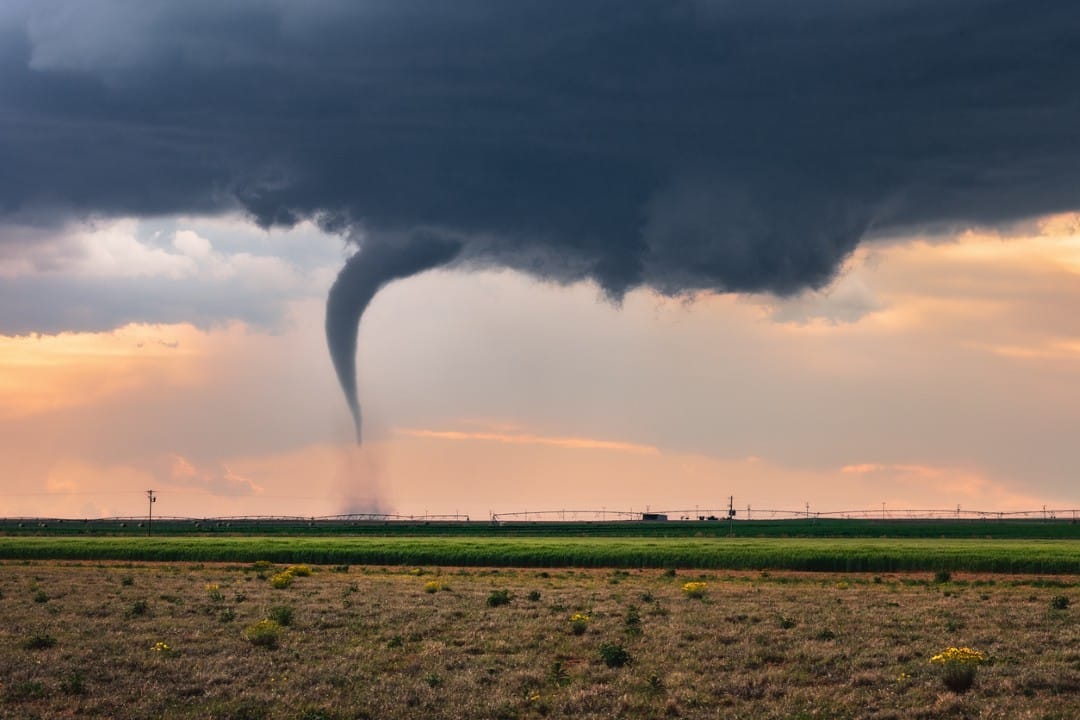
These measures were particularly important given the Tornado Watch in effect for much of north central and northwestern Alabama. While the immediate threat was from the thunderstorm, the potential for tornadoes added an extra layer of urgency to the warnings.
Regional weather patterns
Northwestern Alabama is no stranger to severe weather, particularly during the spring and early summer months. The region’s geography, with its mix of rolling hills and flat plains, can exacerbate storm activity, creating conditions conducive to high winds and hail. The storm on May 20, 2025, was part of a broader weather pattern affecting the Southeast, where warm, moist air collided with cooler fronts, fueling thunderstorm development. Meteorologists noted that the rapid movement of this storm was consistent with similar events in the region earlier in the year.
In the weeks leading up to this event, Alabama had experienced several rounds of severe weather, including tornadoes and flash flooding. These patterns underscored the need for ongoing preparedness, as even seemingly routine thunderstorms could escalate quickly. The National Weather Service’s Huntsville office, responsible for issuing warnings in the affected counties, had been tracking the storm’s development throughout the day, using advanced radar systems to pinpoint its location and intensity.
Local infrastructure at risk
The storm’s potential to damage infrastructure was a major concern for local officials. In Franklin County, power lines and utility poles were vulnerable to high winds, which could lead to widespread outages. Russellville’s electrical grid, while robust, had faced challenges in previous storms, prompting utility crews to preposition resources for rapid response. Similarly, in southwestern Lawrence County, rural roads and bridges were at risk of being obstructed by fallen trees or debris, complicating emergency access.
Hail posed an additional threat to vehicles and buildings. In areas like Mt Hope and Hodges, where many residents rely on personal vehicles for transportation, the prospect of hail damage was particularly worrisome. Businesses with large glass windows, such as those in downtown Russellville, took precautions by closing early or covering exposed surfaces. The agricultural sector, a cornerstone of the local economy, faced risks to crops like corn and soybeans, which were in critical growth stages.
Community resilience shines
Despite the storm’s intensity, the affected communities demonstrated remarkable resilience. Local leaders, including mayors and county commissioners, worked closely with emergency management agencies to ensure residents received timely information. In Russellville, community centers opened as temporary shelters for those without access to sturdy buildings. Volunteers in smaller towns like Hodges and Mt Hope went door-to-door, checking on elderly residents and ensuring they were prepared for the storm.
Social media played a significant role in spreading awareness, with local weather enthusiasts and official accounts sharing updates in real time. Residents posted photos and videos of the storm’s approach, helping to document its progression and alert others to its severity. These grassroots efforts complemented official warnings, creating a robust network of communication that kept the region informed.
Historical storm impacts
Franklin and Lawrence Counties have a history of grappling with severe weather, with past storms leaving lasting impacts on the region. In March 2025, a similar thunderstorm brought quarter-size hail and 60 mph winds to parts of Franklin County, causing damage to homes and vehicles. Earlier events, such as the devastating tornadoes of 2011, remain etched in the collective memory, serving as a reminder of the region’s vulnerability to extreme weather.
Notable past incidents include:
- A 2018 thunderstorm that downed power lines across Russellville, leaving thousands without electricity for hours.
- A 2023 hailstorm in Mt Hope that caused significant damage to local farms.
- A 2020 tornado near Hodges that destroyed several homes and injured residents.
- A 2015 flooding event in Lawrence County that closed major roads for days.
These experiences have shaped the region’s approach to storm preparedness, with local governments investing in improved warning systems and community education programs.
Role of emergency services
Emergency services in Franklin and Lawrence Counties were mobilized well before the storm reached its peak intensity. Fire departments, sheriff’s offices, and paramedics coordinated with the Alabama Emergency Management Agency to ensure a rapid response to any incidents. In Russellville, the city’s fire department conducted pre-storm checks on equipment and personnel, while volunteer firefighters in smaller communities stood ready to assist.
The National Weather Service’s warnings were relayed through multiple channels, including emergency alert systems and local radio stations. In rural areas, where cell service can be spotty, community sirens and word-of-mouth communication played a critical role. These efforts ensured that even the most isolated residents were aware of the storm’s approach and could take appropriate action.
Economic implications
The storm’s potential to disrupt the local economy was a pressing concern. Franklin County’s agricultural sector, which includes livestock and crop production, faced risks from hail and high winds. Damage to fields or equipment could lead to financial losses for farmers, many of whom were still recovering from earlier weather events in 2025. In Lawrence County, small businesses in towns like Mt Hope relied on steady foot traffic, which could be disrupted by power outages or road closures.
Tourism, particularly around Cedar Creek Reservoir, was also at risk. The reservoir, a popular destination for fishing and boating, saw a sharp decline in visitors as the storm approached, with cancellations reported at local campgrounds and rental facilities. These economic ripples highlighted the broader impact of severe weather on rural communities, where recovery could take weeks or months.
Environmental considerations
The storm’s environmental impact extended beyond immediate damage to infrastructure and crops. High winds and hail could disrupt local ecosystems, particularly in areas like Cedar Creek Reservoir, where wildlife habitats are sensitive to disturbance. Fallen trees and debris posed risks to waterways, potentially affecting water quality and aquatic life. In agricultural areas, soil erosion from heavy rainfall was a concern, especially for fields left exposed after recent planting.
Local environmental groups were quick to respond, with plans to assess damage and coordinate cleanup efforts once the storm passed. These efforts were critical to preserving the region’s natural resources, which play a significant role in its economy and quality of life. The storm served as a reminder of the interconnectedness of weather, environment, and community well-being.
Ongoing monitoring and updates
As the storm moved through Franklin and Lawrence Counties, meteorologists continued to monitor its progress, providing updates to local authorities and residents. The National Weather Service’s Huntsville office used Doppler radar to track the storm’s intensity and trajectory, issuing alerts as needed. These updates were critical for communities downstream of the storm’s path, where preparations were underway to mitigate potential impacts.
Residents were encouraged to stay tuned to local media and weather apps for the latest information. In areas under the Tornado Watch, the possibility of additional warnings kept emergency services on edge. The storm’s rapid movement meant that conditions could change quickly, requiring constant vigilance from both officials and the public.
Community response and recovery
In the immediate aftermath of the storm, communities began assessing damage and coordinating recovery efforts. Local governments in Franklin and Lawrence Counties set up hotlines for residents to report issues, such as downed power lines or blocked roads. Utility companies deployed crews to restore electricity, prioritizing critical infrastructure like hospitals and emergency facilities.
Faith-based organizations and nonprofits stepped in to provide assistance, offering food, water, and temporary shelter to those in need. In Russellville, churches opened their doors to displaced residents, while community groups in Hodges and Mt Hope organized cleanup drives. These efforts highlighted the region’s strong sense of solidarity, with neighbors coming together to support one another in the face of adversity.
Preparedness for future storms
The May 20, 2025, thunderstorm served as a stark reminder of the importance of preparedness in northwestern Alabama. Local officials urged residents to review their emergency plans and ensure they had access to reliable weather information. Community workshops on storm safety, offered throughout the year, were highlighted as valuable resources for building resilience.
Key preparedness tips included:
- Creating a family emergency plan with designated safe areas.
- Stocking up on non-perishable food and water for at least three days.
- Keeping a battery-powered radio for updates during power outages.
- Regularly inspecting properties for vulnerabilities, such as loose roofing or unsecured objects.
As the region looked ahead, the focus remained on strengthening infrastructure and fostering a culture of readiness to face future weather challenges.
