

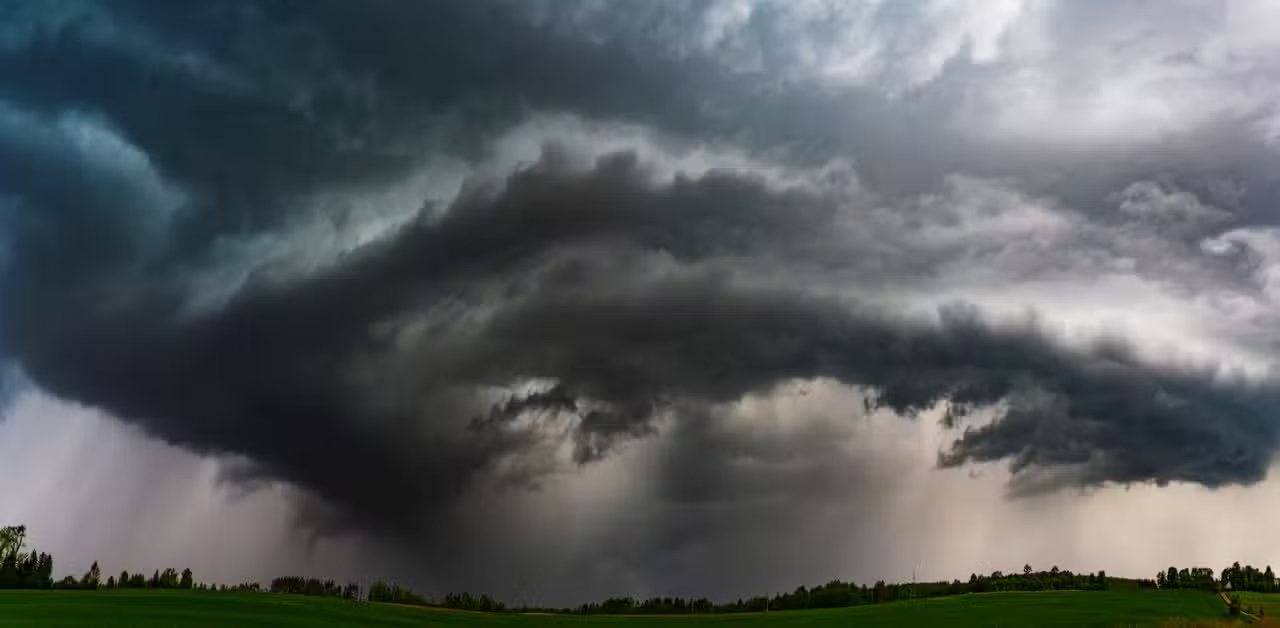
A large tornado was sighted at Minnesota on Monday afternoon and evening. The phenomenon occurred amid severe storms that affected the south of the state. A storm chaser recorded the event, which was part of a sequence of storms with large hail and strong winds.
Authorities confirmed at least two tornadoes in the region south of Minnesota, one west of Amboy in Blue Earth County. Outro tornado was observed near Truman, where the system damaged agricultural structures. The storms also produced large hail, in some cases comparable to eggs or baseballs. Serviço Nacional of Meteorologia issued tornado warnings overnight Monday.
Tornado confirmed in rural area
The tornado west of Amboy touched down around 6:25 pm local time and remained active for about 20 minutes. Relatos indicate damage to a shed on a rural property. Não There is immediate confirmation of injuries or destruction in dense residential areas. Equipes emergency services assessed the affected locations after the alerts ended.
Residents of the region reported intense winds and hail that impacted vehicles and crops. The event marked the beginning of the severe weather season in the state.

Storms affect south of Minnesota
Several rounds of thunderstorms formed on Monday afternoon. The systems brought large hail, destructive winds and a risk of tornadoes to counties including Blue Earth, Faribault and Martin. A tornado warning covered southern parts of the state until late in the evening.
The hail reached significant sizes in several locations. Equipes meteorologists followed the development of supercells in real time. Caçadores of storms positioned in the area captured images of the phenomena.
- Tornado confirmed west of Amboy around 6:25 p.m.
- Tornado observed near Truman with damage in rural area
- Large hail reported in multiple spots
- Strong winds associated with storms
- Tornado warnings issued for several southern regions
Dangerous weather week approaches
A sequence of severe storms is expected to hit the central region of Estados Unidos over the next few days. The pattern includes multiple rounds of thunderstorms that can generate destructive hail, strong winds and some tornadoes. Storm chaser Brandon Clement recorded some of the early activity.
Meteorologists monitor the system’s daily development. The threat covers areas of Meio-West and Planícies Centrais. Residentes should monitor updates from Serviço Nacional of Meteorologia for local alerts.
Atmospheric conditions favor the formation of supercells in the coming days. The risk spans several rounds, with the potential for accumulated impacts on infrastructure and agriculture.
Preparedness for and response to severe weather events
Authorities recommend that the population have shelter plans in case of alerts. Isso includes identifying safe locations within homes or nearby buildings. Veículos do not provide adequate protection against tornadoes.
Emergency response teams remained on standby throughout Monday’s event. Serviço Nacional from Meteorologia issued advance warnings to allow people to prepare.
Initial reports indicate no serious casualties in the areas affected by the tornadoes. Avaliações damage remains ongoing in impacted rural locations.
Continuous season monitoring
Monday’s episode represents the first significant outbreak of severe weather in the spring season in Minnesota. Padrões similar events could be repeated in the coming months.
Meteorologists analyze radar data and field reports to better understand the behavior of systems. The information helps refine predictions for future events in the region.
The population must maintain access to official sources of information about the climate. Aplicativos and weather radios provide real-time updates during hazardous periods.