

As of October 9, 2024, Hurricane Milton has rapidly intensified, posing a significant threat to the west coast of Florida. The storm, which has been categorized as a dangerous Category 4 hurricane, is expected to make landfall by late evening or early night, likely between 9:00 p.m. and 11:00 p.m. local time. Initially projected as a Category 5 hurricane, Milton’s winds were recorded at speeds of up to 160 mph earlier in the day. However, forecasters predict some weakening before landfall, with the storm potentially hitting Florida as a Category 3 or 4 hurricane. Even so, the damage is expected to be severe.
Projected Impact and Wind Speeds
Currently, Hurricane Milton is moving northeastward at about 17 mph, with its winds maintaining a dangerous force. The National Hurricane Center (NHC) continues to warn that winds over 100 mph are expected to sweep across central Florida, especially near the Tampa Bay area. The hurricane’s core winds could still exceed 130 mph upon making landfall. Despite a slight weakening, residents are urged to complete evacuation and safety preparations, as damaging winds, torrential rain, and life-threatening storm surge are imminent.
Milton’s structure has begun to shift, with strong winds now spreading further from the eye of the storm. This expansion of the wind field means that hurricane-force gusts could be felt far inland. As Milton moves across Florida’s peninsula, the storm is expected to cause power outages and infrastructure damage, with debris posing a serious hazard due to the high wind speeds.
Evacuations and Emergency Responses
In preparation for the hurricane’s arrival, counties across Florida have issued evacuation orders. Mandatory evacuations are already in place for vulnerable zones along the coast, including Pinellas, Hernando, and Hillsborough counties. These zones include low-lying areas prone to flooding and storm surge, as well as mobile homes, which are particularly at risk due to high winds. Emergency shelters have been set up to accommodate evacuees, with many schools and public buildings repurposed as safe havens for those fleeing the storm.
The state’s emergency management officials are also urging residents to complete preparations for long-duration power outages, as the storm’s slow movement across the state could exacerbate the damage. Milton’s torrential rains are expected to cause widespread flooding, particularly in urban areas, where drainage systems could become overwhelmed. Some areas may see storm surges exceeding 10 feet, further increasing the risk of severe flooding.
Timeline of the Storm
Here’s a timeline of key events leading up to Hurricane Milton’s projected landfall:
- October 7, 2024: Milton strengthened into a Category 5 hurricane, with winds reaching a peak of 165 mph as it churned over the warm waters of the Gulf of Mexico.
- October 8, 2024: As Milton approached Florida’s west coast, it was downgraded to a Category 4 storm but continued to pose an extreme risk, with wind speeds still exceeding 150 mph.
- October 9, 2024 (Morning): Milton began to slow down, allowing its wind field to expand, which will result in wider areas experiencing hurricane-force winds.
- October 9, 2024 (Afternoon): The storm is expected to make landfall between 9:00 p.m. and 11:00 p.m., bringing a potential storm surge of up to 10 feet in some coastal areas.
Social Media Reports and Real-Time Updates
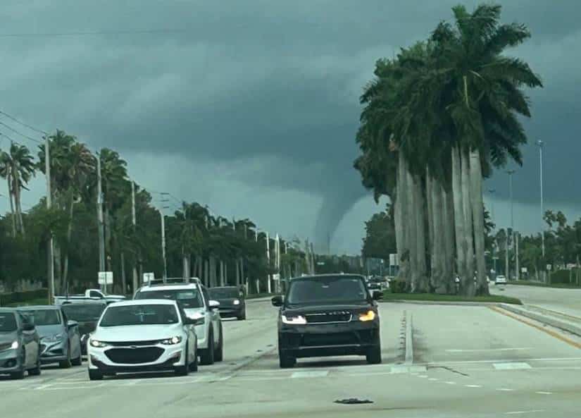
As residents brace for the storm, many are taking to social media platforms like Twitter to share updates, photos, and videos of their preparations. Hashtags related to Hurricane Milton are trending as people across Florida and the broader southeastern U.S. post images of deserted streets, boarded-up homes, and long lines at gas stations. Emergency services and local authorities are also using these platforms to broadcast real-time information, urging people to evacuate and offering guidance on how to stay safe during the storm.

Precautions and Warnings
Authorities are advising everyone in the path of the hurricane to follow evacuation orders and stay tuned to official updates. Those in high-risk areas are encouraged to move to higher ground immediately and avoid the temptation to “ride out” the storm at home. Milton’s storm surge could be one of the most devastating in recent history, and flash flooding is a major concern, especially for coastal communities and urban centers like Tampa and St. Petersburg.
For those who remain in the area, emergency kits, including water, non-perishable food, and batteries, should be prepared. Local officials are stressing the importance of securing outdoor furniture and other objects that could become dangerous projectiles in the high winds. The Florida Department of Transportation is working to keep major evacuation routes open, but residents are urged to leave as soon as possible to avoid traffic jams and road closures.
What Comes Next?
After making landfall, Hurricane Milton is expected to continue its destructive path across the Florida peninsula, possibly emerging on the east coast while still retaining hurricane strength. The long-term impacts on Florida’s infrastructure, economy, and natural environment are expected to be severe, particularly in regions that have yet to recover from previous storms this season.
Floridians are no strangers to hurricanes, but with Milton being one of the most intense storms in recent years, the focus remains on protecting lives and minimizing damage. In the coming days, recovery efforts will likely focus on restoring power, clearing debris, and rebuilding homes and businesses affected by the storm.
As the storm progresses, further updates will provide clarity on the extent of the damage, but for now, the priority is ensuring the safety of those in the path of Hurricane Milton. Residents should stay alert, follow instructions from local authorities, and remain indoors until the storm has passed.