
Bomb cyclone advances along the east coast of the USA and promises the first widespread snowfall in the Northeast this Tuesday

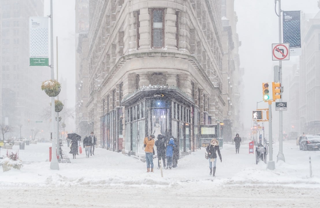
A winter storm moves through the center of the Estados Unidos and gains strength to become a bomb cyclone on Tuesday, December 2, 2025, affecting the east coast towards the Atlantic Canadá. The phenomenon affects regions already covered by recent snow, with winter weather alerts issued for around 70 million people from Planícies to Nordeste. Rapid intensification occurs due to a sharp drop in atmospheric pressure, which increases the risk of strong winds and snow accumulations.
The weather system is heading east, after causing disruption to traffic and snow clearing in the Meio-West region over the weekend. Autoridades locations record flight delays and road accidents in areas such as Des Moines, in Iowa, where strong winds complicate travel. Dezembro begins meteorological winter at Hemisfério Norte, and this front reinforces the season with persistent low temperatures.
- Accumulated snow may exceed 25 centimeters in parts of Nordeste and Apalaches.
- Wind gusts in excess of 80 km/h expected along the coast, with the potential for damage to structures.
- Heavy rains in Sul, with risk of flash flooding on the coast from Golfo to Geórgia.
A subsequent wave of arctic air sweeps across the center and east of the country at the end of the week, increasing the cold to record levels in several places.
Storm trajectory through Meio-West
The cold front has been advancing through the center of the Estados Unidos since Saturday, November 30, after the Ação and Graças holidays. Regiões of Grandes Lagos records the snowiest November day in recent years, with accumulations that require continuous removal efforts.
Airports like Chicago face cancellations and delays, while interstate highways are treated with salt and sand. Equipes emergency personnel monitor the progress of the storm, which intensifies as it absorbs moisture from Golfo from México.
The initial impact is concentrated in states such as Illinois and Iowa, where temperatures range from -7°C to -1°C on Monday, December 1st. Essa condition favors the accumulation of new layers of ice over existing deposits.

Intensification for bomb cyclone
The phenomenon reaches bombogenesis criteria when central pressure drops by at least 24 millibars in 24 hours. Modelos predict a reduction from 1002 hPa to 983 hPa between Tuesday night and Wednesday morning, December 3, exceeding minimum standards.
This acceleration occurs due to the collision of Arctic air with humid Atlantic masses, generating a nor’easter, the first of the season. Áreas inland Nordeste faces the highest precipitation rates, with wet snow weighing down power lines.
Coastal winds gain strength, reaching violent gusts at Nova Escócia and Terra Nova, at Canadá, as the system moves offshore. Autoridades issued warnings on Monday to prepare shelters and stockpile supplies.
Forecasts indicate that the peak of intensity will occur on Wednesday, with the center of low pressure over Atlântico Noroeste.
Alerts and impacts on Nordeste
Winter warnings cover Nova Jersey to Maine, with a state of emergency declared in five counties from Nova Jersey on Monday. Cidades as Boston and Nova York prepare for light layers of snow, but interior areas accumulate more than 15 centimeters.
The US Serviço Nacional of Meteorologia recommends avoiding non-essential travel during prime time on Tuesday, when the morning commute can face chaos. Voos at airports like LaGuardia register reservations with a 20% reduction in advance.
- More than 235 million people under the influence of cold polar air by the end of the week.
- Risk of power outages in 10% of homes in Nordeste due to heavy snow.
- Accumulations exceeding 38 centimeters at elevations of Apalaches, isolating rural communities.
Local governors coordinate responses, focusing on highways and public services.
Conditions at Sul and flooding
While Norte receives snow, the warm side of the storm brings widespread rain to Sul of Estados Unidos. Isolated Tempestades appear over Mississippi and Alabama, with volumes exceeding 100 millimeters in 24 hours.
Flash flooding threatens the coast north of Golfo from México to north of Geórgia, where rivers swell following recent rain. Equipes drainage systems operate in real time, monitoring levels in dams and bridges.
Mild temperatures, above 10°C, contrast with the cold at Norte, but cross winds raise alerts for coastal navigation. The phenomenon as a whole extends over 2,400 kilometers, uniting climate extremes into a single front.
Arctic cold and broken records
Temperatures in the central and northern USA remain between -7°C and -1°C on Monday, with wind chills reduced. Kansas City, in Missouri, records 9 centimeters of snow on December 1, breaking the previous 40-year record of 3.8 centimeters.
About a third of the American continental territory is covered in snow on December 1st, the highest rate for the date in years. Essa coverage amplifies nighttime cooling, with minimums close to -18°C in parts of Planícies.
A second wave of polar air arrives on Thursday, December 4, approaching daily records at Chicago and Minneapolis. The polar vortex contributes to the persistence of the cold, with disruptions predicted for the remainder of the month.
Experts note that December starts with more wintry patterns than the recent average, although local variations occur. Populações urban communities adapt routines, with public heating activated in shelters.
Forecasts for the Atlantic Canadá
The bomb cyclone moves towards Canadá after the American Nordeste, intensifying over Atlântico. Províncias like Nova Escócia face snowfall with accumulations of over 40 centimeters until Wednesday, with winds of up to 100 km/h.
Canadian weather services issue warnings for Newfoundland, where blizzard conditions reduce visibility to zero on highways. Pescadores coastal areas suspend activities, and ports close temporarily.
The transition to the ocean amplifies humidity, prolonging precipitation on Atlantic islands. Temperaturas fall to -10°C, with a slow recovery expected by the end of the week.
This extension of the system highlights climate connectivity between the US and Canadá, with coordinated responses across borders.



