Winter storm moves through the Northeastern US with heavy snow in New York and New Jersey this Tuesday

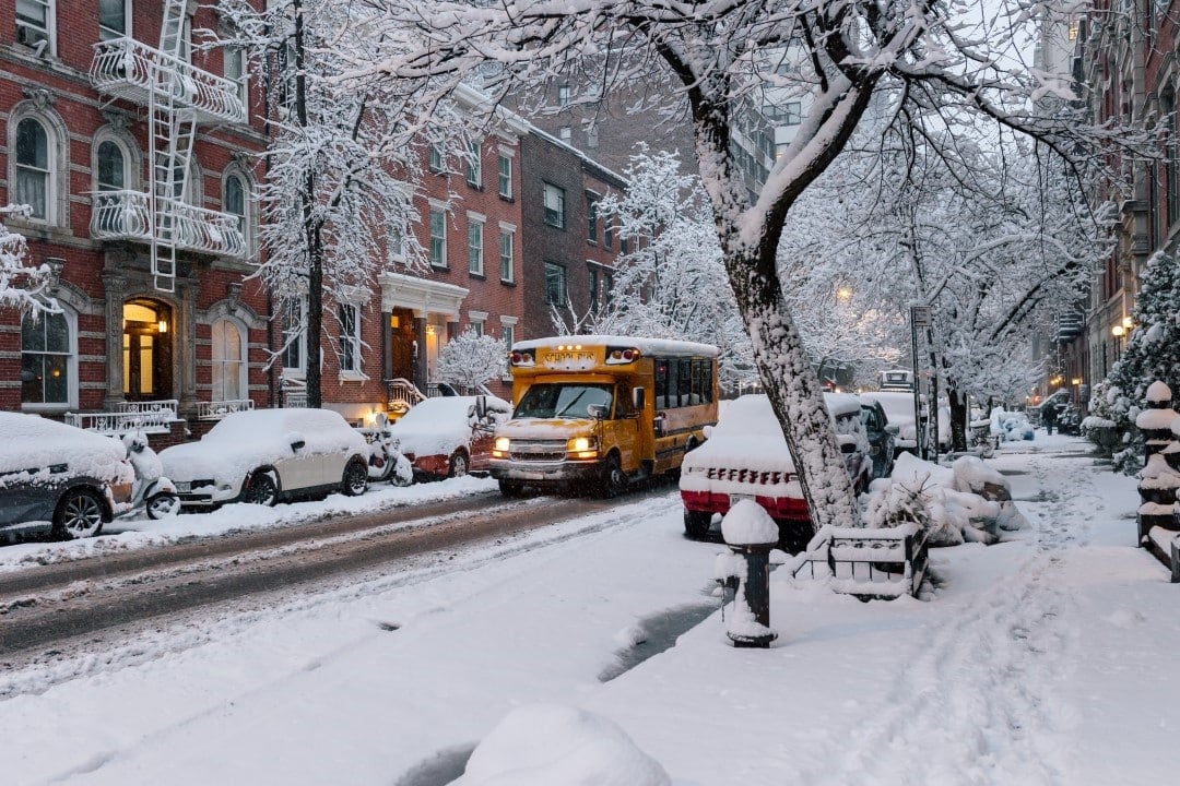
An intense winter storm, known as Winter Storm Chan, moves through Nordeste from Estados Unidos this Tuesday, December 2, 2025, bringing heavy snow and ice to regions of Nova York and Nova Jersey. The weather system, which already caused disruption in Meio-West the previous night, affects tens of millions of people with winter warnings issued by Serviço Nacional of Meteorologia. Precipitation intensifies from the local morning, with times at Tempo of Leste (ET), and should persist until the early hours of Wednesday.
Coastal cities like Nova York and Filadélfia face mostly rain, while inland areas see significant snow accumulations. Autoridades locals mobilize road cleaning teams to mitigate risks to drivers and pedestrians. The phenomenon results from a mixture of cold and humid air coming from Meio-West, generating adverse conditions for air and land traffic.
Forecasts call for the storm to peak between 10 a.m. and 4 p.m. ET, with snowfall at a rate of up to an inch per hour in elevated areas.
- More than 1,100 teams work to remove snow in Ohio and Indiana.
- Flights at Chicago and Nova York airports experience delays of over 200.
- Emergency advice recommends avoiding unnecessary travel until 8pm ET.
The progression of Winter Storm Chan follows a common weather pattern for the time, but with above-average intensity due to persistent cold fronts.
Detailed alerts and forecasts
The Serviço Nacional of Meteorologia has issued winter storm warnings for areas from inland Nova York to east of Regiões elevated from Nova Jersey and Nova York can accumulate 15 to 30 cm of snow, with winds of up to 40 km/h worsening visibility.
Experts monitor the displacement of the system, which moves quickly from Meio-West to Atlântico. Bob Oravec, NWS meteorologist, highlighted that the main band of snow reaches its maximum in the early afternoon locally.
Forecasts updated at 10:43 a.m. ET confirm the risk of ice in Appalachia, affecting secondary roads in Nova Jersey.

Areas most impacted by snow
Nova York records the first flakes since 9 am ET, with initial accumulations of 5 cm upstate. Cidades like Albany and Syracuse face the brunt of the fallout, with local schools opting for remote classes.
In Nova Jersey, the north of the state, including Newark, sees a mix of snow and rain, complicating the morning commute. Autoridades states report more than 500 calls for highway assistance since dawn.
The Meio-Atlântico, from Baltimore to Filadélfia, handles heavy rain, but transitions to snow in the interior raise alerts for drivers.
Strong winds contribute to irregular accumulations, with some isolated areas exceeding 40 cm by the end of the day.
Traffic and aviation disruptions
The storm has already caused more than 300 flight cancellations at airports in Nordeste as of noon ET, with LaGuardia and Newark among the hardest hit. Companhias airlines adjust routes to avoid the turbulence zone.
Interstate highways such as I-95 at Nova York and Nova Jersey have slippery sections, with speeds reduced to 50 km/h at critical points. Equipes of maintenance apply salt to more than 1,000 km of roads.
Pedestrians in urban centers report difficulties with covered sidewalks, and public transport services in Nova York operate at extended intervals.
These disruptions extend travel times by up to 2 hours for regular commuters, according to real-time traffic data.
Local preparedness measures
Nova York authorities activated emergency centers at 7 a.m. ET, distributing warming kits to public shelters. Escolas in Nova Jersey suspended extracurricular activities from 2pm local time.
Recommendations include checking vehicles before departures and stocking up on 24-hour supplies. Bombeiros in rural areas prepare for rescues in deep snow.
Energy companies monitor transmission lines, with teams of 500 professionals on standby for possible power outages.
These actions aim to minimize risks in a region where harsh winters affect millions of residents annually.
Evolution of the weather system
Winter Storm Chan is formed by the interaction of polar air masses with moisture from Golfo and México, a recurring pattern in December. Dados satellites show the storm’s core over Ohio at 11 a.m. ET, moving at 30 mph toward Nordeste.
History indicates that similar events in 2024 accumulated an average of 20 cm in the region, but this year the intensity exceeds it by 15% due to temperatures 5°C below the norm.
Continuous monitoring by the NWS adjusts alerts as radar detects variations in precipitation.
The transition to rain along the coast occurs around 6pm ET, relieving pressures in dense urban areas.
Outlook for the rest of the week
After peaking on Tuesday, remnants of the storm persist on Wednesday with light flakes at Vermont and New Hampshire. Temperaturas drops to -5°C at elevations, prolonging the risk of ice.
Forecasts for Thursday indicate stabilization, with partial sunshine at Nova York and Nova Jersey. However, residual winds could raise coastal alerts until Friday.
Authorities plan damage assessments on Thursday, focusing on affected road infrastructure.
These conditions mark the official start of the snowfall season in the Nordeste, with annual averages of 15 events above 10 cm.