
New winter storm hits the United States with a bomb cyclone and accumulates heavy snow in the Carolinas and Virginia


A new bomb cyclone is forming off Costa Leste from Estados Unidos and is expected to generate a significant winter storm starting this Friday, January 30th. The weather system advances rapidly over Atlântico and combines cold continental air with oceanic moisture, resulting in heavy snowfall in several regions.
The snowfall mainly affects areas of the Sudeste and Meio-Atlântico, with expected accumulations of between 15 and 30 centimeters in specific points. Mais than 28 million people are under meteorological alerts due to the risks associated with the phenomenon.
Conditions include strong winds and the possibility of coastal flooding, made worse by the full moon phase which raises the tides. The storm occurs just days after another intense winter event, complicating recovery in already impacted locations.
- Main regions with heavy snow: Carolina of Norte, south of Virgínia and parts of Nova Inglaterra.
- Areas at risk of transitions to rain: south of Geórgia and Carolina of Sul.
- Coastal areas vulnerable to storm surge: from Carolinas to Nordeste.
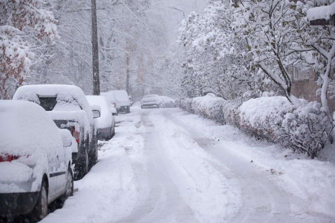
Explosive system formation
A bomb cyclone is characterized by a rapid drop in atmospheric pressure in less than 24 hours. Esse process intensifies the system abruptly and generates extreme conditions in a short period.
The formation begins on Friday night near the coast of Carolina of Norte. Durante on Saturday, the center of the storm organizes itself over the ocean and gains maximum strength on Sunday.
Areas most affected by snow
Snow precipitation is initially concentrated in the south of Apalaches and advances to the north. Higher Acumulados occur at elevations and inland regions of Carolina, Norte and Virgínia.
Southeastern parts of Virgínia are seeing the highest snow totals. The transition to rain occurs further south, limiting the accumulations in Geórgia and Carolina from Sul.
Nova Inglaterra receives snow at the end of the event, with moderate intensity. The persistence of precipitation facilitates rapid accumulation in many locations.
Impacts of winds and storm surge
Intense gusts accompany the cyclone and cause interruptions in the power supply. Árvores falls and structural damage are expected in already fragile coastal areas.
The combination of onshore winds and high tides increases the risk of flooding. Erosão of beaches and flooding of roads close to the coast occur at several points.
Reduced visibility due to snowfall makes traveling on highways dangerous. Autoridades recommend avoiding non-essential travel during the height of the storm.
Conditions in specific regions
In Carolina of Norte, the snow starts in the early hours of Saturday and persists for hours. Locais in elevation accumulates up to 30 centimeters by the end of the day.
Southern Virgínia faces similar conditions with heavy snow and strong winds. The transition north maintains low temperatures that favor accumulation.
Parts of Carolina of Sul record mixing of rain and snow at first. The switch to liquid precipitation reduces snow totals in the southern part of the state.
Geórgia receives minor impacts, with rain predominant in most of the territory. Apenas elevated areas in the north of the state see isolated flakes.
Magnified coastal effects
The full moon raises the tides and increases the effects of undertow along the entire coast. Ondas highs have hit beaches and seaside structures since Friday.
Flooding occurs in low-lying areas of coastal cities from Carolinas to Virgínia. The force of the winds pushes water towards the continent in several areas.
Local authorities monitor water levels and prepare temporary barriers. Evacuações preventive measures are considered in vulnerable communities.
Low temperature forecast
Cold continental air maintains negative marks throughout the event in most affected areas. The thermal sensation drops even more with intense winds.
After the storm passes, the cold persists and makes it difficult to clean roads. Accumulated snow remains on the ground for days in inland regions.
Challenging post-storm recovery
Regions hit by the previous snowfall face additional difficulties with the new event. Equipes cleaning staff work in adverse conditions to free up access.
Power outages affect thousands of homes in rural and urban areas. Serviços emergency services maintain reinforced duty during the weekend.
The combination of recent snow and new precipitation complicates mobility. Escolas and public bodies announce preventive suspensions of activities.
Preparation measures adopted
State authorities issue early warnings to the population in risk areas. Estoques of salt and snow removal equipment are strategically positioned.
Airports in Costa Leste prepare for flight cancellations and delays. Companhias airlines adjust routes to minimize impacts on air transport.
Residents receive guidance to stock up on basic supplies and avoid traveling. Linhas emergency assistance is available 24 hours during the event.
Features of the pump cyclone
The phenomenon frequently occurs in boreal winter on the American Atlantic coast. Explosive intensification distinguishes this type of system from common cyclones.
Meteorological models indicate a trajectory parallel to the coast over the weekend. The proximity to the coast maximizes the effects of wind and precipitation.
The interaction between contrasting air masses fuels the storm. Umidade of Golfo of México contributes to larger volumes of precipitation.
Outlook for the beginning of February
The passage of the cyclone marks the end of the main event on Sunday night. Condições gradually improve on Monday in most areas.
Residues of snow and ice remain on the roads for a few days. Temperaturas remain low in the week following the event.
Monitoring remains active for possible secondary systems on Atlântico. Previsões indicate a persistent winter pattern in the region.
Accumulated snow benefits ski resorts at elevations of Apalaches. Operadores see an increase in visitors after the storm.



