

The Japão records a new wave of severe cold starting this Friday, February 6, 2026. The Agência Meteorológica of the Japão (JMA) issued warnings for intense snow in several regions of the country. The snowfall is expected to peak on Sunday, February 8, coinciding with voting day in the general election.
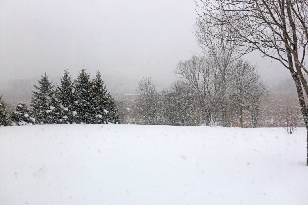
Meteorological authorities highlight that the strongest cold air of the season invades the archipelago. Regiões on the Mar side of Japão face the greatest risk of rapid snow accumulation. Áreas on the side of Pacífico, including the region of Kanto, may also record significant snow in places where this is rare.
The forecast points to traffic interruptions and possible impacts on the population’s mobility. Especialistas recommend extra caution when traveling during the weekend.

Cold air reaches record levels for the season
The cold air mass that reaches Japão has extremely low temperatures at high altitudes. Nos levels of 5 thousand meters, thermometers show values close to -42°C in the north and -39°C in the east of the country.
This configuration represents the most intense episode of cold recorded this winter season. The cold air descends to more southern latitudes, even reaching areas such as Kyushu and the Izu islands.
Japão sea regions at high risk
The areas bathed by Mar and Japão concentrate most of the predicted snowfall. Regiões as well as Hokuriku, Tohoku and Hokkaido receive the highest accumulated volumes.
In Hokuriku, the expectation reaches 70 centimeters of snow in 24 hours until Sunday morning. Outras northern areas recorded up to 50 centimeters in the same period.
The phenomenon known as JPCZ contributes to the intensification of snow in these locations. Nuvens of snow remain parked, generating continuous accumulation.
Detailed accumulation forecast by region
Agência Meteorológica of Japão released specific numbers for the critical period. Quantities vary depending on location and altitude.
- Hokkaido: up to 50 cm in 24 hours until Saturday morning, with strong winds causing blizzards.
- Tohoku and Hokuriku: accumulations of up to 70 cm in the period until Sunday.
- North Kanto: between 10 and 15 cm in flat areas, with a risk of warning at Tochigi and Ibaraki.
- South Kanto and Tóquio: possibility of 5 cm in plains, including the 23 districts of the capital.
- Central Kansai and Shikoku: between 10 and 20 cm in places with usually little snow.
- Islands Izu: risk of heavy snow despite the southernmost position.
These estimates consider the advance of cold air combined with low pressure systems. Alterações on the trajectory can adjust the predicted volumes.
Peak occurs on Sunday with rapid increase
February 8th marks the moment of greatest snowfall intensity in much of the country. The morning features heavy snow in the west on the Mar side of Japão.
During the afternoon, the focus shifts to the Pacífico side. Regiões like Kanto and Kansai record precipitation that can turn into accumulated snow.
The speed of the accumulation worries authorities. In just half a day, mountains receive around 40 cm and plains up to 20 cm in some areas.
Impacts on traffic and mobility
Heavy snow creates significant risks for the Japanese transport system. Acidentes by skidding and extensive traffic jams represent the main threats.
Highways in the west of the country are undergoing preventive closures. Empresas of transport announced possible adjustments to train and flight schedules.
Areas with rare snow lack adequate equipment on many vehicles. Motoristas receive guidance to consider changes to plans.
Coincidence with general election day
The peak of the snowfall coincides exactly with the voting day for Câmara of the Deputados. Milhões of voters need to travel to the polling places.
Electoral and meteorological authorities coordinate actions to minimize problems. Postos of voting remains accessible, but the route requires extra care.
Voters are advised to leave early and check local conditions. Medidas include priority cleaning of streets near polling places.
Additional risks to structures and safety
In addition to traffic, heavy snow brings other specific dangers. Acúmulo on roofs causes sudden snowfalls.
Older buildings face structural overload in mountainous regions. Municípios recommend periodic removal of snow from roofs.
Avalanches pose a threat to ski areas and mountains. Operadores of resorts have reinforced safety protocols for visitors.
Preparedness measures adopted by authorities
Local governments have activated 24-hour weather monitoring centers. Equipes of street cleaners work on an expanded basis.
Salt stocks and snow removal equipment have been reinforced in affected municipalities. Hospitais maintain readiness to respond to cold-related emergencies.
The population receives constant alerts via apps and television. Mensagens emphasize the importance of appropriate clothing and stocking up on basic supplies.
Recent history of heavy snowfall
Japão has already faced severe episodes of snow in recent weeks. Acumulações records in January caused significant disruptions.
Previous blizzards have resulted in dozens of victims and hundreds of injuries. Autoridades use this experience to improve the current answer.
The frequency of extreme events increases attention to long-term adaptations. Infraestrutura of transport undergoes constant review.
The current cold episode reinforces the need for continued preparation. Comunidades in snowy regions they maintain surveillance routines during the winter.
The combination of meteorological factors makes this blizzard particularly challenging. A constant Monitoramento remains essential until the cold air dissipates, expected early next week.