
Bomb cyclone causes record accumulation of snow and cancels flights in several cities in the northeastern US

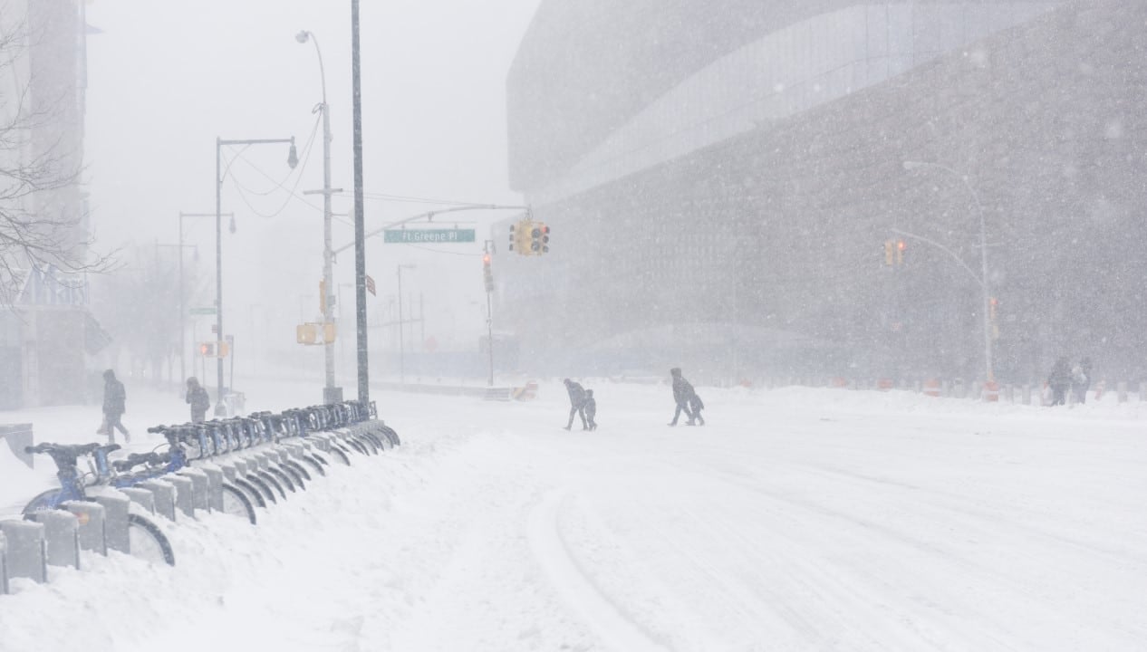
A winter storm of historic proportions hit the northeast region of the Estados Unidos between February 22nd and 24th, leaving a trail of paralysis and breaking snow accumulation records that had stood for decades. The phenomenon, classified by meteorologists as a bomb cyclone due to its rapid intensification, brought hurricane-force winds and intense precipitation that buried entire cities, seriously affecting the daily lives of millions of Americans.
Local authorities confirmed that the weather system caused massive power outages and forced the cancellation of thousands of flights at the region’s main airports. Em Rhode Island, accumulated snow exceeded the 90 centimeter mark in several locations, surpassing previous historical records and isolating communities. The magnitude of the event mobilized state and federal emergency teams to deal with the logistical challenges posed by extreme weather.

The impact was felt across the board, from coastal areas to large urban centers such as Nova York and Boston. Enquanto cleaning teams work around the clock to clear main roads, state governments maintain active safety alerts, asking the population to avoid unnecessary travel.
The situation remains critical in several areas, with new smaller systems expected to bring additional precipitation, hampering recovery efforts. The Serviço Nacional of Meteorologia warns of the ongoing risks associated with ice on roads and the possibility of structural damage to buildings due to the weight of accumulated snow.
Severe impacts on essential infrastructure and services
The passage of the bomb cyclone resulted in a temporary collapse of vital services in several states. Mais than 600,000 customers were without power at the height of the storm, a direct consequence of trees falling onto power lines, driven by the weight of wet snow combined with wind gusts that exceeded 128 km/h (80 mph). Power utilities face significant operational difficulties as adverse conditions prevent repair crews from quickly accessing the most affected areas.
The transport sector was one of the hardest hit, with stoppages that affected regional and national mobility:
- The region’s main airports, including the hubs of Nova York and Boston, have suspended operations, resulting in thousands of cancellations.
- Public transport systems, such as subways and buses, stopped operating to ensure the safety of passengers and employees.
- Interstate roads were preventively closed or became impassable, with reports of abandoned vehicles and zero visibility.
- Rail transport has suffered significant delays and suspensions on critical routes in the northeast corridor.
Schools remained closed in the most impacted districts, with some institutions opting to temporarily transition to remote learning. Em Rhode Island, where the impact was more severe, the resumption of in-person activities is still uncertain in some locations, while Boston began a gradual process of reopening after the winter break, depending on the safety conditions of each neighborhood.
Accumulation records and meteorological data
Data collected during the event confirms the exceptional nature of this snowfall. Providence, in Rhode Island, recorded an impressive 96 centimeters of snow in the Aeroporto T.F. Localidades in Massachusetts and Connecticut also reported accumulations exceeding 78 centimeters, numbers that place this event among the most intense ever documented in the recent history of
In Nova York, Central Park accumulated approximately 50 centimeters of snow. Embora smaller than the totals recorded in Rhode Island, this volume was enough to classify the storm among the ten largest in the city’s history. Long Island and parts of Nova Jersey also faced severe conditions, with accumulation points that rivaled totals observed further north, demonstrating the geographic scope of the system.
Meteorologists explain that “bombogenesis” — the process of rapid drop in atmospheric pressure that characterizes a bomb cyclone — was the determining factor for the intensity of precipitation. The interaction between cold air from the continent and the relatively warmer waters of Oceano Atlântico created the instability necessary for the explosive development of the storm, generating bands of heavy snow that parked over the region for consecutive hours.
Emergency measures and government response
Given the gravity of the situation, state governments activated their emergency operations centers to coordinate the response to the disaster. Abrigos temporary spaces were opened to welcome people in vulnerable situations and those who lost heating in their homes due to power cuts. Authorities issued severe travel restrictions during the height of the storm, measures that were crucial to preventing a greater number of road accidents.
Rescue teams responded to several calls related to exposure to extreme cold and mobility issues. Além In addition, there were records of isolated structural damage, such as the collapse of roofs on commercial and residential buildings that could not withstand the excessive snow load. Removing rubble and assessing the safety of buildings have become priorities for local civil defense teams.
The recovery in large cities is underway, but progressing at different paces. Em Nova York, urban cleaning battalions removed tons of snow to free up traffic on the main arteries. Já into
Historical context and future monitoring
The blizzard of 2026 is already considered a climatological milestone, surpassing in some places the records of the legendary blizzard of 1978, which served as a historical reference for the region of Rhode Island. Especialistas point out that the winter of 2025-2026 has shown above-average activity in the American northeast, with frequent cyclone formations on the east coast, which requires a constant state of alert on the part of authorities and the population.
Meteorological monitoring continues intense, as models indicate the possibility of new precipitation. Sistemas smaller ones have already brought an additional 2 to 7 centimeters of snow to parts of the region in the immediate aftermath of the main storm. Concern now turns to the risk of future flooding if rapid melting occurs, or worsening structural conditions if there is significant new accumulation.
Serviço Nacional of Meteorologia maintains warnings about the formation of “black ice” on roads, an invisible danger created when melted snow refreezes overnight. Driving conditions remain compromised in many secondary areas, where piles of snow reduce visibility and narrow lanes, requiring extreme caution from drivers in the coming days.



