Accumulation of ice and snow complicates morning traffic on southern New Hampshire highways on Friday

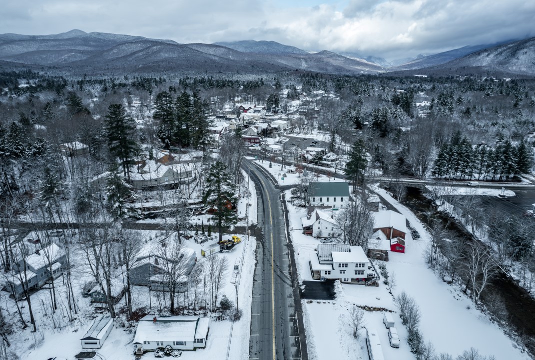
A front of severe weather instability has been hitting the southern and central regions of New Hampshire since Thursday night, turning initial rain into a dangerous mix of snow and freezing precipitation. The meteorological phenomenon drastically changed traffic conditions on Friday morning, requiring extra attention from drivers who use state highways for daily travel and to transport cargo in the Nova Inglaterra region. Temperatures dropped rapidly during the night, consolidating the risk of ice on runways that had not received adequate prior treatment by maintenance teams.
Local traffic authorities and highway patrols have recorded multiple calls for vehicles sliding along critical stretches, especially on bridges and overpasses where freezing occurs more quickly. The official recommendation from public security bodies is that citizens avoid unnecessary trips until the cleaning fleets complete their main work on the busiest routes, ensuring the minimum necessary grip for the tires.
Departamento of Transporte mobilized dozens of salt and sand spreading trucks to mitigate the effects of flash freezing along the state’s main road arteries. Preventative work helped keep primary roads open and flowing at reduced speeds, but secondary roads and local roads still present a high risk of incidents due to the accumulation of black ice, a thin transparent layer that forms on the asphalt and is practically invisible to drivers.
Meteorological experts point out that the transition from rain to snow occurred more quickly than initial forecast models indicated for this period. Isso is due to an arctic air mass that quickly descended over the Canadian border, colliding head-on with residual moisture from the ocean Atlântico, creating a perfect environment for sleet formation before the full transition to snowflakes.
Critical traffic and visibility conditions on southern routes
Morning temperatures remained in the range of -6°C to -1°C in most locations in the south and center of the state, keeping thermometers well below the freezing point. Este thermal scenario favors the maintenance of ice on non-chemically treated surfaces, transforming urban stretches into low traction areas. Drivers who had to leave their homes faced roads covered in a pasty mixture of water and ice, technically known as slush, which drastically reduces the braking capacity of cars.
In addition to the asphalt conditions, the constant wind with a strong onshore component contributes to persistent drizzle in areas closer to the east coast. Essa continuous precipitation worsens visibility on windshields and requires the uninterrupted use of wipers and thermal defogging systems. The cold fog suspended in the air also reduces the field of vision on long stretches of interstate highways.
The expectation of traffic engineers is that fluidity will gradually improve throughout the afternoon, as the volume of precipitation decreases and the mechanical action of the tires helps to disperse the chemicals applied to the asphalt. Contudo, Departamento of
Geographic distribution of snow accumulation in the state
The amount of solid precipitation varied considerably depending on the latitude and elevation of each New Hampshire county. Areas located south of Montanhas Brancas recorded the highest rates, with the snow layer generally varying between 2.5 and 7.6 centimeters throughout the morning. In specific pockets located south of the Lagos region, the convergence of humid winds caused an even more significant accumulation, reaching the 15 centimeter mark in residential and commercial areas, which required the use of heavy machinery to clear sidewalks and accesses to hospitals.
In stark contrast to the south, the northern portion of the state experienced completely different atmospheric dynamics during the passage of this system. Acima of Vale of Mount Washington and in the region of Essa disparidade ocorre porque as regiões sul e central ficaram exatamente posicionadas sob a zona de transição térmica, onde a umidade oceânica encontrou o ar frio de forma mais intensa e duradoura.
Emergency protocols and cleaning of asphalt surfaces
City and state cleaning fleets have been operating under winter contingency protocols since late Thursday afternoon, when the first weather warnings were issued. The main strategy involves applying a liquid brine before precipitation, followed by spreading coarse salt mixed with sand to ensure mechanical traction.
The effectiveness of road salt, however, suffers significant reductions when thermometers approach the -6°C mark, requiring teams to use chemical additives based on magnesium chloride to melt compacted ice. Essa operation increases logistics costs, but is vital to avoid closing supply routes.
Authorities reinforce that the speed limits set on signs are not suitable for the current wet and icy road conditions. The technical guidance is that the cruising speed is reduced by at least thirty percent and that the following distance between vehicles is tripled to allow safe evasive maneuvers.
Rescue teams also operate with maximum response capacity, positioning heavy tow trucks at strategic points on interstate highways to quickly remove cargo vehicles that lose traction on steep inclines, avoiding kilometer-long traffic jams.
Atmospheric factors that drove the storm
The complex system that dominates the state results from a classic late-winter interaction in Nova Inglaterra, where an extremely dry and cold Arctic continental air mass advances over the region at the same time that a low pressure system moves along the Atlantic coast carrying vast amounts of oceanic moisture. The phase change of precipitation, from liquid to solid, occurred abruptly due to the nighttime thermal drop associated with northerly winds. Quando rain falls from a relatively warmer upper layer of the atmosphere and passes through a thick layer of freezing air near the surface, the supercooled drops instantly freeze when they touch the ground, power lines or tree branches, forming the dreaded glassy ice. Esse continuous process during the hours of darkness was largely responsible for turning the morning commute into a logistical challenge. In areas of higher elevation, such as the top of Mount Washington, the dynamics were even more extreme, with meteorological instruments recording brutal temperatures below -10°C, accompanied by hurricane-force winds that reduced visibility to zero and created impossible survival conditions for anyone unprotected outdoors.
Weather stability projected for the weekend
The meteorological institutes’ forecast indicates that dry weather will gradually return on Friday afternoon, with the low pressure system moving quickly towards Atlântico Norte. Apenas focos de garoa isolada ou precipitação congelante muito leve devem persistir em pontos específicos do litoral. Maximum temperatures will remain contained between -1°C and 2°C during the day, ensuring the maintenance of the cold characteristic of the season.
For Saturday, the atmospheric pattern shows a slight structural improvement. Passam There were some isolated rains in the central regions, but without significant volumes that could cause new road disruptions. The sun should appear partially in the afternoon, helping to raise thermometers to the range of 4°C to 9°C, which will bring gradual relief and facilitate the natural melting of accumulated ice. Sunday consolidates this trend, maintaining partly sunny skies in most counties and much more stable conditions for outdoor activities.
Drastic change in the thermal pattern from Monday
A profound change in the circulation of winds at altitude will promote an atypical warming trend that will consolidate from next Monday. Massas of air from the south of the continent will push the maximum to the range of 10°C to 15°C in several regions of New Hampshire. On Tuesday, there is a strong possibility that thermometers will exceed the 15°C mark in specific parts of the state, marking the peak of a wave of relative heat that will accelerate the melting of residual snow. The scenario changes again on Wednesday afternoon, when a new cold front crosses the region, bringing isolated rain and marking the return to thermal conditions more typical of the March transition.