
International Space Station captures unprecedented images of India’s power grid at night

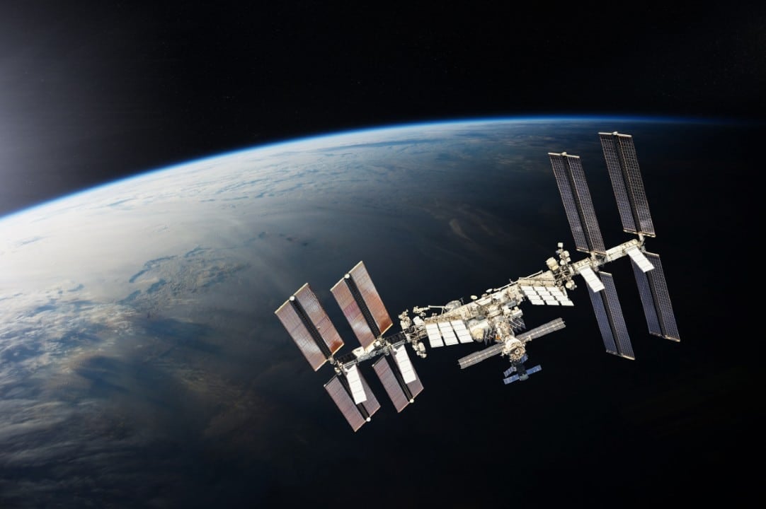
The crew aboard the orbiting laboratory recently captured a new sequence of nighttime photographs focused on Indian territory. The photographic records were taken while the research complex flew over the Mar Arábico region towards the Himalaia mountain range, documenting the earth’s surface at hundreds of kilometers of altitude.
The material released through the mission’s official channels exposes the vast artificial lighting network in the Asian subcontinent. The light mesh accurately maps the current demographic distribution, highlighting the areas with the highest population concentration, land transport routes and the region’s energy generation capacity.
The images transform the country’s physical geography into a visual map of energy consumption and human occupation. It is possible to identify everything from large, highly illuminated metropolises to the thousands of small villages that make up the interior of the territory, creating a mosaic that reflects the level of local urbanization.
Geographic contours drawn by artificial lighting
Nighttime observation from low-Earth orbit reveals topographic details that often go unnoticed during daytime passes. The stark contrast between the darkness of the ocean and the continental light creates a sharp visual boundary along the entire coast, outlining the exact shape of the country against the dark background of the sea and uninhabited mountains.
The intense glow emitted by urban centers works as a direct indicator of the level of development of local infrastructure. Regiões metropolitan areas appear as large nuclei of white and yellow light, from which radiate thinner luminous lines that represent interstate highways and commercial routes that connect different states. Essa energy web demonstrates the logistical complexity necessary to maintain the functioning of a country with continental dimensions and high demand for mobility.
The population density of Índia, which is home to a significant portion of the global population, is directly reflected in the number of photons that escape into space every night. The distribution of these lights is not homogeneous, focusing heavily on the northern plains and along the western coast, while mountainous areas to the north feature deep dark voids. Especialistas in demography use this type of visual mapping to cross-reference data on the rural exodus and the rapid expansion of urban peripheries, phenomena that constantly alter the nation’s light signature when observed from above.
High-precision photographic equipment in orbit
Nighttime photographic records require the use of professional digital cameras adapted for the microgravity environment. Astronauts configure equipment with large aperture lenses and long exposure times to capture the diffuse light of cities without losing the sharpness of geographic contours.
The long exposure technique is essential to compensate for the ship’s speed and the target’s low luminosity. The crew uses mechanical stabilizing supports fixed to the windows of the observation module to prevent the images from becoming blurry during the seconds necessary to capture Earth’s light.
Orbital dynamics and observation windows
The space laboratory orbits the planet at an average altitude that varies between 370 and 460 kilometers above sea level. Deslocando moves at an approximate speed of 28 thousand kilometers per hour, the structure completes an entire lap around Terra every 90 minutes of continuous flight.
This specific orbital dynamic gives crew members the opportunity to witness multiple sunrises and sunsets throughout a single work day. Windows of opportunity to photograph a specific country at night last only a few minutes, requiring rigorous planning and technical precision on the part of the onboard team.
Repercussion of visual material on digital platforms
The publication of the photographic collection generated immediate engagement among astronomy enthusiasts and Indian citizens on the internet. The clarity with which national geography was portrayed made the material one of the most debated subjects in science, technology and urban geography forums.
Users from different regions of the country began exercises to identify their hometowns based solely on light clusters. The cartographic precision achieved by the station’s lenses allowed even specific highways and industrial centers to be recognized by the lay public through the screens.
The visual contrast between densely populated areas and shadow regions, such as the mountains of Himalaia, was widely highlighted in the discussions. The online debate focused on the human capacity to alter the natural landscape and the monumental scale of the energy infrastructure built over decades of development.
Scientific applications of night monitoring
The collection of nighttime images captured by astronauts transcends aesthetic appeal and has direct practical use for the international scientific community. Pesquisadores from various disciplines use this raw data to feed models for environmental analysis, urban planning and energy feasibility studies.
The variation in the intensity of urban lights over the years serves as a reliable thermometer to measure economic growth and real estate expansion. Áreas that previously appeared dark and now emit light indicate new human settlements, the electrification of rural areas or the installation of large industrial complexes.
Continuous monitoring also assists in damage assessment following large-scale natural disasters. Interrupções in power supply caused by cyclones, earthquakes or floods are quickly identified from space, guiding rescue teams on the ground to the most affected and isolated areas.
Ecologists analyze light pollution recorded in photographs to study its effects on nocturnal fauna and bird migration cycles. The disorderly expansion of artificial lighting directly interferes with local ecosystems, and the orbital view provides an exact panorama of this human interference with natural habitats.
Modular structure and operational capacity of the laboratory
The infrastructure that makes these observations possible is the result of decades of applied aerospace engineering. The orbital complex has dimensions comparable to a professional football field and a total mass that exceeds 400 tons, operating uninterruptedly in the vacuum of space. Assembling this structure required dozens of space shuttle and cargo rocket missions, which transported pressurized modules, solar panels and life support systems gradually over the years.
The internal environment is divided into laboratories dedicated to different fields of knowledge, from molecular biology to fluid physics. The observation area facing Terra, equipped with high-resistance quartz windows, was specifically designed to allow visual and photographic monitoring of the planet. Support systems maintain stable temperature and pressure, ensuring crew survival and efficiency during missions that last, on average, six months uninterrupted.
The role of multinational cooperation in aerospace advancement
The continued operation of the orbital facility depends on a diplomatic and technological agreement unprecedented in modern history, involving the world’s leading space agencies. The international consortium shares operating costs, hardware development and logistics for transporting supplies and crews. Essa interdependence ensures that the flow of scientific data, including photographic monitoring of the Earth’s surface, is distributed globally to research institutions and universities. Orbit maintenance requires periodic propulsion maneuvers to correct the natural decay caused by friction with the rarest layers of the atmosphere, a procedure that requires perfect synchronization between mission control centers located on different continents. The success of this shared management model established operational protocols that now serve as the basis for planning future permanent bases on other celestial bodies.
Test platform for deep space missions
Daily operations in Terra’s low orbit serve as a validation ground for life support technologies and long-distance communications systems. The knowledge accumulated through laboratory maintenance and continuous observation of our planet dictates the safety parameters for the next phases of human exploration in the solar system.



