New analysis confirms asteroid impact in the North Sea that generated a 100-meter tsunami in the Eocene
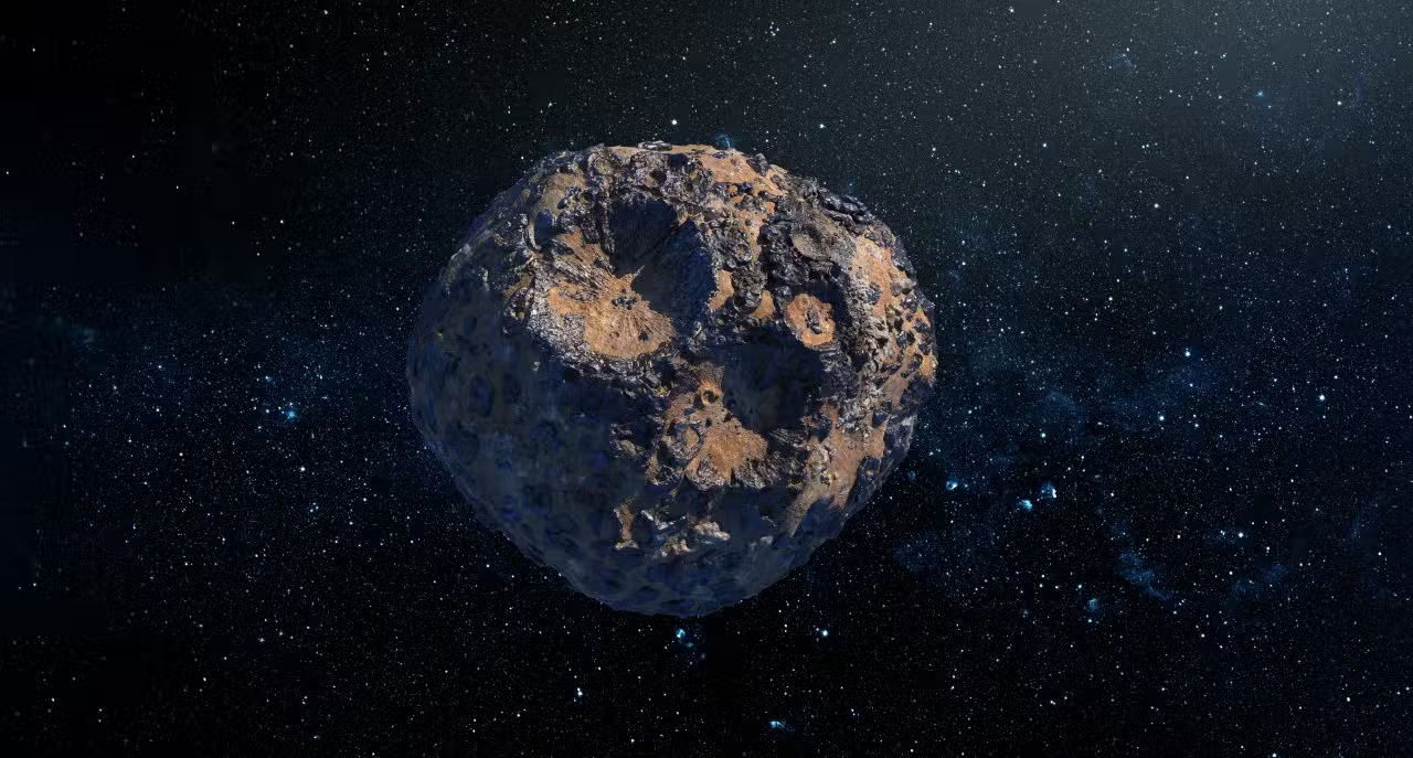
A celestial body approximately 160 meters in diameter collided with the region that today corresponds to Mar of Norte, in an event that occurred between 43 and 46 million years ago. The collision formed a complex geological structure, located approximately 130 kilometers from the current coast of Yorkshire, in the territory of Inglaterra, permanently altering the topography of the local seabed.
The impact generated a massive displacement of water, resulting in a tsunami with waves that surpassed the 100 meter height mark shortly after the fall. The phenomenon drastically altered the coastal dynamics of the time, sweeping away the margins of the shallow marine basin that characterized European geography during that specific geological period.
Researchers from several scientific institutions recently managed to end a long academic debate about the origin of this submerged formation. Através of advanced mapping technologies and analysis of physical samples, the scientific community definitively validated the hypothesis of a hypervelocity extraterrestrial impact, discarding other terrestrial theories.
Initial discovery and academic disagreements
The geological structure, officially named crater Silverpit, was identified for the first time in 2002 during oil exploration campaigns. Seismic data collected by companies in the energy sector revealed a very anomalous circular pattern for the region, featuring a central diameter of three kilometers and a complex system of ring faults that extend up to 20 kilometers from the core. The peculiar morphology immediately caught the attention of geologists, who began to investigate the mechanisms capable of generating such deformation on the seabed.
In the years following the discovery, the origin of the formation became the subject of intense discussions in the international scientific community. Some experts argued that the structure was the result of the movement of layers of underground salt, a common geological process in sedimentary basins, while others suggested the possibility of an ancient volcanic collapse. In 2009, an informal survey carried out among researchers in the field came to overwhelmingly reject the theory of an asteroid impact, a scenario that remained unchanged until the emergence of new instrumental evidence.
Mineral evidence of extreme pressures
The turning point in understanding the site occurred with detailed petrographic analyzes carried out on samples extracted from the bottom of the formation. Scientists identified the presence of shocked quartz and feldspar grains, which are minerals that have undergone structural deformation at the crystalline level.
These microscopic changes occur exclusively under conditions of extreme pressure and very high temperatures, characteristic of hypervelocity events. The force required to modify the crystal lattice of these minerals completely rules out conventional terrestrial geological processes such as volcanism or plate tectonics.
The analyzed material was recovered from oil well drillings located in the vicinity of the geological anomaly. The laboratory confirmation of these shocked minerals served as the definitive physical proof that was needed to attest to the collision of the celestial body against the Earth’s surface.
Collision dynamics and tsunami formation
To understand the mechanics of the event, research teams developed complex numerical models based on the dimensions of the crater and the properties of local rocks. Simulations indicate that the asteroid approached the Earth’s surface at a shallow angle, coming from the west at very high speed.
Upon impact with the water table and the seabed, the kinetic energy released instantly vaporized a vast amount of material. The force of the explosion ejected a colossal curtain of water and fragmented rock, which reached about 1.5 kilometers high in a matter of minutes.


The subsequent collapse of this enormous column of ejecta was the driving mechanism for the devastating tsunami that swept the region. The concentric waves, with an initial height of more than 100 meters, quickly propagated throughout the entire length of the former basin of Mar and Norte.
The energy dissipated by the displacement of water exceeded by multiple times any record of seismic activity or tsunami documented in the modern history of the area. The event temporarily reconfigured the distribution of sediments on the seafloor over hundreds of square kilometers.
Preservation factors on the seabed
Crater Silverpit stands out on the global scientific scene for its exceptional state of preservation, a rare fact when it comes to impact structures located in marine environments. Atualmente, the formation is buried under a thick layer of sediment, positioned approximately 700 meters below the contemporary seabed. Essa Continuous sedimentary cover, deposited over tens of millions of years, acted as a protective shield against natural erosive forces such as deep ocean currents and glaciations that affected the Northern Hemisphere in later times. The integrity of the original morphology, including the concentric rings and elevated central peak, allows researchers to perform precise measurements that would be impossible in craters exposed to the Earth’s surface, where weathering rapidly degrades physical evidence. The depth at which it is located guarantees a stable environment, transforming the site into an invaluable natural laboratory for studying the mechanics of complex craters and the response of the Earth’s crust to very high-energy impacts.
Geographic configuration of the period Eoceno
The impact occurred during Eoceno Médio, a geological epoch characterized by higher global temperatures and a different continental distribution than today. The region that today houses Mar of Norte functioned as an extensive marine basin of shallow waters, connected to other primitive oceans that covered part of Europa.
Biostratigraphy studies, which analyze microfossils present in adjacent sediment layers, made it possible to date the event precisely within this time window of 43 to 46 million years. Regional geological records confirm that no other impact of similar magnitude has reached this specific geographic area since that period, making the event an isolated milestone in European geological history.
Application of mapping technologies
Solving the mystery fundamentally depended on advances in geophysical prospecting techniques applied to the seabed. The research team used very high-resolution three-dimensional seismic data, originally captured for the hydrocarbon industry, to map the seabed with millimeter precision.
Images generated by these systems revealed internal structural details of the crater that align perfectly with theoretical models of cosmic collisions. The ability to visualize geological faults in three dimensions was crucial to rule out salt movement hypotheses and confirm impact deformation.
Relevance to planetary science
Confirming the origin of crater Silverpit provides essential parameters for understanding how asteroid impacts interact with surfaces covered by oceans. The data obtained establishes new geological markers that will assist space agencies and research institutes in identifying analogous structures both in Terra and in other celestial bodies in the solar system, expanding the catalog of hypervelocity events confirmed on the planet.
Veja Tambem em Latest News (EN)

Park Mi-sun returns to TV after battle with breast cancer

Hiroshima Carp confirm Tokoda against Nippon Ham on the 3rd after game postponed by rain

Older, poorly maintained vehicles face problems when using E10 gasoline

Heavy rain and storms hit 17 Indian states this Tuesday with warning from IMD

Claude down in global outage and Anthropic confirms errors in models

Typhoon No. 6 Chanmi approaches southern Kyushu and advances to eastern Japan

Seibu Lions have game canceled due to typhoon and schedule Kaima Taira for the 4th against Hanshin Tiger

Facebook whistleblower, Sarah Wynn-Williams, complies with Meta’s order and remains silent at event in the United Kingdom

Romantic comedies and mysteries arrive on Netflix in June with Office Passion and Oasis

Uruguay announces squad list for the 2026 World Cup with six Brazilian football players

When does the 2026 World Cup start? Date, time, first game and opening ceremony