

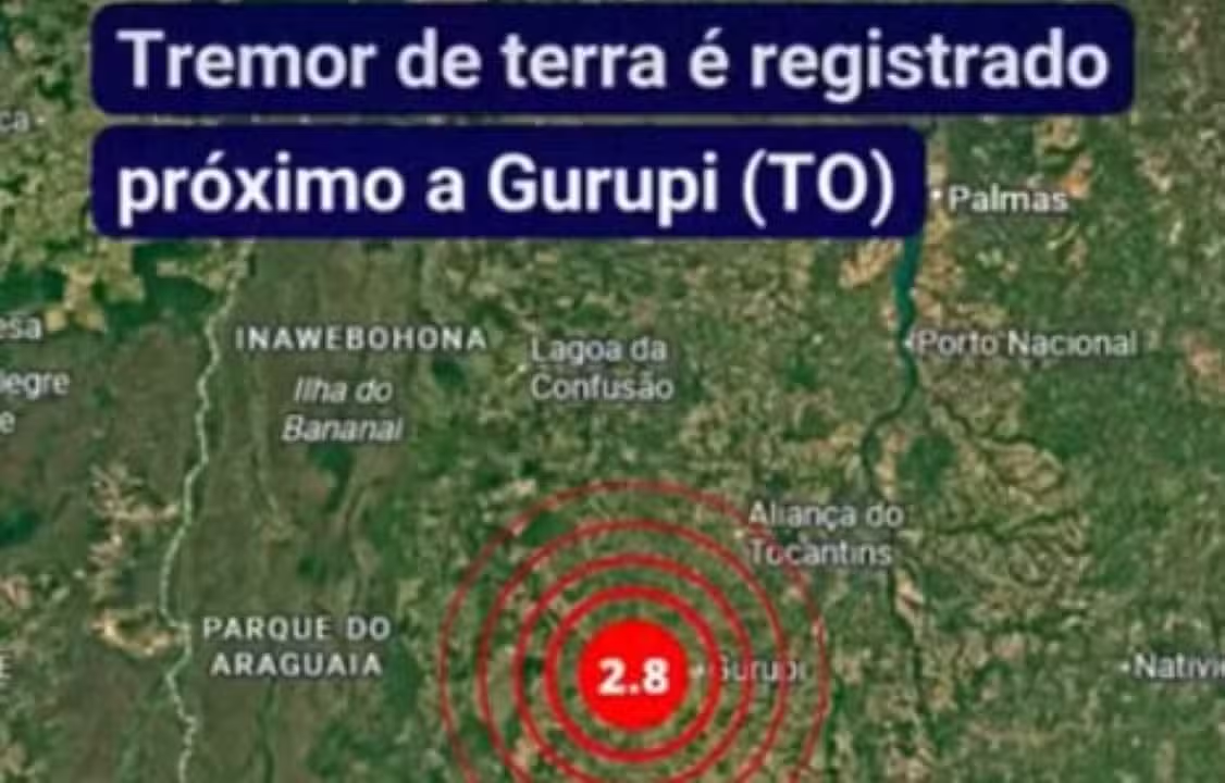
The state of Tocantins has recorded 28 earthquakes in the last ten years, with the most recent event occurring in the early hours of Thursday (21) between Cariri of Tocantins and Gurupi, in the southern region, with a magnitude of 2.8. Embora the phenomenon caused fright among residents, the tremor was analyzed by Observatório Sismológico of Universidade of Brasília (UnB) and did not generate reports of damage or population that had felt the tremor.
The 28 tremors cataloged by Rede Sismográfica Brasileira (RSBR) vary in magnitude and location within the state, distributed between cities from the south to the central region. Especialistas point out that, despite the frequency recorded, most events remain imperceptible to the population or cause only mild unrest.
Magnitude 3.4 in Talismã marks the most intense episode
The strongest tremor among all records occurred in December 2022, in the city of Talismã, in the south of the state. The tremor reached a magnitude of 3.4 and lasted around 45 seconds, causing considerable impact. Moradores reported a loud noise, similar to thunder, followed by tremors that made windows, doors and the floor vibrate. The intensity was enough to draw the attention of experts and the local population.
Outro relevant event occurred in August 2019, in the municipality of Ipueiras, with a magnitude of 3.3. Este tremor was also noticed by residents of neighboring cities, like Santa Rosa of Tocantins and Silvanópolis, generating reports of vibration similar to the passing of a heavy truck. Eventos of this magnitude does not usually cause major structural damage, although it can cause small cracks depending on the proximity to the epicenter.
Como tremors form inside Brasil
The earthquakes that occur inside Brasil are irregular and impossible to predict with precision. Segundo Bruno Collaço, seismologist at Centro at Sismologia at Universidade at São Paulo (USP), geological pressure gradually increases on old Terra faults, and the release of this energy can occur at variable intervals.
Intraplate seismicity, characteristic of the country, is marked by temporal irregularity. Stresses build up slowly in ancient geological faults, and release can occur in episodes separated by months, years, or decades. Essa feature makes any prediction of when and where the next event will occur extremely difficult. Tocantins is located in the center of a tectonic plate, the block of rock that forms the continent, which guarantees more security compared to countries like Japão or Chile, which are on the edges of these plates. In the center, tremors tend to be rarer and weaker.
População begins to feel tremors above 2.5 magnitude
Human perception of tremors depends on the magnitude of the event. Bruno Collaço explains that the population begins to feel tremors from magnitude 2.5 onwards, noticing vibrations, noises or objects moving. Magnitudes below 4.0 rarely causes cracks or damage to houses, even the simplest ones. The force is not enough to topple buildings or cause large-scale destruction.
Contudo, earthquakes remain phenomena that are impossible to predict, and it is not possible to say whether the magnitudes may increase in the future. Therefore, experts count on the contribution of the population, who can report tremors felt through specific platforms, helping with continuous monitoring and collecting data on local experiences.
Risco structural and construction standards in Brasil
Embora or Brasil recorded a magnitude 6.2 tremor in 1955, a rare event that occurred far from the edges of tectonic plates, the current risk in Tocantins remains controlled. The civil engineering practiced in Brasil is considered resistant to the levels of earthquakes usually recorded in the state. The Tocantins is in a low to moderate danger zone, according to the guidelines of the ABNT NBR 15421 standard, which regulates the design of earthquake-resistant structures.
The biggest problem identified by experts is public housing and informal construction, which were not designed with seismic requirements in mind. In a larger earthquake scenario, these buildings would be vulnerable. Precedentes have already occurred in Ceará, in Minas Gerais and in Rio Grande of Norte, demonstrating the fragility of these structures in the face of more intense seismic events.
Histórico complete of the 28 recorded tremors
- May 21, 2026: Cariri of Tocantins — magnitude 2.3
- March 5, 2026: Xambioá — magnitude 2.4
- February 28, 2026: Araguaçu — magnitude 3.3
- February 25, 2026: Conceição of Tocantins — magnitude 2.2
- May 3, 2024: Dianópolis — magnitude 2.7
- December 29, 2022: Talismã — magnitude 3.4
- May 22, 2021: Formoso of Araguaia — magnitude 2.5
- February 11, 2021: Natividade — magnitude 2.5
- February 7, 2021: Lagoa from Confusão — magnitude 3.0
- January 11, 2021: Paraná — magnitude 2.8
- December 13, 2020: São Valério from Natividade — magnitude 2.5
- September 29, 2020: Mateiros — magnitude 3.0
- June 8, 2020: Lagoa of Tocantins — magnitude 2.3
- May 15, 2020: Alvorada — magnitude 2.6
- May 1, 2020: São Salvador of Tocantins — magnitude 2.3
- April 2, 2020: São Valério from Natividade — magnitude 2.6
- January 20, 2020: Natividade — magnitude 2.2
- December 14, 2019: Palmeirópolis — magnitude 2.2
- December 2, 2019: Paraíso of Tocantins — magnitude 2.5
- November 8, 2019: Porto Nacional — magnitude 2.2
- October 19, 2019: Bandeirantes of Tocantins — magnitude 2.6
- August 8, 2019: Ipueiras — magnitude 3.3
- July 24, 2019: Palmas — magnitude 2.4
- September 14, 2018: Alvorada — magnitude 3.0
- March 15, 2018: Brejinho of Nazaré — magnitude 2.9
- May 18, 2017: Paraná — magnitude 2.8
- July 9, 2016: Peixe — magnitude 2.5
- April 27, 2016: Chapada of Areia — magnitude 2.7