NASA and CNES SWOT satellite records 19.7 meter waves in the North Pacific Ocean in 2024

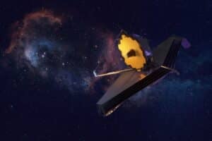
A space mission operated by NASA and Centro Nacional of Estudos Espaciais of França (CNES) recorded waves of 19.7 meters at Oceano Pacífico Norte in 2024. The extreme weather event occurred during the passage of storm Eddie. The mark represents the largest ocean formation ever observed from space in the open sea. The SWOT satellite captured the exact data on December 21st. The discovery establishes a new level of precision for global oceanography.
The equipment mapped the water surface with unprecedented resolution. Satélites from previous generations had technical limitations in capturing details of this magnitude in adverse weather conditions. Current technology has allowed scientists to observe maritime dynamics in a broad way. The advance changes the monitoring capacity for the interaction between severe storms and the movement of deep waters.
Two-dimensional Tecnologia revolutionizes maritime mapping
The SWOT satellite introduces a structural change in ocean observation. Early space missions were able to analyze only narrow bands of the sea surface during their orbits. The new equipment has the ability to produce comprehensive two-dimensional images of the entire affected area. Essa technical feature allows researchers to go beyond simple vertical water measurement. Scientists can determine the propagation direction and exact length of each wave generated.
Oceanographer Fabrice Ardhuin led the research based on this space data. The scientist works on Laboratório of Oceanografia Física and Espacial, located on França. The complete study with measurements was published in the scientific journal Proceedings of the National Academy of Sciences of the United States of America. The information collected by the international consortium offers a detailed perspective on the behavior of the sea under climate stress. The primary objective of the mission is to provide in-depth mapping of the water resources of the planet Terra.
Observation in two dimensions delivers strategic value for climate science. The system tracks sea currents and turbulence zones with high fidelity. Tais records feed ocean prediction models used by government agencies. The partnership between NASA and CNES highlights the need for international cooperation in the development of monitoring tools. The satellite remains in continuous operation to record variations in the natural system.
Measuring Parâmetros grade significant height
The value of 19.7 meters published by the researchers refers to the significant height of the waves. The technical term corresponds to the average of the third of the largest formations recorded during the storm period. Oceanography uses this standardized method for its analytical robustness. The metric is used to assess the real intensity of the sea in extreme conditions. Autoridades maritime companies rely on this standard to establish security protocols for commercial shipping.
Isolated Ondas reached heights exceeding 30 meters at the peak of the climatic event. Esses momentary peaks are outside the official record established by the study. The scientific methodology prioritizes the general and sustained behavior of the ocean. The specific violence of a single wave does not define the classification of the entire storm. The episode gained immediate notoriety in international research centers.
Space missions have been monitoring the behavior of the oceans since the 1990s. Old equipment rarely crossed the exact center of storms at the moment of greatest intensity. The SWOT satellite passed directly over the most violent region of the Eddie storm. The strategic trajectory guaranteed data collection in conditions considered extreme by the scientific community. The synchrony between the satellite’s orbit and the peak of the cyclone generated the historical record.
Capacidades space equipment analytics
Tools onboard the SWOT satellite provide a detailed view of aquatic topography. The system analyzes ocean formations under multiple angles of incidence. The technology delivers a volume of data greater than that of any previous mission aimed at the oceans.


- Altura of waves: Registro accurate vertical magnitude of ocean formations in the open sea.
- Direção of propagation: Rastreamento of the exact direction in which the water masses move.
- Comprimento of waves: Medição of the distance between consecutive crests to calculate the energy transported.
- Comportamento during storms: Análise of the ocean’s response to severe weather events.
- Two-dimensional surface Variações: Mapeamento of water topography to identify complex patterns.
The integration of these five metrics allows the construction of computerized simulations faithful to reality. Identifying currents and turbulence improves global maritime forecasts. The volume of information processed by the equipment requires supercomputers for complete decoding. The success of the operation reinforces the role of space technology in preventing natural disasters.
Propagação from the sea reaches Atlântico Tropical
Storm Eddie acted as a high-intensity extratropical cyclone in Oceano Pacífico Norte. The system caused severe storm surges in extensive coastal areas of the American continent. Material damage affected locations distributed from Canadá to Peru. Waves demonstrated an unusual ability to maintain physical structure. Propagation continued for thousands of kilometers after the original winds dissipated.
The phenomenon of continuous displacement is scientifically called marulho. Ocean energy travels great distances without losing structural strength. Calculations indicate that the ripples traveled around 24 thousand kilometers. The route crossed the entire Oceano Pacífico heading south. The waves crossed Passagem of Drake, located between América of Sul and Antártica. The energy pulse reached parts of Atlântico Tropical weeks after initial formation.
Agência Espacial Europeia (ESA) classifies seas as messengers of storms. The energy crosses entire oceans and reaches regions that have not been directly influenced by the winds. Praias Remote and vulnerable coastal ecosystems take the brunt of these distant ripples. Power transmission proves the physical interconnectedness of global maritime systems. Satellite tracking maps these invisible energy routes.
Revisão of mathematical models optimizes port security
The data provided by the SWOT satellite forced a review of traditional mathematical models. Old equations calculated the energy carried by waves based on imprecise estimates. Previous technologies generated higher values than what actually occurred on the surface. The inconsistency hampered the planning of large maritime operations. The new database corrects these historical distortions.
Updated computer simulations increase the accuracy of weather forecasts for the shipping industry. The safety of cargo ships and fishing fleets directly depends on this information. Ondas giants threaten the integrity of oil platforms and the stability of underwater telecommunications cables. Autoridades port companies use real-time data to change commercial routes. Anticipating extreme events minimizes the risk of accidents and financial losses on the high seas.
Scientists investigate the relationship between storm Eddie and global warming. Oceanos with elevated temperatures provide more energy for the formation of extratropical cyclones. Sea currents, underwater relief and wind direction also affect wave size. The record of 19.7 meters demonstrates that the marine environment has dynamics that have not yet been fully mapped. Modern space sensors continue to scan the planet’s remote areas for new physical data.
Veja Tambem em Latest News (EN)

Galaxy S26 line gains automatic integration with Apple’s AirDrop through Quick Share

HyperOS 3.1 system with Android 16 arrives on Xiaomi cell phones without public testing phase

Accident on BR-116 leaves 16 dead in a family in Santa Terezinha, Bahia

IOS 26.4 update arrives on iPhone with advanced security and playlists generated by artificial intelligence

Iván Cepeda backs down and denies evidence of irregularities in Colombia’s elections

Chris Robinson responds to boos from fans at The Black Crowes concert in Florida

Manufacturer OnePlus prepares portable Android console with exclusive physical controls for shooting games

Apple releases iOS 26.4 for iPhone with new emojis and advanced audio features

New Anker 300 W and 26,250 mAh portable battery hits the Chinese market with high compatibility
Disney confirms releases of Avatar 4 and 5 for 2029 and 2031 after sales of Fire and Ash
James Webb Telescope maps web of primordial gas that connects galaxies after the Big Bang