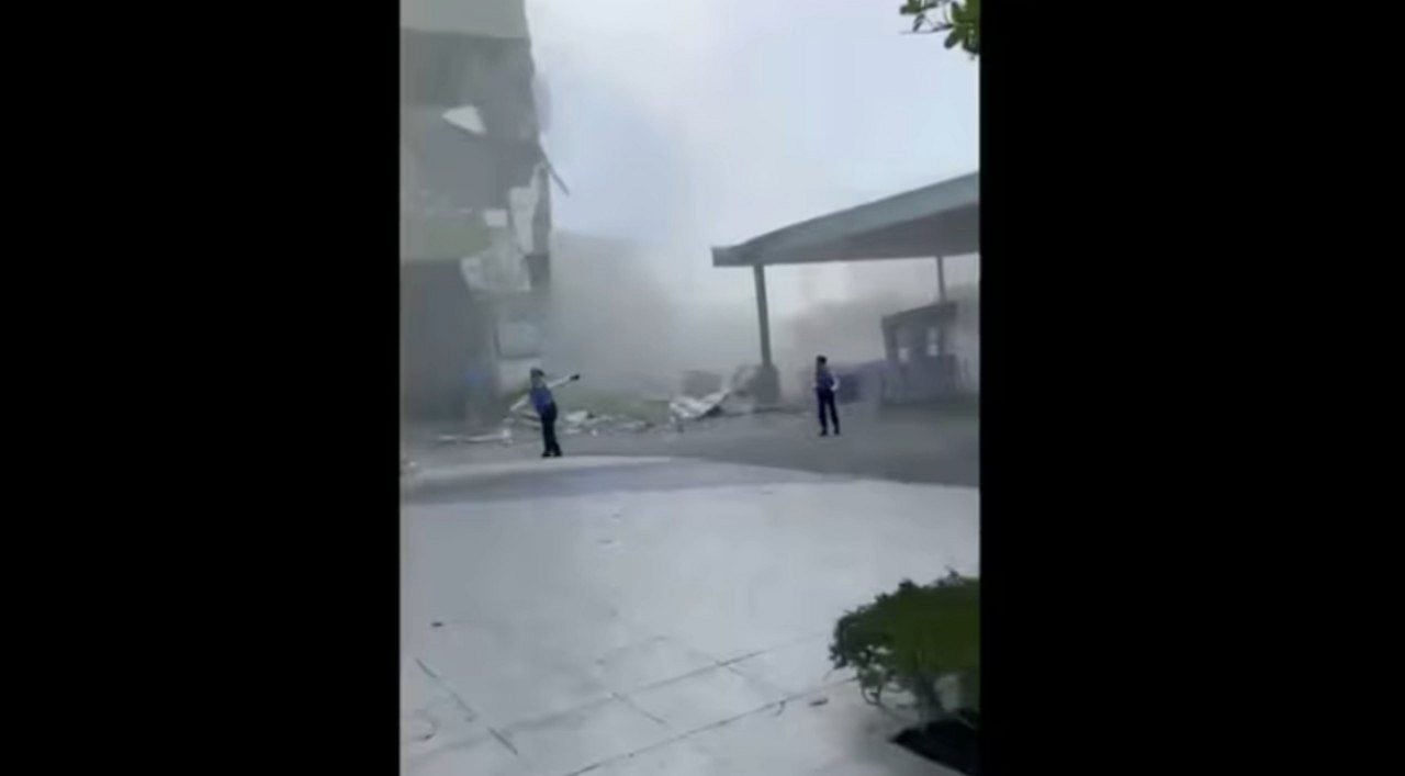
A 7.8 magnitude earthquake shook south of Filipinas early on Monday, June 8, 2026, causing considerable damage in General Santos, a major coastal city. The quake, which had its epicenter at sea, knocked out electricity in several areas and generated tsunami waves of up to 1 meter along nearby coasts. Philippine authorities issued tsunami warnings, and Presidente Ferdinand Marcos Jr. urged people in vulnerable areas to immediately seek higher ground, while Indonesians and Malaysians also warned their neighboring coastal regions.
Magnitude and origin of the seismic event
The strongest earthquake to hit Filipinas this year was recorded at 7:37 am. Segundo or Philippine Institute of Volcanology and Seismology, the epicenter was located offshore, about 13 kilometers southwest of General Santos. The cause of the phenomenon was a movement in Fossa of Cotabato, at a depth of 10 kilometers. Teresito Bacolcol, director of the institute, classified the event as a “major earthquake” and confirmed the expectation of structural damage, based on videos and initial reports. Variation in measurements by different agencies is common in the hours following an earthquake, with the U.S. Geological Survey measuring the original depth at 55 kilometers.
Immediate Impactos on General Santos and region
General Santos, a vital commercial hub and city of more than 700,000 known for its tuna processing, suffered the most visible impacts. A small commercial building, where a branch of DZRH radio operated, partially collapsed, but employees managed to escape without injury. Ainda there is no clear information on whether other people were trapped in the rubble of the four-story building, given that the tremor occurred before business hours. Além In addition, debris fell from other buildings, hitting three-wheeled taxis that were parked. Authorities are still assessing the full extent of the damage and the possibility of injuries.
Tsunami Alertas and safety measures
Pacific Tsunami Warning Center issued an alert indicating the possibility of tsunami waves of up to 3 meters on some coasts of Filipinas. Ondas up to 1 meter are designed for some coastal regions of Indonésia and Malásia. Ground monitoring Estações recorded 1-meter waves in the provinces of Sultan Kudarat and Sarangani, and smaller waves in at least one other Philippine province.
The Presidente Ferdinand Marcos Jr. reinforced the plea: “Please obey the tsunami warning. Movam get to higher ground now. Não wait. Your lives are more important than anything left behind.” Ele assured that the national government is taking action, with disaster response agencies on standby to meet Mindanao’s needs.
- Authorities issued the following warnings and records:
- Tsunami Alerta to the state of Sabah, on the island of Bornéu, by Departamento Meteorológico of Malásia.
- Medição tsunami measuring 83 centimeters by one meter on the coast of the island of Sulawesi, in Indonésia.
- Pequenas maritime changes possible in Taiwan, Japão, Papua Nova Guiné and several island nations and territories of western Pacífico.
- The alert for Guam was lifted about two hours after the earthquake.
- Nenhuma threat has been identified for Havaí, as reported by PTWC.
Pós-tremor and regional seismic context
Após the main tremor, several aftershocks were recorded, with the largest reaching magnitude 6.5. As Filipinas are located in the “Ring of Fogo” of Pacífico, an area known for high seismic and volcanic activity, which makes them one of the most natural disaster-prone countries in the world. Além of earthquakes and volcanic eruptions, the archipelago is frequently hit by around 20 typhoons and tropical storms annually, highlighting the constant need for preparedness and response to emergencies.