
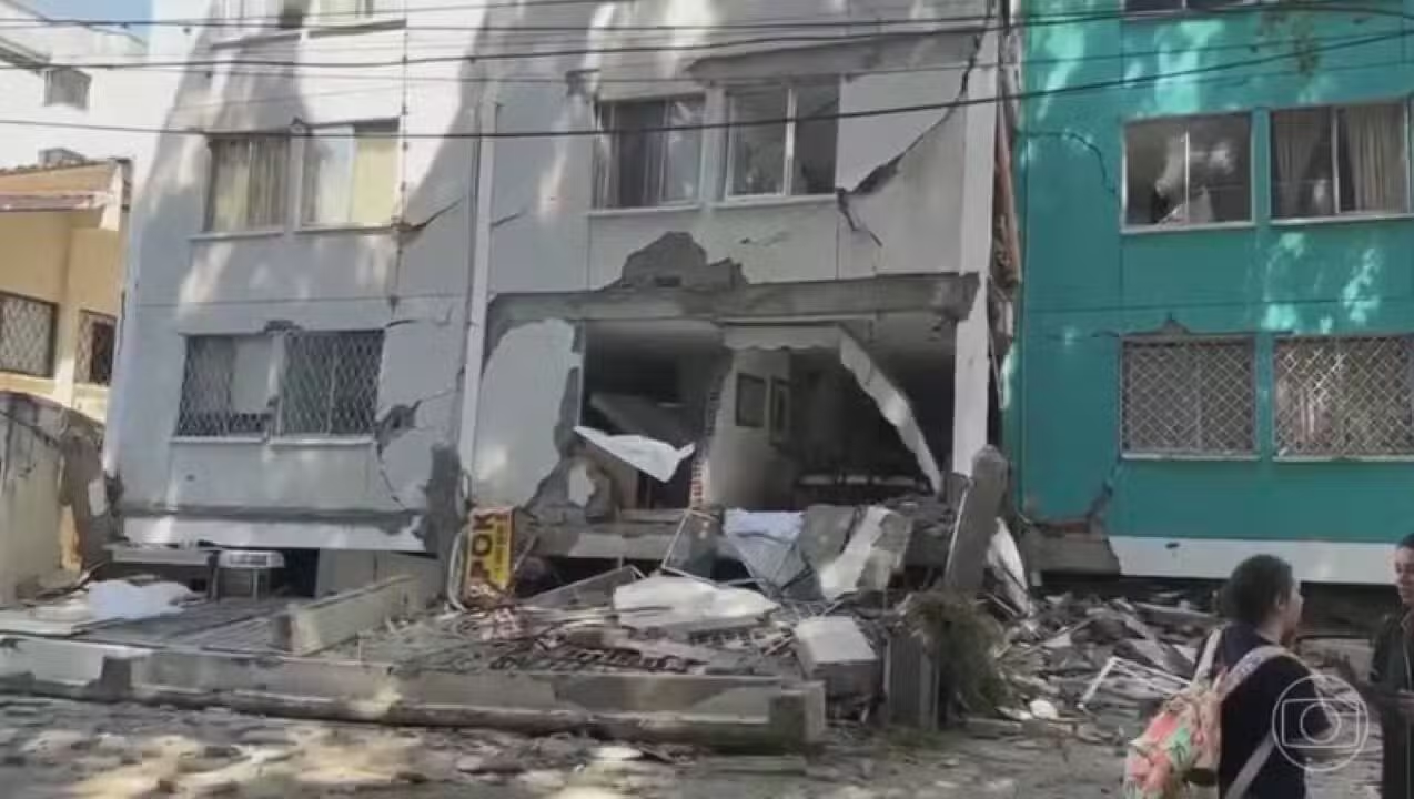
A strong 7.2 magnitude earthquake struck southern Peru on August 21, 2026, just ten days after a 7.4 earthquake was recorded in western Colombia. The proximity of these events in time, added to the fact that both countries are on the same tectonic plate, once again brought to the surface the question of the possible connection between tremors that occurred thousands of kilometers away.
The recent seismic movement in Peru had its epicenter located 35 kilometers north of Coracora, in the province of Parinacochas, region of Ayacucho, with a depth of 108 kilometers, according to information from the Geophysical Institute of Peru (IGP). The tremor was noticeable in Arequipa, Ica, Cusco, Apurímac and even on the upper floors of buildings in Lima, occurring at 1 pm (local time). So far, there are no reports of fatalities, but landslides have been observed in rural areas close to the central point. The head of the IGP, Hernando Tavera, commented that “nothing critical has occurred so far”, while assessments continue in the most impacted areas.
Two processes, the same tectonic range
The earthquake that affected Colombia, recorded on August 10, 2026, had its epicenter in San José del Palmar and a depth close to 100 kilometers. The Colombian Geological Survey (SGC) considered it the most intense in the country this century, explaining that its origin is in the subduction of the Nazca plate under the South American plate, a geological process that is responsible for much of the seismic activity in western Colombia.
This same plate runs along most of the western coast of South America. Colombian seismologist Darío Rivera Vargas clarified that “the Nazca plate covers what is Chile, Peru, Colombia”, therefore including all countries located in this segment of the Pacific Ocean.
This region corresponds to the Pacific Ring of Fire, an area that extends across around 30 nations, including Colombia and Peru, and which concentrates approximately 90% of global seismic activity. In it, several oceanic plates constantly move beneath the continent, releasing energy in the form of tremors and, in certain cases, volcanic eruptions.
They share a board, but are they related?
Although they share the tectonic belt and plate, this does not imply that two distant earthquakes have the same origin. This point was addressed by several geologists after a similar incident occurred weeks earlier, when Venezuela and Colombia recorded large-magnitude earthquakes just six weeks apart.
Argentine geologist Andrés Folguera, professor at the University of Buenos Aires and researcher at Conicet, detailed at the time that the rupture mechanisms of each earthquake depend on the plate involved, the depth and the type of fault activated. These variables, he explained, often differ, even between neighboring countries.
Regarding the possible connection between distant seismic events, Folguera was categorical, stating that the topic is still in the early stages of academic study and will be the subject of future research, although his personal hypothesis points to the absence of a direct relationship between them.
Colombian geologist Adriana Ocampo, who worked for decades at NASA, agreed with this assessment. In an interview after the Colombian earthquake, she reported that the seismic activity observed this year in countries such as Colombia, Venezuela and Mexico is the result of the tectonic dynamics specific to each area, and not an anomalous phenomenon or a sequence of cause and effect between distant earthquakes.
What explains the coincidence
The perception that “everything shakes at the same time” can be explained by the natural frequency of seismic activity in the region. Peru, for example, records between two and three telluric movements daily, according to the IGP, and has already accumulated 569 earthquakes throughout 2026. Colombia, in turn, has an average of 2,500 seismic events per month, with the majority of them imperceptible to the population, according to the SGC.
In this context, the occurrence of two earthquakes of great magnitude a few days or weeks apart at different points in the same seismic belt is a manifestation of the region’s constant geological activity.