Massive dust storm blankets Mali as satellite tracks plume

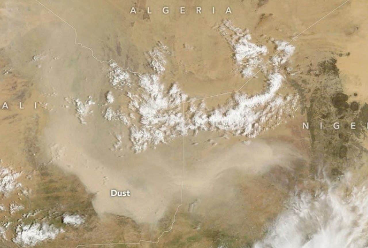
A massive airborne dust cloud spread across regions of Mali and bordering West African territories during an uncharacteristic atmospheric surge in early September 2026. This sudden event disrupted typical seasonal declines in regional sand movements.
Regional atmospheric disturbances still generate major events despite the typical end of summer weather cycles that usually suppress airborne sand over Mali and western Africa.

Instruments on the Terra satellite documented the disturbance on September 5, 2026, utilizing the Moderate Resolution Imaging Spectroradiometer to record aerial conditions. Atmospheric scientist Tianle Yuan from NASA’s Goddard Space Flight Center explained that such disturbances frequently link to haboobs. Violent winds drove the system.
Subsequent orbital observations tracked aerosol layers drifting westward over the Atlantic Ocean, though forecasters consider a complete transatlantic crossing improbable because those massive transoceanic transfers typically rely on the high-altitude Saharan Air Layer earlier between late spring and midsummer. Normal atmospheric circulation patterns rarely carry these late-season plumes across the entire marine basin.
Ongoing development of El Niño threatens to alter atmospheric circulation across the Sahel. Yuan indicated that changes to the Intertropical Convergence Zone might shift convective activity, creating conflicting environmental effects across Mali. Arid ground provides loose soil for winds to displace, yet weaker convective activity reduces the severe haboobs required to loft vast plumes into the air. “The connection can be real,” Yuan said, “but hard to pin down for individual events.”