Giant waves and king tides increase flood risks on the coast of San Francisco Bay By Beatriz
5 min read
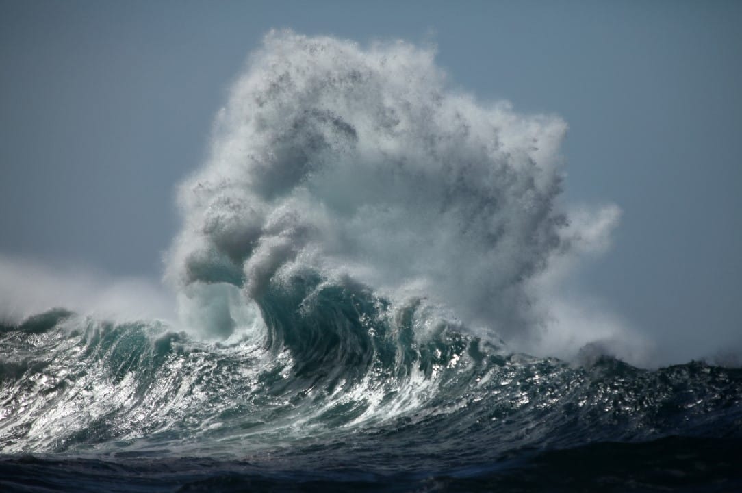 |
The Serviço Nacional of Meteorologia of the Estados Unidos issued warnings for the region of the Baía of Ondas breaking 10 to 14 feet, strong surf and elevated risk of surprise waves affect the coast between Sonoma and Monterey. Bairros Low-lying coastal areas face minor flooding due to king tides, which raise water levels up to 1.4 feet above the ground in areas near the tide line and waterways.
These phenomena occur due to the gravitational alignment between Sol, Lua and Terra, intensifying normal tides. The danger alert on beaches is in effect until 10pm on Wednesday, with the greatest threat of surprise waves between Monday night and Tuesday morning. Autoridades recommend avoiding the ocean and rocky structures to prevent accidents.
The superposition of high waves and high tides could worsen flooding on Tuesday and Wednesday. Em San Francisco, morning high tide times vary slightly across the Baía and Pacífico coast, with differences of up to 90 minutes.
- Tuesday: 8:24 am (0.8 feet above normal).
- Wednesday: 9:04 am (1.2 feet above normal).
- Thursday: 9:48 am (1.4 feet above normal).
- Friday: 10:35 a.m. (1.4 feet above normal).
- Saturday: 11:25 am (1.2 feet above normal).
- Sunday: 12:17 pm (0.9 feet above normal).
Causes of king tides and predicted impacts
King tides arise from the alignment of celestial bodies, which amplifies gravitational pull and raises sea levels. Esse annual event offers a preview of the effects of rising sea levels caused by climate change, according to data from Comissão Costeira and Califórnia. Na Baía of São Francisco, these tides coincide with long-term swells coming from the west, generating more powerful waves.
The coastal flood warning extends from Tuesday at 6am until Sunday at 3pm, covering the banks of Baía of São Francisco, Baía of San Pablo and Baía of Monterey. Áreas low areas, such as parking lots, parks and roads, register initial flooding up to two hours before the peak of the tide. In vulnerable regions such as North Bay and interior valleys, the risk persists throughout the week.
Forecasts indicate that the 2025 event could surpass previous episodes in intensity, with flooding affecting coastal properties during associated storms. Observadores participate in community projects to document the effects, helping with future urban planning.
🌊 High Surf & Coastal Flood Advisories are up for California! Ventura County beaches could see 4-7ft waves today. 🏄♂️ Dangerous rip currents and tidal flooding possible. We’re watching the coast LIVE on YouTube & X.#CAwx #HighSurf pic.twitter.com/8EDCaumoOw
— YallBot (@OfficialYallbot)December 3, 2025
Most vulnerable areas on the coast of Baía
Regions such as Point Reyes National Seashore and Península of San Francisco concentrate the greatest risks of strong hangovers. Ondas 10 to 14 feet create long pauses of 10 to 20 minutes between larger sets, increasing unpredictability. Visitantes must stay away from the water and never turn their back to the sea, as per Serviço Meteorológico’s instructions.
At Baía of Monterey, northern and southern beaches face similar conditions, with alerts until Wednesday. Bairros of low altitude in Marin and Santa Clara record a history of flooding in past events, with damage to infrastructure. Autoridades locals monitor the progress of the tides to adjust access routes.
Projeto of Marés of Rei of Califórnia encourages public participation in observations, with guided events at refuges like Don Edwards San Francisco Bay. Esses records contribute to risk maps and coastal adaptation strategies.
Events at Alviso and Menlo Park take place on Saturday from 12pm to 1pm, focusing on community science. Caminhadas explore flooded areas, measuring impacts on marine habitats and migratory birds.
Offshore winds and additional conditions
Intense offshore winds blow Tuesday night into Wednesday morning, reaching 15 to 30 miles per hour in the North Bay mountains, East Bay hills, and Montanhas Santa Cruz. Rajadas tops out at 40 miles per hour, with peaks of 55 miles per hour in the interiors of North Bay. Apesar of strength, no fire weather concerns due to relative humidity.
These winds coincide with the peak of the tides, increasing coastal erosion on cliffs and beaches. Pescadores and surfers receive specific alerts to avoid going out at night. Condições improve on Thursday, with moderate breezes from the north.
Continuous monitoring of the Serviço Meteorológico adjusts predictions based on tidal station data. Em San Francisco, the tide gauge records levels above the mean lower low water (MLLW), confirming the projected peaks.
Precautionary measures for residents and visitors
Authorities emphasize safety in coastal areas, recommending avoiding jet skis and rock climbing. Ondas surprise can advance hundreds of meters beyond the normal line, dragging people into the sea. Treinamento in identifying undertows saves lives, with a focus on swimming parallel to the shore if caught in currents.
- Stay at least 50 feet away from the water on exposed beaches.
- Wear life jackets for water activities and check local conditions before heading out.
- Report emergencies to 911 and avoid driving through flooded roads.
- Participate in alerts via Serviço Meteorológico apps for real-time updates.
This guidance is based on recent incidents where storm surges caused rescues in Pacifica and Big Sur. Comunidades coastal areas prepare temporary barriers at critical points.
Community Observation Events
Projeto of Marés of Rei promotes guided tours to document floods, with a focus on citizen science. Em Crab Cove, Alameda, a Wednesday session at 10:30 explores bird refuges during high tides. Participantes photograph affected areas, contributing to public databases.
In Exploratorium of San Francisco, the After Dark event on Thursday discusses celestial alignments and environmental impacts. Inscrições are free but limited, prioritizing education on coastal resilience.
These initiatives integrate residents in data collection, improving future predictions for Baía.
Collective preparedness reduces risks in annual events like this, with an emphasis on long-term planning for sea level rise.