Historic Christmas Storm Causes Flooding, Breaks Rainfall Records in Southern California


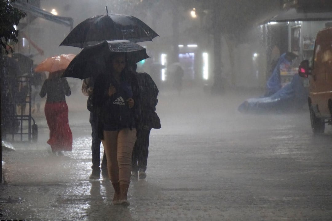
A storm of historic proportions struck south of Califórnia during the 2025 Natal holiday, setting new rainfall records and causing widespread flooding. The phenomenon, fed by an intense corridor of humidity known as an atmospheric river, discharged an unprecedented volume of rain between December 24th and 25th, transforming the celebrations into an alert and emergency scenario for millions of residents.
The intensity of the weather system led authorities to issue evacuation orders in high-risk areas and multiple flood warnings across the region. Governor Gavin Newsom declared a state of emergency in several counties to mobilize resources and accelerate response operations, while rescue teams worked on several fronts to help people stranded by landslides and floods.
The extreme weather event not only interrupted festivities, but also caused serious disruption to local infrastructure, with the closure of major highways, power outages and damage to property. The magnitude of the rain surpassed marks that had been in force for decades, redefining the climatic parameters for the Christmas period in the state’s history.
Historical precipitation marks are surpassed in several cities
The scale of the storm was confirmed by data collected at numerous meteorological stations, which recorded new records for the 48-hour period between the day before and the day of Natal. In the city of Santa Bárbara, the local airport measured a cumulative 4.83 inches, shattering the previous record of 3.22 inches set in 1955. The city of Burbank was not far behind, with 3.5 inches of rain. In the center of Los Angeles, the volume of 2.59 inches positioned this Natal as the fourth wettest since records began in 1889, being the wettest since 1971. 3.36 inches surpassed the 1979 record. The Aeroporto Internacional of Los Angeles (LAX) also reported record daily volumes on December 24, confirming the scope and strength of the weather system throughout the metro region and adjacent valleys.
Extreme volumes of rain hit mountainous regions
While urban and coastal areas experienced record amounts of rain, the southern mountainous regions of Califórnia received an even more impressive amount of precipitation over a three-day period. Essas areas of higher elevation acted as a catalyst for the storm, intensifying totals and, consequently, associated risks. The location of Rose Valley, in Ventura County, recorded a staggering accumulation of more than 17 inches, a volume that quickly overwhelmed the region’s natural drainage systems.
In San Marcos Pass, in Santa Barbara County, precipitation exceeded 14 inches, and in Chilao South, in the mountains of San Gabriel, the total was more than 11 inches. Esses extreme volumes have drastically increased the danger of landslides and debris flows, especially in areas scarred from recent wildfires, where the soil has lower absorption capacity. The saturation of the ground led authorities to maintain evacuation orders in vulnerable communities, such as Riverwood, in Sunland, where the controlled release of water from dams was necessary to prevent structural failures and catastrophic flooding downstream.
Severe impact on infrastructure and the lives of the population
Torrential rains caused significant disruptions to the region’s transport infrastructure. Trechos of vital highways, such as Interstate 5 and
In the mountains of San Gabriel, the community of Wrightwood was hit by landslides that buried vehicles and damaged homes, requiring a quick response from emergency teams. The situation generated moments of great tension for local residents, who saw their properties threatened by the force of nature.
Rescue teams were mobilized for dozens of operations across the region, removing people who were swept away by strong currents in flood control channels such as the Tujunga Wash and San Jose Creek. Veículos were trapped in pockets of water in Antelope Valley, requiring specialized interventions.
Unfortunately, the storm also had a human cost, with at least four deaths confirmed in incidents directly related to the severe weather, including traffic collisions on slippery roads and drownings. Além In addition, tree falls on the power grid left thousands of homes without power during Natal.
Government response and state of emergency
Given the severity of the situation and the extent of the damage, Governor Gavin Newsom acted quickly to declare a state of emergency for the most affected counties. The measure covered densely populated areas such as Los Angeles, San Diego, Orange, Riverside and San Bernardino, in addition to the county of Shasta.
This declaration is a crucial mechanism that allows the state government to speed up the sending of resources, personnel and equipment to the affected locations. Além In addition, it facilitates access to federal funds intended for disaster recovery, which will be essential for repairs to public infrastructure, such as roads, bridges and drainage systems.
At the same time, the National Weather Service (NWS) maintained constant monitoring of the weather system, issuing continuous flash flood warnings and classifying the risk of excessive precipitation as moderate. Forecasts also indicated the possibility of snow at altitudes above 7,000 feet, adding another layer of complexity for emergency crews operating in the mountains.
A climatic contrast accentuates the severity of the event
The Christmas flood of 2025 represented a drastic climate reversal in relation to the pattern observed the previous year. Southern Califórnia was experiencing a record drought, with the summer and fall of 2024 recorded as the hottest on the state’s coast since measurements began in 1895. Essa’s abrupt transition from a dry extreme to a wet extreme highlights the increasing climate volatility affecting the region.
The current hydrological year, which began on October 1, 2025, is already positioned as one of the wettest recorded to date, a strong contrast with previous years. Meteorologistas explain that the intensity of atmospheric rivers has been enhanced by anomalous oceanic conditions, which provide more moisture and energy for the formation of severe storms like the one that hit the state.
Forecast points to gradual improvement in weather
After the peak of the storm on the 24th and 25th, additional, although less intense, rainfall was still recorded on Friday, December 26th. Algumas areas received up to 3 extra inches of precipitation, keeping the ground completely saturated and landslide risks elevated. The forecast, however, indicated a gradual improvement in weather conditions over the weekend.
The weather was expected to progressively dry out, allowing emergency and public works teams to begin a more complete assessment of the damage and begin recovery work. Para the following week, the forecast pointed to the arrival of moderate winds of Santa Ana, a dry weather pattern that would rule out the possibility of new significant rains in the short term. Mesmo with the improvement, the authorities maintained the alert for the population to double their caution when traveling, as the unstable ground still represented a considerable danger.
The atmospheric river phenomenon
The main cause behind this extreme weather event was a phenomenon known as an “atmospheric river.” Trata is a long, narrow band of concentrated water vapor that moves through the atmosphere, transporting moisture from tropical regions to higher latitudes. Quando one of these atmospheric rivers encounters a topographic barrier, such as the southern mountains of Califórnia, it is forced to rise, cool and release this moisture in the form of heavy rain or snow, explaining the extraordinary volumes observed during the holiday.