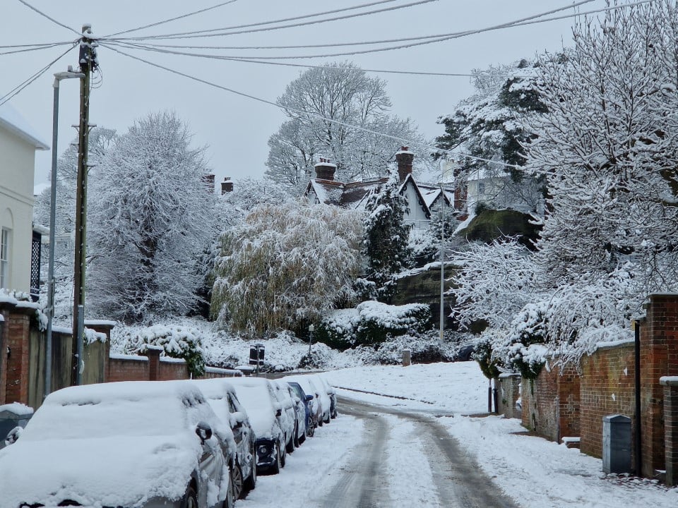
The Met Office issued a yellow alert for snow and strong winds in wide areas of the continental Escócia, Orkney and Shetland. The warning comes into effect from midnight on Monday and extends until 3pm on Wednesday in most affected regions. A second specific alert for Shetland begins at 6pm on Tuesday.
The regions have already faced disruptions from snow, rain and flooding since the start of the year. Previsões indicate accumulation of up to 5 cm at low levels and 20 cm on high ground by Wednesday.
Blizzard conditions may occur due to a combination of snow and strong gusts, especially in the north.
Weather alert details
The main warning covers the mainland Escócia and the Orkney islands since midnight on Monday. Ele remains active until 3pm on Wednesday, covering the period with the greatest risk of winter precipitation.
A separate warning for Shetland starts at 6pm on Tuesday and ends at midnight on Wednesday. Essa division considers differences in the arrival of the weather system to the northernmost islands.
⚠️ Yellow weather warning issued ⚠️
—Met Office (@metoffice)February 2, 2026
Snow across northern and eastern parts of Scotland
Tuesday 0000 – Wednesday 1500
Latest info 👉https://t.co/QwDLMfRBfs
Stay#WeatherAware⚠️pic.twitter.com/f52h8URXvb
Most affected regions
The most exposed areas include Highlands, Moray, Aberdeenshire and Perth and Kinross. Essas locations have recorded significant snow in the last month, which increases the risk of new disruptions.
Other affected areas cover Grampian, Tayside, Fife and parts of Argyll and Bute. Precipitation arrives as a mix of rain, hail and snow at lower levels.
At altitudes above 200 meters, snow predominates and accumulates more quickly. Ventos strong conditions aggravate the situation by causing drift of snow already deposited on the ground.
- Highlands and Inverness
- Aberdeenshire and Moray
- Perth and Kinross
- Orkney Islands
- Shetland Islands
Snow Accumulation Forecast
Forecasts point to up to 5 cm of snow in low-lying areas until the end of the warning. On high ground, accumulation can reach 20 cm in exposed locations.
On the Shetland islands, widespread coverage of 3 cm is expected. Valores reach 10 cm at higher points on the islands.
The transition from rain to snow occurs gradually throughout Tuesday and Wednesday. Essa change depends on the entry of colder air from the east.
Expected impacts on transport
Roads and railways may experience delays due to snow and ice on the tracks. Autoridades recommend checking conditions before traveling in areas under alert.
Bus and train services face the risk of cancellations or timetable reductions. Snow drift causes localized blockages on secondary roads.
Airports in affected areas, such as Inverness and Aberdeen, are monitoring the situation. Voos may be postponed or diverted in cases of reduced visibility.
Electricity is vulnerable in rural areas exposed to intense winds. Quedas of tree or power line damage occurs in previous similar events.
Blizzard conditions in the north
Strong winds combined with snow create blizzard conditions, especially in the north of the warning. Visibility drops drastically in these situations, making travel difficult.
The removal of existing snow from the ground worsens obstructions on roads and rural accesses. Equipes of road maintenance work preventively on the main routes of Highlands.
These conditions mainly affect open and coastal areas, where gusts reach higher speeds. Motoristas receive guidance to reduce speed and maintain a greater distance between vehicles.
Temperatures remain low during the period, favoring the stay of snow on the ground. The combination of cold, wind and precipitation increases discomfort during outdoor activities.
Alert for Shetland
The specific warning for Shetland considers the late arrival of the weather system. Precipitação intense begins only on Tuesday night on the islands.
Expected accumulation varies between 3 cm and 10 cm, depending on local altitude. Ventos strong snow also accompanies this isolated region.
Official recommendations
Met Office guides advance travel planning in areas covered by the alert. Verificação of weather updates remains essential throughout the days.
Drivers should equip vehicles with emergency items such as blankets and flashlights. Pneus winter chains or chains improve grip in slippery conditions.
Residents in rural areas are preparing for possible interruptions in the power supply. Carregamento of mobile devices and non-perishable food stocks help with temporary isolation.
Local authorities coordinate responses for road clearing and emergency assistance. The collaboration of the population facilitates the management of the impacts of the meteorological event.
Scottish winter backdrop
Escócia has recorded a harsh winter this year, with repeated episodes of snow since January. Regiões from the north accumulate successive impacts from cold systems coming from Ártico.
Winter precipitation affects infrastructure in mountainous and isolated areas. Equipes emergency services maintain high readiness throughout the cold season.
Climate change influences precipitation patterns in Reino Unido. Eventos of heavy snow become more variable, requiring constant monitoring by meteorological services.
Road safety measures
Vehicles must keep headlights on even during the day in low visibility conditions. Distância security increases to allow braking on icy roads.
De-icing equipment and windshield scrapers become essential. Verificação of fuel levels avoids prolonged stops in remote areas.
- Check forecast before leaving
- Equip car with emergency items
- Reduce speed on snow-covered stretches
- Avoid non-essential travel during peak alert times