Severe winter storm blocks transportation and leaves trail of destruction along US East Coast

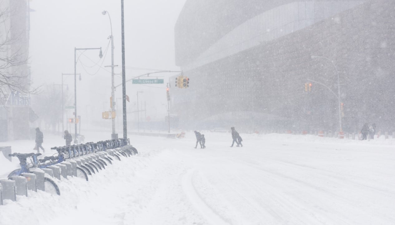
A powerful winter storm swept across the US East Coast on Monday, bringing severe blizzard conditions and winds strong enough to cause structural damage. The system, technically classified as a nor’easter, dumped more than 55 centimeters of snow in critical areas, paralyzing large urban centers from Nova York to Boston and changing the routine of millions of inhabitants. Governadores from several states, including Nova Jersey and Rhode Island, acted quickly to declare a state of emergency in the face of rapidly deteriorating weather and risks to public safety.
Authorities have issued strict travel ban orders in several jurisdictions, aiming to make the work of cleanup crews easier and prevent accidents on roads that have become impassable. Serviço Nacional of Meteorologia warned that visibility was reduced to less than 150 meters at times of the storm’s peak, making any vehicle movement extremely dangerous and inadvisable. The impact of the phenomenon extended over a vast geographic area, affecting from Carolina of Norte to the north of Maine and parts of the east of Canadá.
Here’s a look at Westerleigh on Staten Island as New York City deals with more than a foot of snow that has accumulated overnight.
Snowfall is forecast to continue until 9 a.m. todaypic.twitter.com/QpodULONXK
—Spectrum News NY1 (@NY1)February 23, 2026
Residents reported scenes of deserted and silent streets, typical of historic weather events, while tourists found themselves stranded in hotels and airports. The combination of heavy snow and freezing temperatures created immense logistical challenges for emergency crews, who struggled to keep main roads accessible for ambulances and police cruisers.
Collapse in the air and road network
Transport infrastructure took an immediate and wide-ranging blow, with more than 5,000 flights canceled across the region, affecting domestic connections and crucial international routes, especially for Reino Unido. Aeroportos majors operated at minimum capacity or closed runways due to rapid ice accumulation, while train and bus services, such as those on the NJ Transit, were preemptively suspended to ensure the safety of passengers and operators.
- Massive cancellation of flights at the Nova York and Boston hubs, impacting thousands of passengers.
- Total or partial suspension of public transport services and closure of schools in six states.
- Secondary and main road closures due to falling trees and ice build-up.
- Prohibitions on the circulation of commercial and passenger vehicles in cities such as Hoboken and throughout the state of Rhode Island.
Impact on energy supply
The weight of the wet snow, combined with intense gusts of wind, caused significant damage to the power grid, leaving a vast area in the dark. Massachusetts was the most affected state proportionally, with more than 224 thousand homes and businesses without electricity, followed by significant numbers in Nova Jersey, with 137 thousand cases, and Delaware, with 75 thousand registered interruptions.
Utility repair teams faced extreme difficulties restoring service, with adverse weather conditions preventing the safe use of basket lifts in many locations. The forecast of continuous winds raised authorities’ concerns about further cuts and the possible delay in fully restoring power, leading governors to request federal resources to deal with the crisis.
Meteorological data and accumulation
Official records showed impressive amounts of solid precipitation, with cities like Trenton and Aeroporto of Atlantic City reporting accumulations of between 37 and 40 centimeters, respectively. The storm was characterized by the rapid formation of soft snow in coastal areas, driven by temperatures that hovered close to the freezing point, which favored the creation of larger and heavier flakes.
Meteorologists explained that low atmospheric pressure intensified the storm as it advanced along the coast, creating a favorable scenario for trees and branches to fall on wiring and vehicles. Em Mount Holly, Nova Jersey, accumulation reached 49 centimeters, while Filadélfia recorded 35 centimeters, data that helped direct recovery efforts.
Despite the forecast of a gradual decrease in snow intensity, the warning for frozen surfaces remained in effect for the following nights. The phenomenon demonstrated the volatility of the region’s climate, requiring constant monitoring by experts.
Urban security and response measures
The government response focused primarily on protecting life, with the closure of public parks, such as Madison Square in Nova York, due to the imminent risk of branches falling under the weight of snow. Departamento of Saneamento mobilized its entire fleet of trucks and heavy machinery to clear priority roads, although persistent ice kept the risk high for pedestrians and drivers even after the partial lifting of traffic restrictions.
Residents were advised to stay at home and prepare emergency kits with flashlights and batteries, while tourists had to forcibly extend their stays due to the closure of transport infrastructure. Coordination between local and state agencies was essential to mitigate the effects of one of the most severe storms in recent memory in the region.