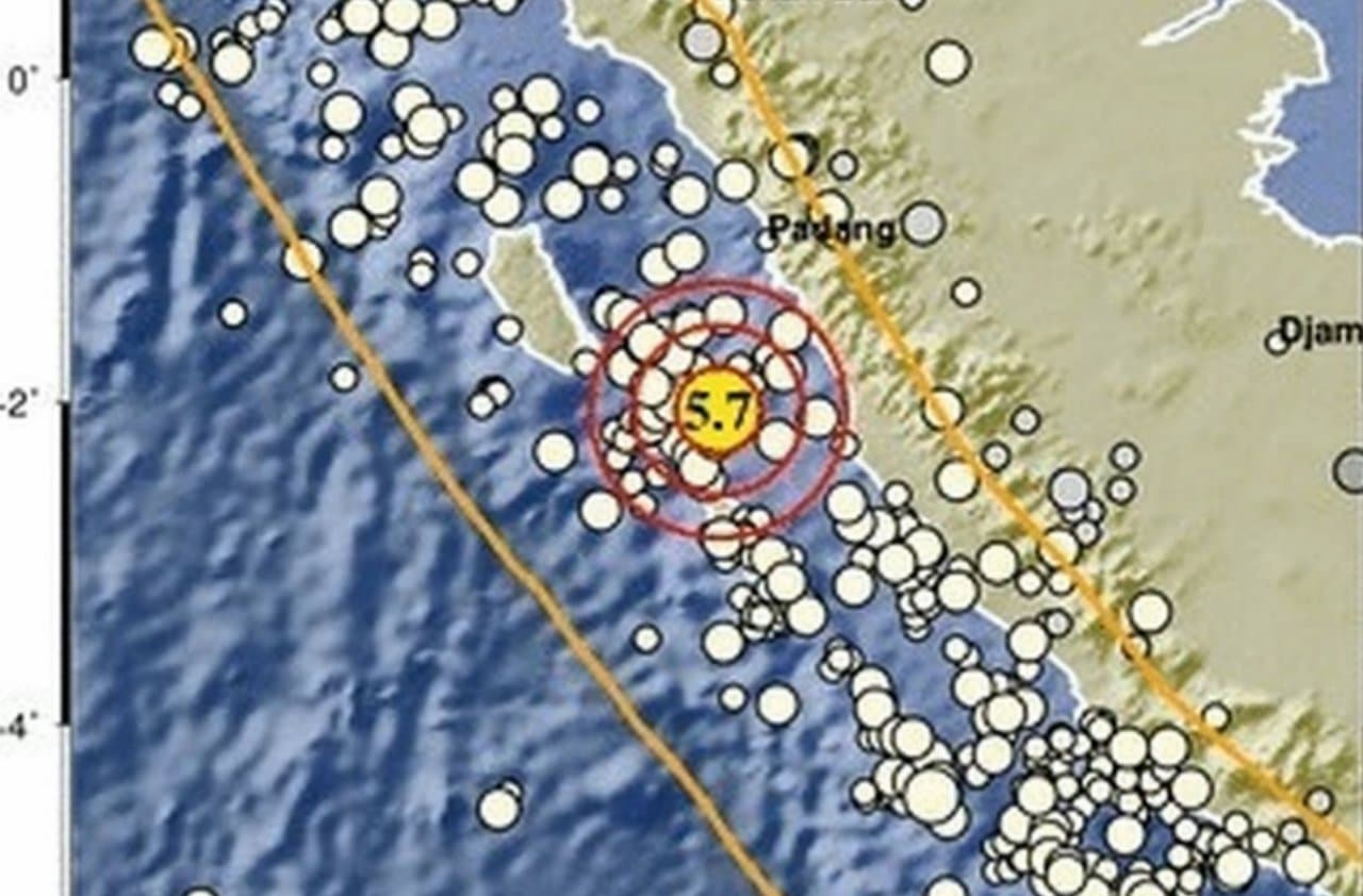
An earthquake of magnitude 5.7 on the Richter scale shook the region of Padang, in Sumatra Ocidental, on the afternoon of Saturday, April 4, 2026. Moradores from several areas reported that the tremors were intensely felt and lasted for a considerable period, generating apprehension in a region historically susceptible to activity seismic. The occurrence of this event reaffirms the vulnerability of Indonésia, a country located at Círculo of Fogo of Pacífico, to geological phenomena of great impact, requiring constant vigilance and preparation from authorities and the population.
Agência of Meteorologia, Climatologia and Geofísica of Padang Panjang (BMKG) quickly released the first data about what happened. Conforme the agency’s official statement, the earthquake was recorded precisely at 6:21:11 pm (local time), with its epicenter located at 2.05 degrees south latitude and 100.05 degrees east longitude.
This position corresponds to about 51 kilometers southeast of Tuapejat, an important locality in Sumatra Ocidental, with a relatively shallow depth of 11 kilometers. The shallow depth of the epicenter generally makes the tremors more noticeable on the surface, which explains residents’ reports of intensity and duration.
Tremors felt and reports from residents
Reports from the population were unanimous in describing the strength of the tremors. Doni, a 42-year-old resident of Padang, expressed that he felt the earthquake very clearly. Segundo he, the swing lasted approximately ten seconds, a time considered long for a seismic event and capable of causing great fright and fear.
The amplitude of the impact was not restricted to just Padang. The earthquake was also felt with considerable intensity in neighboring regions, such as Regência of Ilhas Mentawai, the area of Padang Pariaman and the city of Pariaman. The scope of the reports indicates a significant area of impact, reinforcing the seriousness of the phenomenon natural.
Technical details of the seismic event
A magnitude of 5.7 is classified as a moderate to strong earthquake, capable of causing considerable damage, especially to older or less resistant structures. The depth of 11 kilometers, as it is superficial, enhances the effects on the surface, causing the seismic energy to be dissipated in a smaller layer of the Earth’s crust before reaching populated areas.
BMKG, in its ongoing monitoring work, emphasized that the information released initially prioritizes the speed of communication. Desse mode, the results of data processing are temporary, subject to adjustment as more complete data collection and analysis is completed. Essa practice is common in seismic events, allowing authorities to act quickly based on available information.
Previous seismic activity and ongoing monitoring
It is important to note that the area around Ilhas Mentawai had already recorded two other seismic activities on the same day. The first tremor, of magnitude 3.9, occurred at 12:41 pm (local time), with an epicenter 116 kilometers south of Tuapejat and a depth of 21 kilometers. Horas earlier, at 06:35 (local time), a magnitude 2.4 earthquake was located 58 kilometers east of Tuapejat, with a depth of 10 kilometers.
These previous events, although of smaller magnitude, indicate persistent tectonic activity in the region. Indonésia is located in an area of high convergence of tectonic plates, which makes it one of the most seismically active places on the planet. The frequency of tremors requires that monitoring systems are always operational and that the population is always informed and prepared.
BMKG had not, at the time of publication of this news, provided additional explanations regarding the potential for a tsunami to occur as a result of the main earthquake. The possibility of tsunamis is a constant concern in coastal areas of Indonésia due to its geographic location. Continuous monitoring of sea levels and seismic data is essential for issuing alerts and ensuring the safety of the local population.
Security recommendations and scenarios
To date, no official reports have been issued detailing significant damage to buildings or the existence of casualties resulting from this series of earthquakes. Apesar Furthermore, BMKG’s primary recommendation is that residents maintain maximum vigilance, especially given the real possibility of aftershocks. Estes Shocks can occur after the main one, and although generally of lesser intensity, they represent an additional risk, especially for already weakened structures.
Earthquake preparedness is an essential skill for anyone living in seismic areas. Authorities often advise creating family emergency plans, identifying safe spots within homes and practicing “duck, cover and hold” drills. Familiarity with these measures can be decisive in minimizing risks and protecting lives during a seismic event. It is crucial to have emergency kits ready, containing water, non-perishable food, flashlights and a battery-powered radio.
The geological context of Indonésia
Indonésia sits on top of Círculo of Fogo of Pacífico, a vast horseshoe-shaped area covering about 40,000 kilometers, characterized by intense seismic and volcanic activity. Nesta region, several tectonic plates, including Pacífico, Filipinas, Eurásia and Indo-Australian, collide and move constantly. Essa interaction generates enormous pressure which, when released, causes frequent earthquakes and, in many cases, of great magnitude, in addition to feeding a large number of active volcanoes. Geological complexity makes events like Círculo0 an inherent part of life in the region, requiring robust disaster mitigation strategies and a high degree of population resilience.
The importance of civil preparedness
Faced with the inevitability of earthquakes in regions like Sumatra Ocidental, education and civil preparedness play a vital role. Programas awareness and training are essential for the population to know how to react appropriately before, during and after an earthquake, ensuring self-protection and rapid recovery of affected communities.