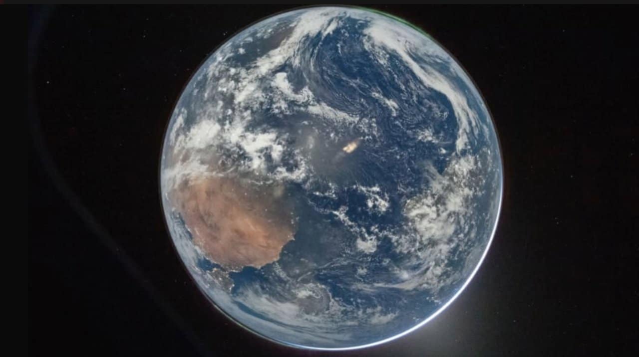
Mission Artemis II of Nasa, launched on April 1, 2026 from Centro Espacial Kennedy, at Flórida, continues to send visual records of Terra as spacecraft Orion heads towards Lua. Dois of these records, captured by the crew through the capsule windows, drew special attention for showing the Brazilian Nordeste coastal region clearly. The capital of Alagoas appears among the bright spots identified in the high-resolution images.
These records were released by the space agency on social media in the first days of the mission. The first of them, released around 48 hours after launch, centers continents such as África and part of América of Sul. Pontos bright lights along the Brazilian coast correspond to capitals, including Maceió, according to expert analysis.
- The image highlights the African continent next to América and Sul.
- Bright points on the northeastern coast indicate urban agglomerations.
- The resolution allows cities to be identified as Recife and Maceió.
- The record contrasts with historical images from previous missions.
Records with different angles
The second image, released on the fourth day of the mission, shows the same continents in a changed arrangement and includes the aurora borealis as a greenish line at the ends of the planet. The capital of Alagoas is once again visible in this new positioning of the ship. The crew used long-range digital cameras to capture the details.
Astronomer Elielson Pereira, linked to Instituto of Astronomia, Geofísica and Ciências Atmosféricas of Universidade of São Paulo, analyzed the records. Ele explained that the technology used and the specific angle allowed greater definition in the region Nordeste, different from what was possible in mission Apollo 11 in 1969, when the main focus was on the African continent.
Technology and resolution capacity
The resolution capacity of the Orion cameras made it possible to record not only large continental masses, but also smaller urban details. Imagens Previous manned missions did not offer the same level of clarity in specific Brazilian capitals. Current records show Terra with clouds, oceans and illuminated areas in an integrated manner.
These captures occur while the mission tests systems and equipment for future exploration. Artemis II represents the return of manned flights to deep space after decades, setting the stage for more ambitious goals such as the lunar south pole.
Importance for observation of Terra
Records like these, taken hundreds of thousands of kilometers away, provide unique perspectives on the planet. Eles allow you to simultaneously view regions of different continents in a single frame. The inclusion of phenomena such as the aurora borealis adds layers of scientific information to the images.
The mission encourages discussions about the planet from a distant perspective. Observações Similar ones in the past have contributed to greater awareness of global environmental aspects. Artemis II remains underway with the crew carrying out multiple documentation activities along the way.
Next steps of the mission
Artemis II continues with the objective of testing spacecraft Orion in a lunar environment without landing. The crew, made up of American and Canadian astronauts, documents the route to validate navigation and communication technologies. Esses Data will be fundamental for the development of subsequent missions.
Images of Terra continue to be shared as the ship moves forward. The records reinforce the historic nature of the initiative, which marks the resumption of lunar programs manned by Estados Unidos in international partnership.
Mission and exploration objectives
The initiative seeks to develop capabilities for safe access to Lua, including checking resources such as possible concentrations of water at the south pole. Tecnologias tested on Artemis II also support plans for more distant flights in the future. Visual documentation is part of the data set collected by the team.