
Space agency releases unprecedented collection of 12,000 images from the Artemis II mission


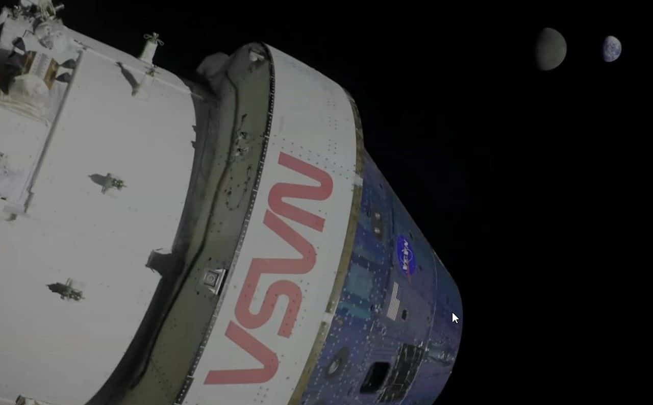
Nasa made a collection of 12,000 photographs captured during the Artemis II mission available to the public, marking one of the agency’s largest releases of visual material on lunar exploration in decades. The images, which document the journey to lunar orbit until the return to Terra, reveal details of the lunar landscape, astronomical phenomena and scenes from the crew’s daily life in a microgravity environment. The opening of the database represents unprecedented transparency and democratization of access to information about the human return program to Lua.
The photographic material captured by the crew includes records of solar eclipses seen from space, high-resolution lunar craters and documentation of scientific experiments carried out aboard the Orion spacecraft. Cada image has been cataloged with technical metadata and capture context, facilitating academic research and independent scientific analysis. Pesquisadores from universities and institutes around the world already access the Nasa open portal to study aspects of the mission.
Primeiras images reveal new angles of the lunar surface
The photographs initially highlighted by the agency show Lua from perspectives rarely documented before, focusing on regions close to the south pole, a strategic objective of the Artemis program. Crateras of variable depth, potential lunar ice deposits and geological formations emerged at resolution that allows analysis of structures meters in diameter. Cientistas are already using the material to refine lunar topographic maps and identify ideal locations for future permanent human installations.
A particular sequence of images captured the rise of Terra seen from lunar orbit, a visual document of the contrast between the blue planet and the gray satellite. The records also documented the total solar eclipse observed by the crew during the trajectory, a rare phenomenon whose photography contributes to research in solar astrophysics. Universidades has already requested permission to use the material in coursework and peer-reviewed scientific publications.
Documentação of everyday life in microgravity
The collection includes hundreds of images of the interior of the Orion capsule, showing how the crew carried out routine tasks, food preparation, physical conditioning exercises and testing life support systems in a zero gravity environment. Essas photographs gain scientific importance for space medicine, as they document prolonged human behavior in microgravity and the effectiveness of adaptation protocols. Agências from international healthcare and aerospace research already queries the database to validate procedures.
The records also capture moments of scientific observation carried out by astronauts through the Orion windows, with emphasis on studies of terrestrial atmospheric phenomena, storm structures seen from space and ocean color variations. Cada georeferenced photography allows correlation with data from operational meteorological and oceanographic satellites. Pesquisadores indicate that this crossing of human data with automated telemetry will produce new insights into climate dynamics.
Cataloging and Public Access Processo
Nasa structured the database into thematic categories, allowing search by date, lunar region, type of phenomenon or documented experiment. Usuários can filter images by resolution, file format and scientific context, facilitating specialized search. The portal implements reverse image search technology, allowing researchers to identify related records even without exact metadata.
- Imagens of lunar landscapes and craters in high resolution
- Documentação of solar eclipses observed from lunar orbit
- Registros of scientific experiments in microgravity
- Fotografias from inside the Orion capsule during the mission
- Imagens of the planet Terra seen from lunar orbit
- Dados georeferenced lunar polar regions
Access is free and without restrictions on use for educational, scientific and journalistic purposes, in accordance with Nasa’s open data policy established more than a decade ago. Plataformas education already integrate selections from the collection into astronomy and aerospace engineering curricula. Museus of science on several continents request exhibition permission for interactive and immersive exhibitions.
Impacto on future lunar research
The visual data complements technical telemetry already released about Artemis II, creating holistic understanding of the mission that transcends numbers and graphs. Geólogos uses the images to refine hypotheses about the mineral composition of specific regions of Lua. Engenheiros study landscape photographs to plan safe landing and mobility routes for future human exploration modules.
Agências space partners, including Esa and Jaxa, consult the Nasa database to coordinate complementary lunar exploration strategies. The visual material reduces uncertainty in design decisions for future Artemis missions and other countries’ lunar landing programs. Relatórios research using these images are already circulating among astrophysics institutes and postgraduate universities.
The release of the collection reinforces Nasa’s commitment to open science and citizen participation in space exploration, a trend that has gained strength since 2015 at the American agency. Plataformas of scientific citizenship already recruits volunteers for collaborative image analysis, projects known as “citizen science”. Public Escolas in regions with limited access to educational resources now obtain institutional quality material for science teaching.



