
American agency confirms arrival of El Niño and warns of risk of extreme weather in the world

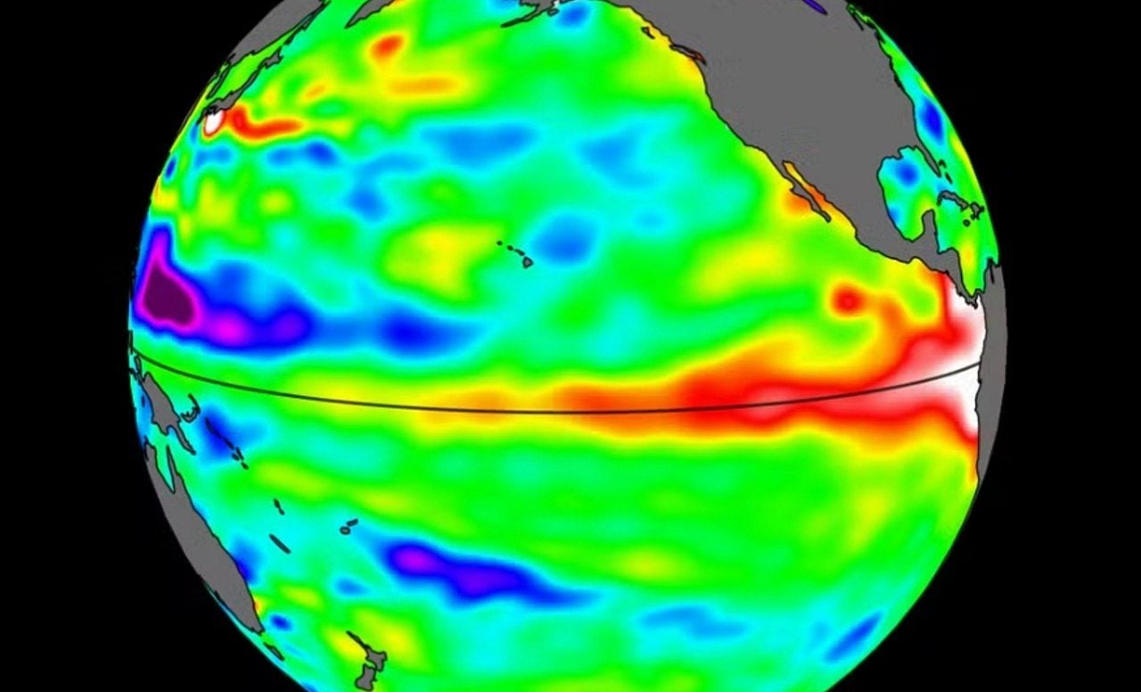
The United States National Oceanic and Atmospheric Administration (NOAA) confirmed this Thursday (11) the formation of El Niño, a climate event characterized by the atypical warming of surface waters in the Equatorial Pacific Ocean.
The American agency highlighted that the meteorological pattern is already active and should gain even more strength during the winter of 2026 to 2027 in the Northern Hemisphere.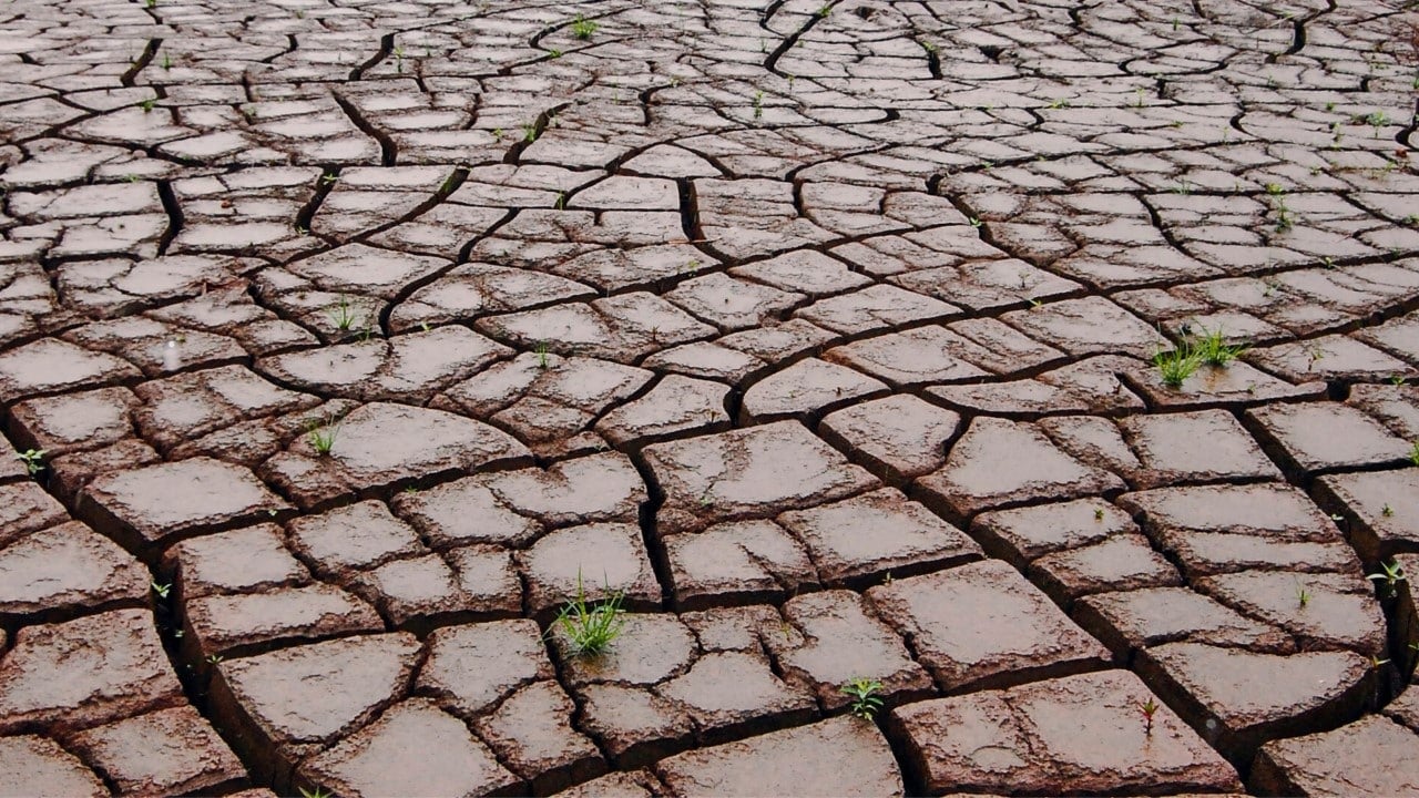
Meteorology experts were already awaiting this official announcement, considering the continuous rise in ocean temperatures recorded in recent months and the mathematical models that pointed to the consolidation of the situation in the first half of 2026.
During the month of May, the institution calculated a chance of 82% for the event to take place in the short term. Now, with the June report marking the beginning of the cycle, the scientific debate is focusing on the degree of severity that this anomaly will reach.
Fundamental differences between the El Niño and La Niña phenomena
Both systems are part of the opposite phases of a large atmospheric cycle called El Niño-Southern Oscillation (ENSO). The warm stage, which has just been declared, occurs when the equatorial portion of the Pacific registers an increase in temperature equal to or greater than 0.5°C.
This warming usually appears at intervals ranging from two to seven years, remaining active for around twelve months and helping to raise thermometers on a planetary scale. On the other hand, the cold phase, called La Niña, promotes the cooling of this same oceanic strip, generating inverse climatic consequences.
In Brazil, the repercussions depend greatly on the geographic region. The states in the southern region tend to suffer from an excessive amount of precipitation, a scenario that drastically increases the danger of floods, landslides and severe storms.
In areas that encompass the North region and a large part of the Northeast, atmospheric blockage inhibits the formation of heavy clouds, worsening droughts and damaging water supply.
For the Southeast and Central-West, weather behavior becomes quite unstable, resulting in days of intense heat, poorly distributed rain and a blockage in the natural passage of polar air masses.
Concerns of the scientific community about global warming
The return of this oceanic anomaly generates a high alert among researchers, as the Earth is already facing successive heat records driven by climate change.
Although it is a natural fluctuation of the Earth’s system and not the direct cause of the greenhouse effect, the event acts as a catalyst. When superimposed on an already superheated planet, it has the power to drastically worsen heat waves, dry periods and destructive storms.
Because of this combined risk, climatologists around the world monitor every change in the Pacific, especially since projections indicate a considerable probability of a very rigorous cycle.
NOAA estimates a 63% chance for the formation of a very strong pattern between November and January, which would place it in the ranking of the most severe events since 1950. This data is even more frightening when one remembers that the strong cycle from 2023 to 2024 helped the world record, in an unprecedented way, a day with a global average 2°C above pre-industrial levels, highlighting the current climate fragility.
A high-intensity configuration directly affects agricultural productivity, compromises water storage in dams, makes electricity generation more expensive, facilitates the spread of forest fires and, consequently, increases the price of food on the shelves.
Despite the signs, experts still cannot confirm whether the current situation will reach the status of “Super El Niño”, a popular expression used when temperature anomalies exceed the 2.0°C mark, repeating the catastrophic scenarios observed in the 1982-1983, 1997-1998 and 2015-2016 seasons.
The ultimate force of this climate change will be tied to the continued warming of the Pacific in the coming months and how the atmosphere will react. For the system to gain real strength, the ocean and air need to work in total synchronization, as hot water alone cannot sustain the phenomenon.
Since 2006, successive occurrences of this anomaly have been transforming the meteorological dynamics of the planet, which today finds itself at a thermal level much higher than in the past.
Even when classified as weak or moderate, these episodes increase environmental dangers due to the already heated base scenario. Follow the recent history of these occurrences:
- Season from 2006 to 2007: record of intensity varying between weak and moderate.
- 2009 to 2010 season: consolidation of a moderate strength event.
- Season from 2014 to 2016: extremely strong cycle, associated with breaking thermal records and frequent natural disasters.
- 2018 to 2019 season: weak to moderate performance, with reduced duration and more limited damage.
- Season from 2023 to 2024: strong pattern, among the most intense ever documented and responsible for new heat peaks.
How Pacific Ocean dynamics affect climate around the world
The essence of this meteorological disturbance lies in the unusual increase in the temperature of surface waters in the extensive strip of the Pacific located above the Equator.
This change is part of a natural mechanism of the Earth’s climate, which moves between moments of warming, cooling and neutrality, spreading its effects across all continents.
By altering the circulation of winds at high altitudes, the oceanic disturbance completely messes up the precipitation map and temperature averages in several nations.
Within Brazilian territory, the consequences show a clear contrast, dumping an excess of water on the southern states while condemning vast areas of the North and Northeast to long droughts.
The anomaly also acts as a driver for global temperatures. In years when the system is more robust, the Earth tends to experience heat well above normal, adding to the climate crisis caused by human action.
The level of destruction and characteristics change with each new cycle. With the constant increase in the globe’s average temperature, even phases considered average can cause damage much greater than that recorded in past decades.
Main expected consequences for Brazilian territory
The country’s meteorological history shows that this oceanic change profoundly changes the rainfall regime and the behavior of thermometers, causing the following scenarios:
- Excessive volume of water in the South region, increasing the likelihood of climate tragedies.
- Sharp drop in rainfall in the Amazon basin and the northeastern hinterland.
- Extreme irregularity in the distribution of rain across the Southeast and Central-West states.
- Significant increase in the quantity and duration of hot air masses.
Climatologists emphasize that the population must prepare to face consecutive days of suffocating heat, a condition that tends to worsen significantly during the spring and summer seasons.
Even with the constant dance between the warm, cold and neutral phases of the Pacific, the scientific community reinforces that the emission of greenhouse gases continues to be the real driver behind the climate imbalance that the planet currently faces.





