
NOAA confirms arrival of El Niño and warns of risk of extreme weather events in Brazil

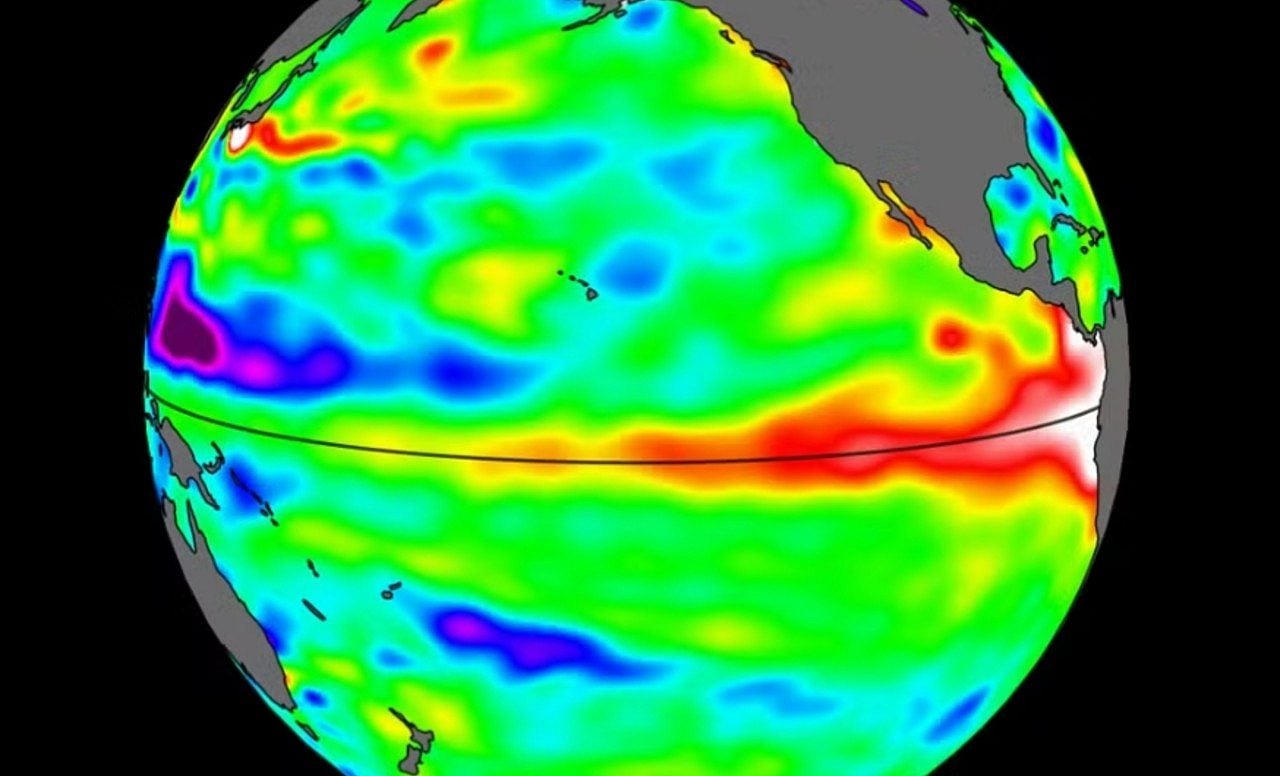
The United States National Oceanic and Atmospheric Administration (NOAA) officially confirmed this Thursday (11) the onset of El Niño, a climate event of natural origin characterized by the atypical warming of surface waters in the Equatorial Pacific Ocean.
In its statement, the American body highlighted that the oceanic pattern is already active and should gain even more strength during the winter of 2026 to 2027 in the Northern Hemisphere.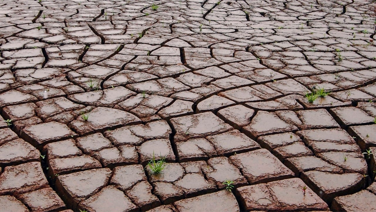
Meteorology experts were already awaiting this official announcement, motivated by months of continuous rise in Pacific temperatures and by mathematical models that indicated a high chance of the climate pattern forming in the first half of 2026.
During the month of May, the institution had calculated a probability of 82% for the event to be consolidated in the following months. Now, with the June report highlighting its existence, the scientific debate is entirely about how severe it could be.
Understand the fundamental differences between oceanic phenomena
Both patterns configure the two sides of a climate cycle called El Niño-Southern Oscillation (ENSO). The warm phase occurs when the waters of the equatorial portion of the Pacific register an increase in temperature equal to or greater than 0.5°C.
Generally, this thermal anomaly appears at intervals ranging from two to seven years, remaining active for around twelve months and driving global temperatures upward. On the other hand, the cold phase of the cycle causes the same oceanic strip to cool, generating diametrically opposite climatic consequences.
In Brazilian territory, the consequences are manifested in a way that is quite divided by regions. Historical records show that the anomaly heats the waters and dumps immense volumes of rain over the southern region, drastically increasing the danger of flooding and severe storms.
On the other hand, vast areas of the North region and much of the Northeast suffer from a lack of precipitation, which often worsens drought cycles and harms the local water supply.
In the Southeast and Central-West states, weather behavior becomes quite erratic, marked by days of suffocating heat, poorly distributed rain showers and a blockage in the natural passage of cold fronts.
Concerns of the scientific community about global warming
Confirmation of this oceanic pattern raises a red alert around the world, mainly because the Earth has already been facing successive heat records due to ongoing climate change.
Although the peaceful event is a natural oscillation and not the cause of the planet’s warming, its combination with an already superheated atmosphere acts as a catalyst for disasters, enhancing prolonged droughts, destructive storms and deadly heat waves.
Faced with this volatile scenario, researchers from different nationalities monitor every variation in the oceans, fearing that the current anomaly will reach levels of extreme severity.
The American agency calculates a 63% chance that the pattern will become very strong between November and January, which would place it on the list of the most rigorous events since 1950. This data gains even more weight when we remember that the strong episode from 2023 to 2024 helped the planet record, in an unprecedented way, a day with a global average 2°C above pre-industrial levels, proving the destructive power of a hotter world.
A thermal anomaly of very high intensity has the power to devastate agricultural crops, dry out hydroelectric reservoirs, multiply fires and drastically increase the cost of living. In Brazil, this scenario tends to put direct pressure on official inflation (IPCA), driven mainly by the spike in fresh food prices and the activation of more expensive tariff flags on the electricity bill.
Despite the worrying signs, meteorologists still cannot predict whether the current cycle will reach “super” status, a popular and non-academic expression used to classify devastating episodes, such as what was seen in the 1982-1983, 1997-1998 and 2015-2016 biennia.
The degree of severity will depend not only on how much the waters of the Equatorial Pacific will warm in the coming months, but on how the atmosphere will react to this heat. For the pattern to reach its peak, it is mandatory that the ocean and atmospheric winds work in perfect harmony, as hot water alone cannot sustain the phenomenon.
Since 2006, a sequence of peaceful warming cycles has gradually modified the Earth’s climate dynamics, which today are considerably warmer than in past decades.
Even occurrences classified as weak or moderate, when inserted in the current context of global upheaval, multiply the dangers of environmental tragedies. Check out the recent history of ocean anomalies:
- Between 2006 and 2007: Event with intensity varying from weak to moderate.
- Between 2009 and 2010: Occurrence of moderate force.
- Between 2014 and 2016: Episode classified as very strong, directly associated with temperature records and climate disasters.
- Between 2018 and 2019: Weak to moderate cycle, with reduced duration and more limited damage.
- Between 2023 and 2024: Strong pattern, among the most severe ever recorded and responsible for new heat spikes on Earth.
How thermal anomaly reshapes the planet’s climate
The essence of this climate disturbance lies in the unusual warming of sea currents located in the equatorial strip of the Pacific Ocean.
It integrates a natural mechanism of the Earth’s climate that transitions between hot, cold and neutral periods, generating profound impacts on all continents.
By changing the water temperature, the event completely alters the circulation of winds in the atmosphere, disrupting the rainfall regime and thermometer readings on a global scale.
On the national territory, this atmospheric mess creates a divided country: while the southern states face excess humidity, the populations of the North and Northeast have to deal with prolonged droughts.
Earth’s average temperature also takes a significant hit. In years dominated by an intense hot phase, the globe usually experiences suffocating heat, which adds to the damage already caused by the emission of greenhouse gases.
Each cycle has its own strength and level of destruction. However, with the planet continually warming, even the mildest anomalies can cause much greater damage than they did in the last century.
Main expected consequences for Brazilian territory
When analyzing the history of the climate in Brazil, it is noted that the anomaly profoundly changes the country’s routine, causing:
- Excessive volume of rain in the South region, increasing the probability of natural disasters.
- Sharp drop in rainfall in much of the North and Northeast.
- Unstable behavior of precipitation in the Southeast and Central-West states.
- Significant increase in the occurrence of suffocating heat waves.
Meteorology professionals warn that the population must prepare to face long sequences of extremely hot days, with a special focus on the spring and summer seasons.
Even with the natural dance between the warm, cold and neutral phases of the ocean, the scientific community is categorical in stating that global warming caused by human action continues to be the major driver behind the current climate collapse.





