Typhoons 7 and 8 advance at the same time and put Japan on alert for intense rains and floods
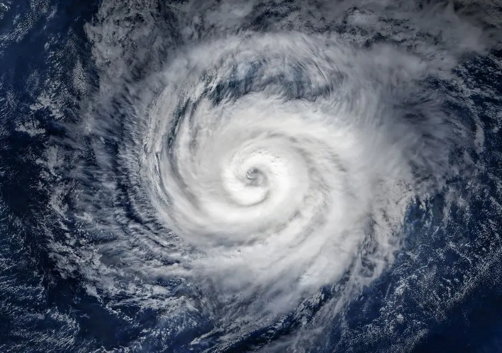
Japan faces a double meteorological threat with the simultaneous approach of typhoons number 7 (Mekkala) and 8 (Higos). Both systems are moving towards the east coast of the country, generating a maximum alert scenario. While Typhoon Higos is already located close to Chiba Prefecture, Mekkala accelerates towards the Kanto-Koshin region, promising a night of intense rain and strong winds.
High alert from the Japan Meteorological Agency for residents
The Japan Meteorological Agency has issued an urgent warning to residents of the Kanto-Koshinetsu and Kinki regions. The population must remain in a state of high vigilance due to the imminent risks of landslides and floods that could affect waterways. Authorities ask for maximum attention to safety recommendations.
Historic rainfall and intensification due to the rainy season
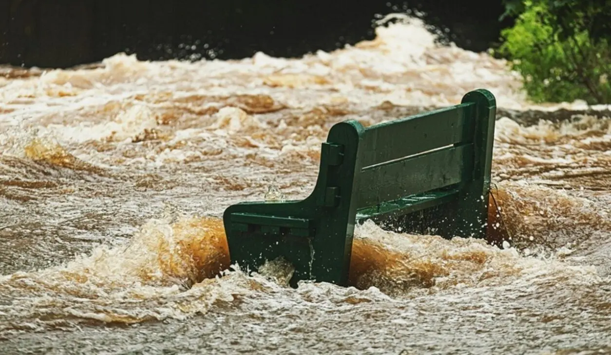
The situation is worsened by the presence of an active cold front, characteristic of the rainy season, which remains parked over the Pacific coast. The combination of this front and the strength of the typhoons resulted in extreme precipitation in some areas. In Chiba Prefecture, record volumes were recorded for the month of June, with the city of Kimitsu receiving 55.5 mm of rain in just one hour and Ichihara recording 42 mm. This confluence of meteorological events significantly increases the destructive potential of storms.
Rain accumulation forecasts for the next few hours
Meteorologists warn of significant amounts of precipitation in the next 24 hours. Until 6 am on June 28, projections indicate:
- Tokai:250mm
- Kanto-Koshinetsu:200mm
- Kinky:150mm
These rates can cause severe impacts, especially in areas already saturated by previous rains.
Leia Também

Messi reaches 19 goals in FIFA World Cups with great free kick for Argentina in clash with Jordan

Cristiano Ronaldo shines beyond the pitch at the 2026 World Cup with business empire and family luxury

At 41, Cristiano Ronaldo reaffirms his historic legacy and prepares to shine in the 2026 World Cup
Risks of strong winds and material damage
In addition to the rain, intense winds are expected on June 27, with the potential to cause damage and injuries. The expected speeds are:
- Kanto-Koshinetsu and Tokai:Sustained winds of 25 meters per second and gusts of up to 35 meters per second.
- Kinki and Shikoku:Sustained winds of 20 meters per second and gusts of up to 30 meters per second.
There is a high possibility that these winds will carry debris, posing a danger to those outdoors and local infrastructure.
Details of typhoon trajectories and intensities
The latest information from the Japan Meteorological Agency, collected at 6 a.m. on June 27, details the status of each system. Typhoon No. 8, Higos, with a central pressure of 998 hectopascals and sustained winds of 23 m/s (gusts of 35 m/s), was advancing at 95 km/h to the northeast, near the city of Kamogawa, in Chiba, approaching the Boso peninsula. Typhoon No. 7, Mekkala, with a central pressure of 992 hectopascals and sustained winds of 18 m/s (gusts of 25 m/s), was moving northeast at 35 km/h, positioned about 110 kilometers east-southeast of the island of Tanegashima. Both typhoons are expected to move east of Japan and subsequently transform into extratropical cyclones.