
International agencies monitor the formation of typhoons 9 and 10 and detail the predicted routes in the Pacific and China Sea

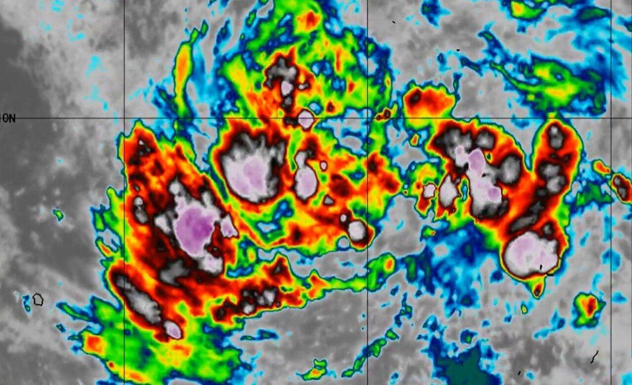
The Japan Meteorological Agency (JMA) issued an alert, indicating that two tropical formations, located in the South China Sea and close to the Marshall Islands, are expected to develop into typhoons within the next 24 hours. If confirmed, the progression will result in typhoons number 9 and 10 of the season. This statement consolidates projections from the JMA, the Joint Typhoon Warning Center (JTWC) and the European Center for Medium-Range Weather Forecasts (ECMWF), whose analyses, although detailed, may present significant variations, highlighting the complexity of weather systems and the importance of multiple perspectives for effective preparedness.
According to the most recent data from the Japan Meteorological Agency, the tropical depression present in the South China Sea was heading west at a speed of 30 kilometers per hour. The expectation is that this system will convert into a typhoon by the late afternoon of July 2nd. For the same period, the forecast indicates a central pressure of 998 hectopascals, with wind gusts that can reach 18 meters per second near the center and peaks of 25 meters per second. The projected trajectory indicates a northwestward shift, crossing the South China Sea and reaching the southern coast of China on July 5, where it is expected to lose strength and return to the tropical depression stage by the end of the day.
At the same time, the tropical depression located in the Marshall Islands is also forecast to become a typhoon by 6 pm on July 2. This system should advance westward, progressively gaining intensity, and approach the Mariana Islands by the 5th. At 3pm on the same date, the projection indicated a central pressure of 965 hectopascals, maximum sustained winds of 40 meters per second close to its core and gusts that could reach 55 meters per second. A vast area, within a radius of 410 kilometers from the center, is under a storm warning.
The forecast for the path of these typhoons after July 6 has not yet been detailed by meteorological authorities. Therefore, it is essential that the population and civil defense agencies remain attentive to future updates and alerts that will be issued.
Monitoring by the United States Joint Typhoon Warning Center (JTWC)
Joint Typhoon Warning Center (JTWC) assessments did not include track projections for the tropical formation in the South China Sea. However, regarding the depression moving towards the Marshall Islands, the JTWC aligns with the Japan Meteorological Agency, predicting a westward shift. The strongest winds, near the center of this system, are estimated to reach 62 meters per second at 9am on July 6th.
Below, the evolution of maximum wind speed near the center of the tropical depression over the Marshall Islands, according to JTWC:
- July 1st, 3pm: 15 meters per second
- July 2, 3am: 21 meters per second
- July 2, 3pm: 26 meters per second
- July 3, 3am: 31 meters per second
- July 3, 3pm: 36 meters per second
- July 4th, 3am: 41 meters per second
- July 4th, 3pm: 49 meters per second
- July 5th, 3pm: 59 meters per second
- July 6, 3pm: 62 meters per second
Analysis from the European Center for Weather Forecasts
The Czech platform Windy.com, recognized for providing real-time weather information, uses analysis and data from the European Center for Medium-Range Weather Forecasts (ECMWF). Through visual animations, the portal allows you to monitor the progression of typhoons up to five days in advance. To view the projected movement, simply press the “▷” button located in the bottom left corner of the interface.





