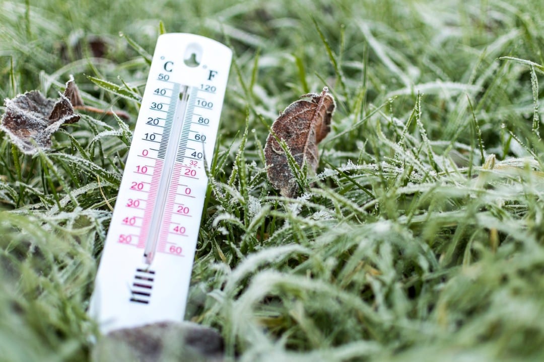
Campo Grande started this Friday (July 3, 2026) under the influence of a cold front, with the minimum temperature reaching 14°C, but the thermal perception reaching only 7.6°C. The day dawned with heavy fog, persistent drizzle and freezing wind, a scenario that should extend the low temperatures to other locations in the interior of Mato Grosso do Sul.
The decrease in temperatures is a direct consequence of the displacement of a mass of cold air that, previously stationed over the south of Brazil and Paraguay, is now progressing towards Mato Grosso do Sul. According to information from Cemtec (Weather and Climate Monitoring Center), this meteorological system contributes to the increase in cloudiness, the drop in minimum and maximum values, and the intensification of winds blowing from the south.
In the capital of Mato Grosso do Sul, although the lowest temperature recorded was 14°C, the feeling of cold was significantly more intense, reaching 7.6°C. The fog phenomenon was noticed especially in the areas of Três Barras and Ministro João Arinos avenues, the access road to Três Lagoas, and also in the Vivendas do Bosque neighborhood.
Aena, the company responsible for managing Campo Grande International Airport, reported that air operations were running normally during the morning, without interruptions due to weather conditions.
The projection for Campo Grande this Friday points to a cloudy to partially cloudy day, with the possibility of drizzle or rain of low intensity and in isolation. The expected maximum for the city should not exceed 24°C.
In cities in the interior of the state, the cold was more pronounced in the south, southwest and west regions. In Nhecolândia, located in Corumbá, thermometers registered 8°C. Other locations that also dawned cold include Sete Quedas (10.2°C), Aral Moreira (10.4°C), Ponta Porã (10.7°C), Amambai (11.4°C), Dourados (12.6°C), Porto Murtinho (12.7°C) and Corumbá (13.6°C).
For this day, temperature variations in Campo Grande should range between 13°C and 24°C. Dourados will have minimums and maximums between 13°C and 21°C. Ponta Porã will be one of the coldest cities, with a minimum of 12°C and a maximum of 18°C. In Iguatemi, the forecast is 11°C to 18°C. Porto Murtinho can register between 12°C and 18°C, while Corumbá will remain between 13°C and 20°C.
In other locations, such as Aquidauana, the forecast varies from 14°C to 24°C. Coxim will have a minimum of 17°C and a maximum of 28°C. Camapuã should have temperatures between 17°C and 29°C. In Paranaíba, thermometers must stay between 16°C and 29°C. Três Lagoas will register between 16°C and 27°C, and Anaurilândia, between 15°C and 25°C.
Despite the active cold front, meteorological models indicate a low probability of significant rainfall. However, Cemtec emphasizes that the occurrence of isolated shocks, of low intensity and with small accumulated volumes, cannot be ruled out.
Daily oscillations mark the weather with freezing mornings and milder afternoons
Between Saturday and next Monday, the weather in Mato Grosso do Sul tends to stabilize, presenting sunshine and alternating clouds. This firmer weather condition is attributed to the presence of a high atmospheric pressure system, which reduces the formation of rain and makes the air drier.
On Saturday, temperatures will still start low, with minimums that can vary between 9°C and 12°C in different parts of the state. For Campo Grande, the forecast is 14°C to 27°C. Dourados should register between 11°C and 24°C, Ponta Porã between 11°C and 23°C, Iguatemi between 10°C and 22°C and Porto Murtinho between 12°C and 23°C.
On Sunday, temperatures will experience a progressive rise. The expectation for Campo Grande is a minimum of 17°C and a maximum of 29°C. Cities like Corumbá can reach 31°C, Aquidauana 32°C and Camapuã 31°C. Relative air humidity, in turn, should show a drop, especially during the afternoon, with rates varying between 20% and 40%.
On Monday, the intensity of the afternoon heat will increase before a new cold front approaches. Campo Grande will have temperatures between 17°C and 29°C. Corumbá can reach 31°C, Aquidauana 31°C, and Coxim can record 32°C. In the south of the state, temperatures should be milder, with Dourados between 15°C and 29°C, Ponta Porã between 15°C and 25°C and Iguatemi between 15°C and 25°C.
The Weather and Climate Monitoring Center (Cemtec) issues an alert for the significant expected temperature range, that is, a large difference between morning and afternoon temperatures. In some locations, this variation can exceed 15°C.
Forecast indicates arrival of a new cold front for the state
Between Tuesday and Wednesday of next week, a new cold front is expected in Mato Grosso do Sul. The meteorological projection points to an increase in cloudiness, the occurrence of isolated rain showers and a subsequent reduction in temperatures, with a greater impact in the south of the state.
Na terça-feira, Campo Grande deve ter temperaturas variando entre 16°C e 25°C. Dourados is forecast to reach 13°C to 24°C. Ponta Porã should register between 13°C and 21°C, and Iguatemi could have a minimum of 10°C and a maximum of 21°C. In southern areas, minimum temperatures can reach 7°C or 8°C in some places.
For Wednesday, the capital expects a minimum of 17°C and a maximum of 26°C. Dourados will be between 11°C and 26°C. Ponta Porã should fluctuate between 11°C and 23°C, and Iguatemi will experience the most intense cold among the cities mentioned, with a minimum of 8°C and a maximum of 24°C.
In other regions of the state, the weather should continue to be sunny and cloudy, but with temperatures rising during the afternoon. As máximas podem situar-se entre 28°C e 31°C, enquanto a umidade relativa do ar deverá ficar entre 25% e 45%.
Winds also require special attention. Between Saturday and Monday, they should blow predominantly at speeds ranging from 30 km/h to 50 km/h. On Monday, with the approach of the new cold front, the winds will change to a southerly direction, possibly presenting localized gusts above 60 km/h. Between Tuesday and Wednesday, wind speeds may vary between 40 km/h and 60 km/h, with the possibility of gusts exceeding 60 km/h.
For the period between July 2nd and 18th, the climate estimate indicates that the accumulated rainfall in Mato Grosso do Sul should vary between 20 mm and 100 mm, with the largest predicted volumes concentrated in the extreme south of the state.