
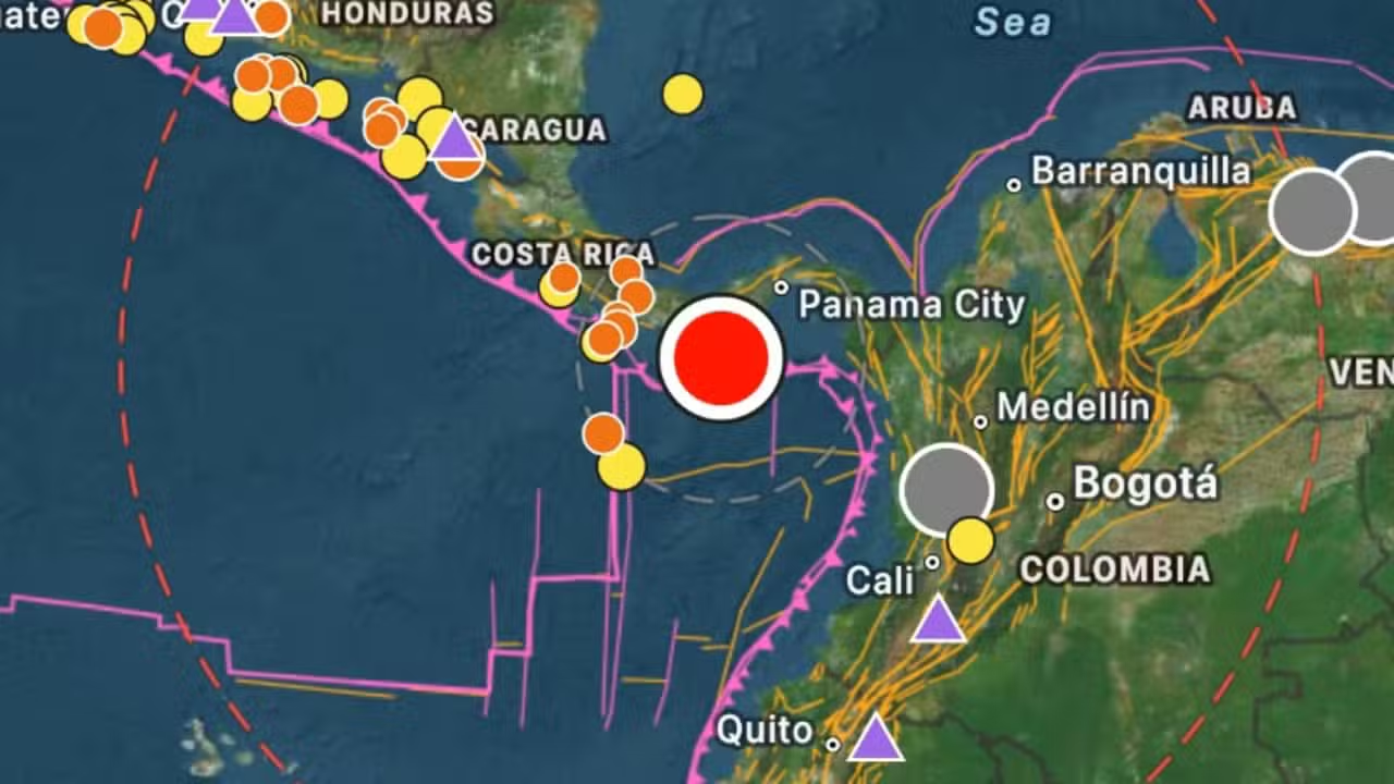
A major seismic tremor measuring magnitude 7.6 struck southern Panama on Friday afternoon, October 9, 2026, prompting immediate coastal alerts across the Pacific basin. The event occurred at 12:56 local time (17:56 UTC and 14:56 Brasilia time), originating off the country’s southern shoreline. Ground motion rattled communities across the Isthmus, triggering safety measures along broad maritime perimeters.
Shockwaves spread quickly through metropolitan centers, producing pronounced shaking across high-rise structures in Panama City and reaching into the southern border regions of Costa Rica. Journalist Iñigo Alexander reported noticeable oscillations in office towers and residential buildings throughout the capital as office workers reacted to the prolonged sway. Residents in Costa Rica’s southern Zona Sur similarly experienced noticeable earth movement during the main shock.
Seismic data revised after initial magnitude calculation
The United States Geological Survey, known internationally as the USGS, initially pegged the tremor at magnitude 8.0 with a focal depth of 33 kilometers before refining its calculations. Updated evaluations placed the seismic event at magnitude 7.6 at a shallow depth of 10 kilometers beneath the surface. Seismologists positioned the precise epicenter 10 kilometers west-southwest of Pitaloza Arriba, situated close to the coastal district of Quebro.
M8 earthquake 🔴 – 14 km SW of Pitaloza Arriba, Panama Oct 9 12:56 local time (7m ago) Depth 33 km https://t.co/aSqXr6cjjf Download the free iPhone app for quake details: https://t.co/fkLKflBuod https://t.co/yog9oUjapq— Earthquakes (@NewEarthquake) October 9, 2026
Discrepancies in measurement parameters emerged between international and regional geophysical monitoring networks following the event. Panama’s national seismological body, the Instituto de Geociencias at the Universidad de Panama, calculated the quake at magnitude 7.6 situated 39 kilometers northwest of Tonosí. Their technical readout registered an exceptionally shallow depth estimated at approximately 4 kilometers.
Learn more: Farellones sustains 4.8 magnitude earthquake in central Chile
Regional coastal threat issued across Pacific waters
The United States Tsunami Warning Center published an international advisory highlighting potential marine disturbances and sea level fluctuations across nine littoral territories:
- Panama
- Costa Rica
- Colombia
- Ecuador
- Peru
- Nicaragua
- El Salvador
- Guatemala
- Mexico
While maritime monitoring centers outlined potential hazards for coastlines across Central and South America, regional emergency networks kept observation protocols under continuous review. Local harbor officials and maritime observers along the Pacific seaboard reported no sightings of destructive wave formations or hazardous inundations following the seismic impulse. Authorities maintained coastal vigilance while scientific agencies continued analyzing real-time sea gauge metrics.
Emergency response teams survey southern provinces
Panama’s National Civil Protection System, operating under the agency acronym Sinaproc, mobilized emergency inspection teams across the southern provinces of Los Santos, Veraguas, and Herrera. Civil protection officials confirmed that the tremor resulted in no confirmed deaths, injuries, or severe structural failures throughout the affected sectors. Operational commanders deployed field personnel to review strategic infrastructure and verify public utility networks.
See also: Santiago rattles after 4.8 magnitude earthquake hits Chile
The tectonic event fits into an active regional framework marked by recurring seismic activity along Central America and northern South America. On August 10, 2026, a magnitude 7.4 to 7.6 earthquake located off the Colombian Pacific coast near the department of Chocó sent strong vibrations into Panama, prompting high-rise building evacuations. In historical records, the major earthquake of September 7, 1882, in the Gulf of San Blas registered an estimated magnitude of 7.7 to 7.9 and triggered documented tsunami waves along the Panamanian coast.
Technical brigades and first responders continue conducting field surveys of municipal properties, public schools, and residential clusters across southern districts. Crews are inspecting concrete foundations and load-bearing walls to detect unrecorded cracks or secondary structural damage as monitoring operations proceed.