

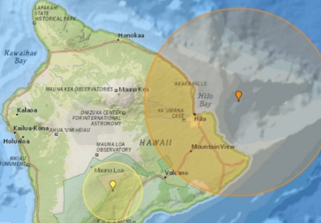
A 4.7 magnitude earthquake shook Hawaii Island last Tuesday night. The tremor, whose epicenter was located east of Papaikou, was felt by almost 800 people, according to data from the U.S. Geological Survey (USGS). There were no immediate reports of significant damage or tsunami warnings issued.
Details of the tremor and reports from the population
O abalo sísmico ocorreu precisamente às 22h37, horário local, na terça-feira, 10 de junho de 2026. Sua profundidade foi registrada em 39 quilômetros abaixo da superfície. Around 800 individuals used the “Did You Feel It?” from the USGS to report the sensation of the tremor, with reports coming from several locations on Hawaii Island.
A small tremor of 2.1 magnitude was later recorded near Pahala, considered an aftershock. The location of the epicenter indicates an area with frequent geological activity, characteristic of the Hawaiian archipelago.
Hawaii’s geological context
Hawaii is recognized as one of the most seismically active regions in the United States. This characteristic is due to its formation on a hot spot in the Earth’s mantle, which feeds active volcanoes such as Kīlauea and Mauna Loa. Constant volcanic activity directly contributes to local geological instability, causing frequent tremors.
Seismic shocks are an integral part of the archipelago’s natural setting. They result both from the movement of lava within volcanoes and from the accommodation of oceanic tectonic plates. Although a magnitude 4.7 earthquake is notable, events of this intensity are common and do not generally cause widespread destruction on the island.
Precedents and characteristics of seismic activity
This earthquake adds to other recent records of seismic shocks in the Hawaiian Islands. Seismic activity maps show a concentration of events around Hawaii Island, with some occurrences also near Maui. The frequency of these events is a constant reminder of the region’s geological dynamics.
Despite the constancy of tremors, structures on Hawaii Island are often designed to withstand seismic activity. Local authorities monitor the situation closely, with tsunami warning systems activated only for events of much higher magnitude or with a specific ocean epicenter.
Key facts about the earthquake
- Magnitude: 4.7
- Date and Time: Tuesday, June 10, 2026, at 10:37 pm (local time)
- Location: East of Papaikou, Hawaii Island
- Depth: 39 kilometers
- Reports: Approximately 800 people felt the tremor