

Global navigation satellite systems (GNSS) such as GPS, GLONASS and Galileo are essential for defining the geographic position of objects in real time. These digital tools are integrated into a wide range of devices, from everyday smartphones to complex military devices.
Knowing the distinctions between these platforms is crucial, covering aspects such as accuracy, geographic range, number of satellites in operation and their primary applications. Below, we detail what characterizes each of these essential infrastructures for global localization.
Understanding the global positioning system (GPS)

Launched by the United States in 1978, the Global Positioning System (GPS) is a pioneering satellite navigation technology. Initially created for military strategies, its use was expanded and became a pillar for several civil applications. Currently, GPS is the dominant GNSS system in devices such as mobile phones and vehicles.
Getting to know the Russian Global Navigation Satellite System (GLONASS)
GLONASS, an acronym for “Global Navigation Satellite System” in Russian, was implemented by Russia in 1982. Similar to GPS in its origins, this system was also designed for military use, but has evolved to largely meet civilian needs, being present in many cell phones today.
The European satellite navigation proposal (Galileo)
Representing the European Union, Galileo is a global satellite navigation system that began operations in 2016. Unlike its predecessors, it was designed from the beginning with a focus on civil applications and also serves government entities. Its name honors the renowned astronomer Galileo Galilei.
The main distinctions between GPS, GLONASS and Galileo systems
The GPS, GLONASS and Galileo navigation platforms have significant particularities. They differ, for example, in the number of active satellites, location accuracy and the nations responsible for their management.
To facilitate understanding, see a comparison of the most important characteristics between global satellite navigation systems:
- Countries of origin: GPS was developed by the United States, GLONASS by Russia and Galileo by the European Union.
- Number of satellites: GPS has 32 satellites in total, with 31 operational; GLONASS has 24 in total and all are operational; Galileo has 30, 28 of which are in operation. (Data from August 2023).
- Coverage: GPS achieved global coverage in 1995, GLONASS in 2011, and Galileo in 2019.
- Accuracy: GPS and Galileo offer accuracy of less than 5 meters, while GLONASS is typically accurate to less than 10 meters.
- Satellite altitude: GPS satellites orbit at approximately 20,200 km, GLONASS satellites at approximately 19,100 km, and Galileo satellites at approximately 23,200 km.
- Compatibility: GPS and GLONASS have broad compatibility, while Galileo is being expanded into devices.
- Main use: both GPS and GLONASS were created for military purposes and later adapted for civilian use; Galileo was designed directly for civilian use.
Origin and development of responsible countries
The development of GPS began in 1973, under the supervision of the United States Department of Defense, with operational launch in 1978. At the same time, the former Soviet Union began the GLONASS project in 1976, making it functional in 1982. Both systems were originally military, but over time, they were adapted for public use.
On the other hand, Galileo was born from an initiative by the European Union, via the European Space Agency (ESA), with the primary objective of reducing dependence on American and Russian systems. Unlike the others, Galileo was not designed for military purposes. Its first satellite went into space in 2005, with the system only coming into full operation in 2016.
The number of satellites for efficient operation
The performance of each GNSS is directly linked to its number of satellites, which changes as units are activated or deactivated. GPS is designed for a total of 32 satellites, but can operate effectively with 24.
GLONASS, in turn, was designed for a constellation of 24 satellites, although it can operate with 21 and guarantee full coverage over Russia with 18. Galileo, which provides 30 satellites in its complete structure, can operate with 24 units.
The global reach of each positioning system
Coverage capacity defines the areas of the planet where a satellite navigation system can be used. GPS, GLONASS and Galileo are classified as global systems, indicating that their area of operation extends across the entire Earth. For all three, global coverage was achieved when the number of active satellites surpassed the 20 mark.
GPS has offered global reach since 1995, while GLONASS reached this level in 2011 and Galileo in 2019. Generally, operation with around 24 satellites is necessary to guarantee this coverage, although small variations in this number may occur.
Accuracy in determining location
Accuracy measures how accurately the geographic position of an item is defined. This attribute is conditioned by the number of satellites involved, the frequency of operation and external variables, such as weather conditions and the presence of high buildings in the location.
For GPS, the average accuracy on smartphones in open areas is 4.9 meters. GLONASS, in turn, presents a variation of 5 to 10 meters in accuracy. Galileo stands out with an accuracy generally less than 5 meters, and can reach less than 1 meter in ideal circumstances.
The different orbital heights of satellites
The GPS, GLONASS and Galileo systems use satellites in Medium Earth Orbit (MEO), which are located between 2,000 and 36,000 km in altitude. In the case of GPS, distribution occurs in six orbital planes, at an average altitude of 20,200 km. GLONASS employs three orbital planes, with satellites positioned approximately 19,100 km apart.
Similarly, Galileo satellites are also organized into three orbital planes. However, they operate at a slightly higher standard altitude of 23,222 km.
The scope of use across devices and applications
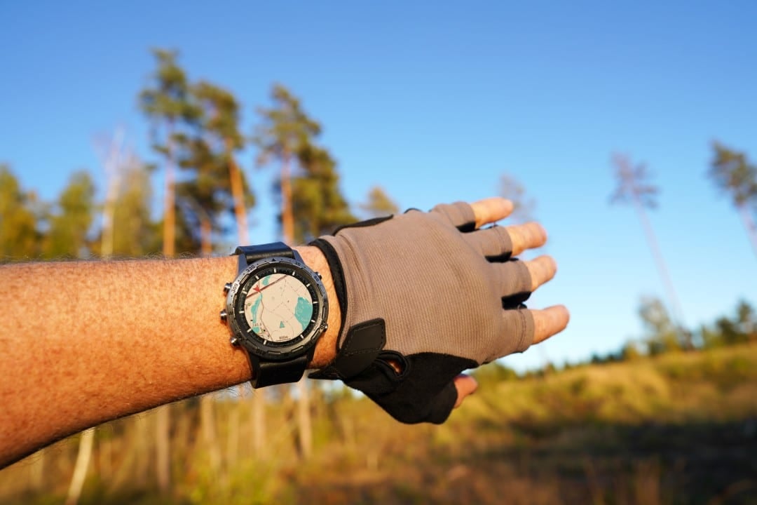
Among navigation systems, GPS demonstrates the greatest ubiquity, being found in a wide range of devices, such as cell phones, smartwatches and automotive on-board systems. It is also widely used in corporate solutions, including vehicle trackers.
GLONASS is also integrated into mobile devices and professional solutions, often operating in conjunction with GPS. As it is the most recent, launched in 2016, Galileo is still the least widespread, but its presence has grown, especially in the smartphone market.
The original and current destinations of each technology
The GPS system originated in the United States with an eminently military purpose. However, in the 1980s, its use for civilians was allowed, a milestone that came after the incident of Korean Airlines Flight 007, which was shot down while invading Soviet airspace. American authorities concluded that accurate GPS navigation could have prevented such a tragedy.
Similarly, GLONASS was a Russian creation, initially intended for military applications. Release for civilian use by the Russian government in the 2000s aimed to boost the system’s improvement and capacity.
In contrast, Galileo stands out for being the only one of the three systems to have been designed from the outset for civilian applications. Its creation by the European Union had the fundamental goal of reducing dependence on GPS and GLONASS systems.
Is it possible to combine GPS and GLONASS for better navigation?
Yes, this functionality is possible. Certain devices, such as some Garmin smartwatch models, are capable of processing GPS and GLONASS data simultaneously. This combination of information aims to improve location accuracy and expand coverage in specific regions, through the combination of satellite signals.
Accuracy gains when combining systems such as GPS and Galileo or GLONASS
Research indicates that merging GPS data with GLONASS or Galileo can result in greater accuracy for certain applications, with special relevance in the scientific field.
For the common user, the manufacturer Garmin suggests that the combination of GPS and GLONASS can speed up the acquisition of satellite signals by a device by up to 20%. However, this improvement may not be noticed in places with high buildings, which obstruct the signal, or in environments such as tunnels and during heavy rainfall.
Battery consumption when using GPS and GLONASS simultaneously
The joint use of GPS and GLONASS can, in fact, increase the energy consumption of a device. This happens because the two systems operate at different frequencies. Companies like Garmin have already issued warnings about this potential increase in spending in their documentation. In cases of significant impact on battery life, the alternative is to opt for exclusive use of GPS.
Other Global Navigation Systems (GNSS) options beyond the main trio
Yes, GPS is the best known GNSS, but not the only one globally. In addition to GPS, GLONASS and Galileo, there are other important networks such as BeiDou, QZSS and NavIC, which complement the satellite navigation scenario.
- BeiDou: system maintained by China, active since 2011, with both military and commercial applications.
- QZSS: of Japanese origin, designed to improve GPS range, especially in the regions of Asia and Oceania.
- NavIC: developed by India, focused on offering comprehensive coverage across its national territory.